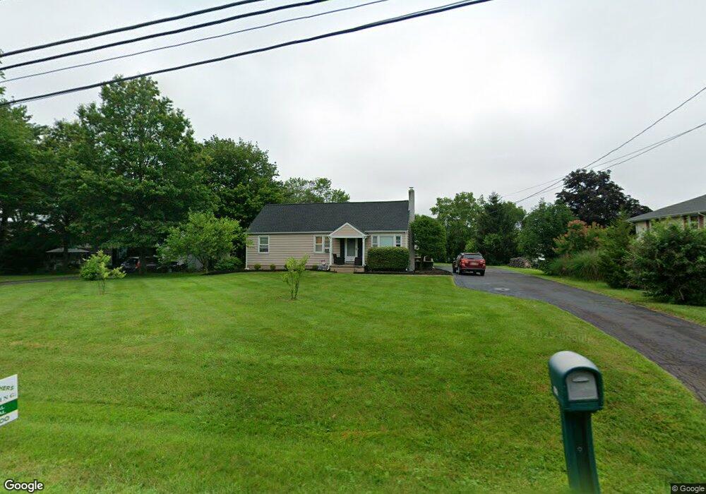
437 Mininger Rd Souderton, PA 18964
Estimated Value: $402,000 - $476,000
3
Beds
2
Baths
1,575
Sq Ft
$273/Sq Ft
Est. Value
About This Home
This home is located at 437 Mininger Rd, Souderton, PA 18964 and is currently estimated at $429,974, approximately $272 per square foot. 437 Mininger Rd is a home located in Montgomery County with nearby schools including West Broad Street Elementary School, Indian Crest Middle School, and Souderton Area Senior High School.
Ownership History
Date
Name
Owned For
Owner Type
Purchase Details
Closed on
Jun 29, 2005
Sold by
Lindner Susan M and Blacklock Bertha L
Bought by
Womack Kevin H and Womack Debra
Current Estimated Value
Home Financials for this Owner
Home Financials are based on the most recent Mortgage that was taken out on this home.
Original Mortgage
$184,000
Outstanding Balance
$96,112
Interest Rate
5.67%
Mortgage Type
New Conventional
Estimated Equity
$333,862
Create a Home Valuation Report for This Property
The Home Valuation Report is an in-depth analysis detailing your home's value as well as a comparison with similar homes in the area
Home Values in the Area
Average Home Value in this Area
Purchase History
| Date | Buyer | Sale Price | Title Company |
|---|---|---|---|
| Womack Kevin H | $230,000 | -- |
Source: Public Records
Mortgage History
| Date | Status | Borrower | Loan Amount |
|---|---|---|---|
| Open | Womack Kevin H | $184,000 |
Source: Public Records
Tax History Compared to Growth
Tax History
| Year | Tax Paid | Tax Assessment Tax Assessment Total Assessment is a certain percentage of the fair market value that is determined by local assessors to be the total taxable value of land and additions on the property. | Land | Improvement |
|---|---|---|---|---|
| 2025 | $4,798 | $119,460 | $61,040 | $58,420 |
| 2024 | $4,798 | $119,460 | $61,040 | $58,420 |
| 2023 | $4,578 | $119,460 | $61,040 | $58,420 |
| 2022 | $4,438 | $119,460 | $61,040 | $58,420 |
| 2021 | $4,345 | $119,460 | $61,040 | $58,420 |
| 2020 | $4,286 | $119,460 | $61,040 | $58,420 |
| 2019 | $3,912 | $119,460 | $61,040 | $58,420 |
| 2018 | $4,234 | $119,460 | $61,040 | $58,420 |
| 2017 | $4,128 | $119,460 | $61,040 | $58,420 |
| 2016 | $4,081 | $119,460 | $61,040 | $58,420 |
| 2015 | $3,971 | $119,460 | $61,040 | $58,420 |
| 2014 | $3,971 | $119,460 | $61,040 | $58,420 |
Source: Public Records
Map
Nearby Homes
- 708 Finlay Dr
- 723 Finlay Dr
- 510 Berkshire Dr
- 552 Creekside Dr
- 701 Quail Cir
- 3113 Arbour Green Ct
- 2921 Cowpath Rd
- 635 Elroy Rd
- 2031 Oak Ave
- 1520 Fairgrounds Rd
- 51 Cambridge Ct Unit 51
- 829 Alexander Dr
- 103 Allentown Rd
- 2713 Beech St
- 2801 Denbeigh Dr
- 2821 N Ford Dr
- Arcadia Plan at Glenwood Chase
- Sebastian Plan at Glenwood Chase
- Arcadia Plan at Retreat at Boyertown Farms
- Caldwell Plan at Glenwood Chase
- 433 Mininger Rd
- 441 Mininger Rd
- 429 Mininger Rd
- 60 Barlow Dr
- 445 Mininger Rd
- 58 Barlow Dr
- 420 Turnberry Way
- 422 Turnberry Way
- 56 Barlow Dr
- 418 Turnberry Way
- 54 Barlow Dr
- 63 Barlow Dr
- 424 Turnberry Way
- 449 Mininger Rd
- 52 Barlow Dr
- 61 Barlow Dr
- 501 Auburn Ct
- 59 Barlow Dr
- 416 Turnberry Way
- 50 Barlow Dr