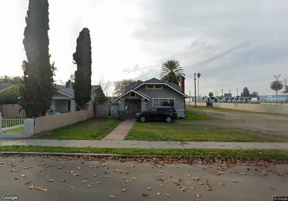
437 N Roosevelt Ave Fresno, CA 93701
Lowell NeighborhoodEstimated Value: $214,226 - $302,000
2
Beds
1
Bath
1,095
Sq Ft
$241/Sq Ft
Est. Value
About This Home
This home is located at 437 N Roosevelt Ave, Fresno, CA 93701 and is currently estimated at $263,807, approximately $240 per square foot. 437 N Roosevelt Ave is a home located in Fresno County with nearby schools including Muir Elementary, Fort Miller Middle School, and Fresno High School.
Ownership History
Date
Name
Owned For
Owner Type
Purchase Details
Closed on
Dec 19, 2006
Sold by
Hovannisian John and Hovannisian Vars
Bought by
Hovannisian John and Hovannisian Vars
Current Estimated Value
Purchase Details
Closed on
May 25, 1995
Sold by
Tefft Scott and Tefft Tammy M
Bought by
Hovannisian John and Hovannisian Vars
Purchase Details
Closed on
Apr 17, 1995
Sold by
Hud
Bought by
Tefft Scott and Tefft Tammy M
Purchase Details
Closed on
Feb 24, 1995
Sold by
Metmor Financial Inc
Bought by
Hud
Purchase Details
Closed on
Dec 8, 1994
Sold by
Metmor Financial Inc and Kissel Richard
Bought by
Metmor Financial Inc
Create a Home Valuation Report for This Property
The Home Valuation Report is an in-depth analysis detailing your home's value as well as a comparison with similar homes in the area
Home Values in the Area
Average Home Value in this Area
Purchase History
| Date | Buyer | Sale Price | Title Company |
|---|---|---|---|
| Hovannisian John | -- | None Available | |
| Hovannisian John | $27,000 | Landmark Title Company | |
| Tefft Scott | $27,000 | North American Title Company | |
| Hud | -- | Fidelity National Title | |
| Metmor Financial Inc | $37,766 | Fidelity National Title Ins |
Source: Public Records
Tax History Compared to Growth
Tax History
| Year | Tax Paid | Tax Assessment Tax Assessment Total Assessment is a certain percentage of the fair market value that is determined by local assessors to be the total taxable value of land and additions on the property. | Land | Improvement |
|---|---|---|---|---|
| 2025 | $591 | $43,636 | $20,138 | $23,498 |
| 2023 | $581 | $41,944 | $19,357 | $22,587 |
| 2022 | $573 | $41,123 | $18,978 | $22,145 |
| 2021 | $559 | $40,317 | $18,606 | $21,711 |
| 2020 | $556 | $39,905 | $18,416 | $21,489 |
| 2019 | $537 | $39,123 | $18,055 | $21,068 |
| 2018 | $526 | $38,356 | $17,701 | $20,655 |
| 2017 | $518 | $37,604 | $17,354 | $20,250 |
| 2016 | $502 | $36,867 | $17,014 | $19,853 |
| 2015 | $495 | $36,314 | $16,759 | $19,555 |
| 2014 | $484 | $35,603 | $16,431 | $19,172 |
Source: Public Records
Map
Nearby Homes
- 603 E Mildreda Ave
- 630 N Roosevelt Ave
- 728 N Broadway St
- 555 N Harrison Ave
- 630 E Dudley Ave
- 930 N Roosevelt Ave
- 340 N Fulton St
- 517 N Farris Ave
- 235 N Fulton St
- 745 E La Sierra Dr
- 0 Belmont Ave Unit FR25206445
- 0 W Belmont Ave
- 728 N Farris Ave
- 807 N Van Ness Ave
- 1010 N Ferger Ave
- 219 E Dennett Ave
- 706 N College Ave
- 186 N College Ave
- 916 E Divisadero St
- 981 N Thorne Ave
- 433 N Roosevelt Ave
- 421 N Roosevelt Ave
- 415 N Roosevelt Ave
- 440 N Ferger Ave
- 444 N Roosevelt Ave
- 428 N Ferger Ave
- 436 N Roosevelt Ave
- 460 N Roosevelt Ave
- 445 E Franklin Ave
- 428 N Roosevelt Ave
- 418 N Ferger Ave
- 466 N Roosevelt Ave
- 414 N Roosevelt Ave
- 401 E Franklin Ave
- 501 E Franklin Ave
- 375 N Roosevelt Ave
- 373 N Roosevelt Ave
- 441 N Echo Ave
- 435 N Echo Ave
- 447 N Ferger Ave