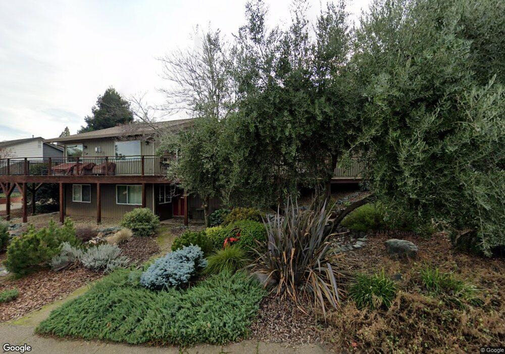
437 Olive Orchard Dr Auburn, CA 95603
Estimated Value: $578,000 - $900,000
4
Beds
3
Baths
2,538
Sq Ft
$317/Sq Ft
Est. Value
About This Home
This home is located at 437 Olive Orchard Dr, Auburn, CA 95603 and is currently estimated at $804,556, approximately $317 per square foot. 437 Olive Orchard Dr is a home located in Placer County with nearby schools including Skyridge Elementary School, Placer High School, and Bowman Charter School.
Ownership History
Date
Name
Owned For
Owner Type
Purchase Details
Closed on
Jun 28, 2019
Sold by
Rock Patrick J and Rock Eden E
Bought by
Rock Patrick J and Rock Eden E
Current Estimated Value
Purchase Details
Closed on
Feb 2, 2007
Sold by
Da Roza Carol M
Bought by
Rock Patrick and Rock Eden
Home Financials for this Owner
Home Financials are based on the most recent Mortgage that was taken out on this home.
Original Mortgage
$392,656
Outstanding Balance
$234,530
Interest Rate
6.11%
Mortgage Type
Purchase Money Mortgage
Estimated Equity
$570,026
Create a Home Valuation Report for This Property
The Home Valuation Report is an in-depth analysis detailing your home's value as well as a comparison with similar homes in the area
Home Values in the Area
Average Home Value in this Area
Purchase History
| Date | Buyer | Sale Price | Title Company |
|---|---|---|---|
| Rock Patrick J | -- | None Available | |
| Rock Patrick | $491,000 | First American Title Company |
Source: Public Records
Mortgage History
| Date | Status | Borrower | Loan Amount |
|---|---|---|---|
| Open | Rock Patrick | $392,656 |
Source: Public Records
Tax History Compared to Growth
Tax History
| Year | Tax Paid | Tax Assessment Tax Assessment Total Assessment is a certain percentage of the fair market value that is determined by local assessors to be the total taxable value of land and additions on the property. | Land | Improvement |
|---|---|---|---|---|
| 2025 | $7,869 | $657,574 | $247,850 | $409,724 |
| 2023 | $7,869 | $565,000 | $213,000 | $352,000 |
| 2022 | $7,176 | $565,000 | $213,000 | $352,000 |
| 2021 | $6,295 | $491,000 | $185,100 | $305,900 |
| 2020 | $6,067 | $468,000 | $176,400 | $291,600 |
| 2019 | $6,179 | $478,000 | $180,200 | $297,800 |
| 2018 | $5,909 | $469,000 | $176,800 | $292,200 |
| 2017 | $5,871 | $469,000 | $176,800 | $292,200 |
| 2016 | $5,709 | $458,000 | $172,600 | $285,400 |
| 2015 | $5,493 | $547,146 | $206,229 | $340,917 |
| 2014 | $4,259 | $326,038 | $122,890 | $203,148 |
Source: Public Records
Map
Nearby Homes
- 438 Olive Orchard Dr
- 440 Foresthill Ave
- 486 Foresthill Ave
- 681 Foresthill Ave
- 381 Foresthill Ave
- 274 Huntley Ave
- 101 Lincoln Way
- 60 Lincoln Way
- 13111 Thistledown Ct
- 13005 Lincoln Way Unit F
- 13061 Lincoln Way Unit B
- 173 Center St
- 300 Cherry Ave
- 143 Hillmont Ave
- 146 E Placer St
- 1430 Auburn Ravine Rd
- 287 Swenson Ct
- 258 Swenson Ct
- 225 Flood Rd
- 278 Swenson Ct
- 121 Haswell Ct
- 431 Olive Orchard Dr
- 111 Haswell Ct
- 133 Haswell Ct
- 434 Olive Orchard Dr
- 425 Olive Orchard Dr
- 128 Haswell Ct
- 120 Haswell Ct
- 149 Haswell Ct
- 108 Toyon Dr
- 112 Haswell Ct
- 114 Toyon Dr
- 136 Haswell Ct
- 109 Thirza Ct
- 430 Olive Orchard Dr
- 106 Toyon Dr
- 152 Haswell Ct
- 421 Olive Orchard Dr
- 144 Haswell Ct
- 446 Olive Orchard Dr