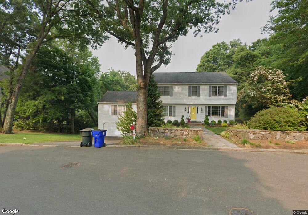
437 Orchard Hill Ln Fairfield, CT 06824
University NeighborhoodEstimated Value: $1,415,308 - $1,645,000
4
Beds
4
Baths
2,827
Sq Ft
$542/Sq Ft
Est. Value
About This Home
This home is located at 437 Orchard Hill Ln, Fairfield, CT 06824 and is currently estimated at $1,531,827, approximately $541 per square foot. 437 Orchard Hill Ln is a home located in Fairfield County with nearby schools including Osborn Hill Elementary School, Fairfield Woods Middle School, and Fairfield Ludlowe High School.
Ownership History
Date
Name
Owned For
Owner Type
Purchase Details
Closed on
Aug 13, 2003
Sold by
Smola Richard D and Smola Diane C
Bought by
Ward Stephen J and Ward Jill
Current Estimated Value
Home Financials for this Owner
Home Financials are based on the most recent Mortgage that was taken out on this home.
Original Mortgage
$450,000
Outstanding Balance
$195,851
Interest Rate
5.46%
Estimated Equity
$1,335,976
Purchase Details
Closed on
Feb 24, 1993
Sold by
Schnurr James V and Schnurr Christine
Bought by
Smola Richard D and Smola Diane C
Create a Home Valuation Report for This Property
The Home Valuation Report is an in-depth analysis detailing your home's value as well as a comparison with similar homes in the area
Home Values in the Area
Average Home Value in this Area
Purchase History
| Date | Buyer | Sale Price | Title Company |
|---|---|---|---|
| Ward Stephen J | $890,000 | -- | |
| Ward Stephen J | $890,000 | -- | |
| Smola Richard D | $395,000 | -- | |
| Smola Richard D | $395,000 | -- |
Source: Public Records
Mortgage History
| Date | Status | Borrower | Loan Amount |
|---|---|---|---|
| Open | Smola Richard D | $450,000 | |
| Closed | Smola Richard D | $450,000 | |
| Previous Owner | Smola Richard D | $300,000 |
Source: Public Records
Tax History Compared to Growth
Tax History
| Year | Tax Paid | Tax Assessment Tax Assessment Total Assessment is a certain percentage of the fair market value that is determined by local assessors to be the total taxable value of land and additions on the property. | Land | Improvement |
|---|---|---|---|---|
| 2025 | $16,538 | $582,540 | $341,180 | $241,360 |
| 2024 | $16,253 | $582,540 | $341,180 | $241,360 |
| 2023 | $16,026 | $582,540 | $341,180 | $241,360 |
| 2022 | $15,868 | $582,540 | $341,180 | $241,360 |
| 2021 | $15,717 | $582,540 | $341,180 | $241,360 |
| 2020 | $16,782 | $626,430 | $337,540 | $288,890 |
| 2019 | $16,782 | $626,430 | $337,540 | $288,890 |
| 2018 | $16,513 | $626,430 | $337,540 | $288,890 |
| 2017 | $16,174 | $626,430 | $337,540 | $288,890 |
| 2016 | $15,943 | $626,430 | $337,540 | $288,890 |
| 2015 | $16,298 | $657,440 | $357,070 | $300,370 |
| 2014 | $16,042 | $657,440 | $357,070 | $300,370 |
Source: Public Records
Map
Nearby Homes
- 338 Orchard Hill Ln
- 25 Millspaugh Dr
- 1207 Stillson Rd
- 1165 Stillson Rd
- 33 Middlebrook Place
- 1137 Stillson Rd
- 66 Adams Rd
- 2107 N Benson Rd
- 56 Drake Ln
- 44 Deer Run Rd
- 359 Reid St
- 45 Robin Cir
- 105 Charter Oak Rd
- 115 Mayfair Rd
- 210 Pansy Rd
- 79 Mayfair Rd
- 706 Judd St
- 254 Sherwood Farm Rd
- 28 Stillson Place
- 68 Figlar Ave
- 411 Orchard Hill Ln
- 398 Orchard Hill Ln
- 455 Orchard Hill Ln
- 40 Ferguson Dr
- 401 Orchard Hill Ln
- 85 Hersh Rd
- 44 Ferguson Dr
- 100 Hersh Rd
- 371 Orchard Hill Ln
- 41 Ferguson Dr
- 79 Hersh Rd
- 380 Orchard Hill Ln
- 351 Orchard Hill Ln
- 70 Hersh Rd
- 218 Lower Farm Rd
- 2248 Mill Plain Rd
- 2292 Mill Plain Rd
- 2292 Mill Plain Rd Unit lot 10
- 360 Orchard Hill Ln
- 1381 Stillson Rd