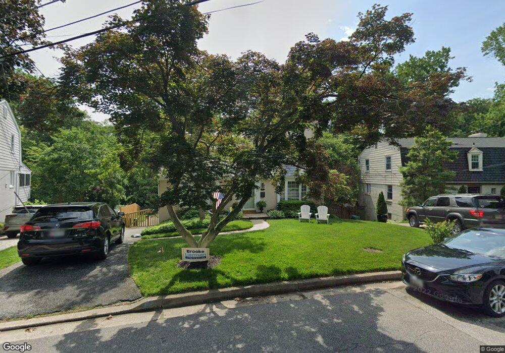
437 Range Rd Towson, MD 21204
Estimated Value: $572,000 - $659,000
Studio
2
Baths
1,596
Sq Ft
$382/Sq Ft
Est. Value
About This Home
This home is located at 437 Range Rd, Towson, MD 21204 and is currently estimated at $610,238, approximately $382 per square foot. 437 Range Rd is a home located in Baltimore County with nearby schools including West Towson Elementary School, Dumbarton Middle School, and Towson High Law & Public Policy.
Ownership History
Date
Name
Owned For
Owner Type
Purchase Details
Closed on
Dec 24, 1996
Sold by
Bain Andrew E
Bought by
Dendrinos John G and Morgan Dendrinos Catherine A
Current Estimated Value
Purchase Details
Closed on
Jun 9, 1993
Sold by
Martin Clarence V
Bought by
Bain Andrew E
Create a Home Valuation Report for This Property
The Home Valuation Report is an in-depth analysis detailing your home's value as well as a comparison with similar homes in the area
Home Values in the Area
Average Home Value in this Area
Purchase History
| Date | Buyer | Sale Price | Title Company |
|---|---|---|---|
| Dendrinos John G | $210,000 | -- | |
| Bain Andrew E | $183,000 | -- |
Source: Public Records
Tax History
| Year | Tax Paid | Tax Assessment Tax Assessment Total Assessment is a certain percentage of the fair market value that is determined by local assessors to be the total taxable value of land and additions on the property. | Land | Improvement |
|---|---|---|---|---|
| 2025 | $5,805 | $467,800 | $131,700 | $336,100 |
| 2024 | $5,805 | $441,967 | $0 | $0 |
| 2023 | $2,773 | $416,133 | $0 | $0 |
| 2022 | $5,290 | $390,300 | $122,400 | $267,900 |
| 2021 | $4,945 | $376,900 | $0 | $0 |
| 2020 | $4,945 | $363,500 | $0 | $0 |
| 2019 | $4,801 | $350,100 | $122,400 | $227,700 |
| 2018 | $4,732 | $348,367 | $0 | $0 |
| 2017 | $4,509 | $346,633 | $0 | $0 |
| 2016 | $3,657 | $344,900 | $0 | $0 |
| 2015 | $3,657 | $344,700 | $0 | $0 |
| 2014 | $3,657 | $344,500 | $0 | $0 |
Source: Public Records
Map
Nearby Homes
- 448 Range Rd
- 425 Woodbine Ave
- 507 Allegheny Ave
- 1008 W Wind Ct
- 901 Navy Rd
- 1006 W Joppa Rd
- 922 Rolandvue Rd
- 0 Charlesway
- 28 Allegheny Ave Unit 1308
- 28 Allegheny Ave Unit 2710
- 28 Allegheny Ave Unit 1504
- 28 Allegheny Ave Unit 805
- 28 Allegheny Ave Unit 1306
- 28 Allegheny Ave Unit 1804
- 28 Allegheny Ave Unit 2700
- 132 Warwick Dr
- 8328 Bellona Ave
- 1028 Winsford Rd
- 105 Meridian Ln
- 19 Coldwater Ct
- 435 Range Rd
- 439 Range Rd
- 441 Range Rd
- 440 Charles Street Ave
- 433 Range Rd
- 431 Range Rd
- 434 Range Rd
- 445 Range Rd
- 502 Charles Street Ave Unit A
- 502 Charles Street Ave
- 502A Charles Street Ave
- 430 Charles Street Ave
- 443 Range Rd
- 442 Charles Street Ave
- 438 Range Rd
- 429 Range Rd
- 430 Range Rd
- 502 A Charles Street Ave
- 500 Charles Street Ave
- 432 Range Rd
Your Personal Tour Guide
Ask me questions while you tour the home.