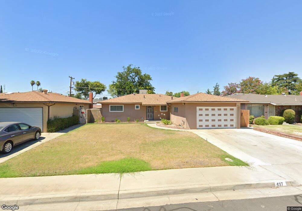
437 W Keats Ave Clovis, CA 93612
Estimated Value: $218,000 - $322,000
3
Beds
1
Bath
1,066
Sq Ft
$267/Sq Ft
Est. Value
About This Home
This home is located at 437 W Keats Ave, Clovis, CA 93612 and is currently estimated at $284,850, approximately $267 per square foot. 437 W Keats Ave is a home located in Fresno County with nearby schools including Sierra Vista Elementary School, Clark Intermediate School, and Clovis High School.
Ownership History
Date
Name
Owned For
Owner Type
Purchase Details
Closed on
Aug 3, 2015
Sold by
Carter Michael J and Arter Julie L
Bought by
Michael & Julie Carter Living Trust and Carter Julie L
Current Estimated Value
Purchase Details
Closed on
Feb 12, 2014
Sold by
Eaton Delores M
Bought by
Cartr Michael Jeffery and Carter Julie Lane
Purchase Details
Closed on
Jun 8, 2006
Sold by
Brown Roi W
Bought by
Eaton Dolores M and Dolores M Eaton Revocable Living Trust
Purchase Details
Closed on
Aug 1, 2005
Sold by
Eaton Dolores M
Bought by
Eaton Dolores M and Dolores M Eaton Revocable Living Trust
Purchase Details
Closed on
Nov 24, 1998
Sold by
John Eaton Martin
Bought by
Eaton Martin J and Eaton Debra J
Create a Home Valuation Report for This Property
The Home Valuation Report is an in-depth analysis detailing your home's value as well as a comparison with similar homes in the area
Home Values in the Area
Average Home Value in this Area
Purchase History
| Date | Buyer | Sale Price | Title Company |
|---|---|---|---|
| Michael & Julie Carter Living Trust | -- | None Available | |
| Cartr Michael Jeffery | $136,001 | None Available | |
| Eaton Dolores M | $78,000 | None Available | |
| Eaton Dolores M | -- | -- | |
| Eaton Martin J | -- | First American Title Ins Co |
Source: Public Records
Tax History
| Year | Tax Paid | Tax Assessment Tax Assessment Total Assessment is a certain percentage of the fair market value that is determined by local assessors to be the total taxable value of land and additions on the property. | Land | Improvement |
|---|---|---|---|---|
| 2025 | $1,987 | $166,706 | $49,029 | $117,677 |
| 2023 | $1,913 | $160,234 | $47,126 | $113,108 |
| 2022 | $1,888 | $157,093 | $46,202 | $110,891 |
| 2021 | $1,835 | $154,014 | $45,297 | $108,717 |
| 2020 | $1,828 | $152,436 | $44,833 | $107,603 |
| 2019 | $1,793 | $149,448 | $43,954 | $105,494 |
| 2018 | $1,755 | $146,519 | $43,093 | $103,426 |
| 2017 | $1,725 | $143,648 | $42,249 | $101,399 |
| 2016 | $1,667 | $140,832 | $41,421 | $99,411 |
| 2015 | $1,642 | $138,717 | $40,799 | $97,918 |
| 2014 | $1,257 | $94,000 | $52,200 | $41,800 |
Source: Public Records
Map
Nearby Homes
- 487 W San Jose Ave
- 3600 W Shaw Ave
- 1500 Villa Ave Unit 107
- 1500 Villa Ave Unit 170
- 1500 Villa Ave Unit 27
- 1500 Villa Ave Unit spc 7
- 1335 Cindy Ave
- 431 W Alamos Ave Unit 4
- 1650 Villa Ave Unit 48
- 1314 Terry Ave
- 647 W Dennis Dr
- 2236 Peach Ave Unit 3
- 2236 Peach Ave Unit 4
- 593 W Alamos Ave
- 1272 Villa Ave Unit 69
- 1272 Villa Ave Unit 76
- 1272 Villa Ave Unit SPC92
- 2110 Helm Ave Unit 19
- 1468 Plymouth Rock Way
- 1448 Plymouth Rock Way
- 427 W Keats Ave
- 447 W Keats Ave
- 436 W Scott Ave
- 446 W Scott Ave
- 426 W Scott Ave
- 417 W Keats Ave
- 457 W Keats Ave
- 416 W Scott Ave
- 436 W Keats Ave
- 426 W Keats Ave
- 446 W Keats Ave
- 467 W Keats Ave
- 407 W Keats Ave
- 416 W Keats Ave
- 456 W Keats Ave
- 466 W Scott Ave
- 406 W Scott Ave
- 477 W Keats Ave
- 466 W Keats Ave
Your Personal Tour Guide
Ask me questions while you tour the home.