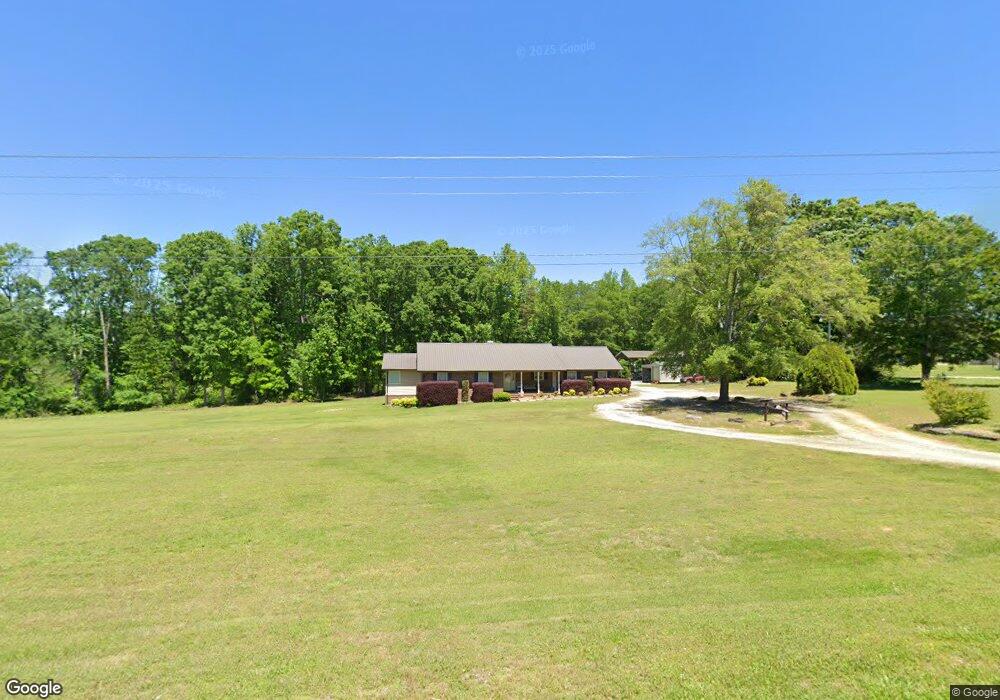
4370 Highway 198 Carnesville, GA 30521
Estimated Value: $293,906 - $345,000
3
Beds
2
Baths
2,124
Sq Ft
$150/Sq Ft
Est. Value
About This Home
This home is located at 4370 Highway 198, Carnesville, GA 30521 and is currently estimated at $318,227, approximately $149 per square foot. 4370 Highway 198 is a home located in Franklin County with nearby schools including Franklin County High School.
Ownership History
Date
Name
Owned For
Owner Type
Purchase Details
Closed on
Jul 31, 2020
Sold by
Henderson Harold G
Bought by
Mcduffie Carolyn J and Gibson Tyler A
Current Estimated Value
Home Financials for this Owner
Home Financials are based on the most recent Mortgage that was taken out on this home.
Original Mortgage
$176,739
Outstanding Balance
$156,780
Interest Rate
3%
Mortgage Type
FHA
Estimated Equity
$161,447
Purchase Details
Closed on
Jul 15, 2005
Sold by
Charlotte Denise Banks
Bought by
Henderson Harold G
Home Financials for this Owner
Home Financials are based on the most recent Mortgage that was taken out on this home.
Original Mortgage
$75,650
Interest Rate
5.59%
Mortgage Type
New Conventional
Purchase Details
Closed on
Mar 26, 2001
Sold by
Banks Sara Sue
Bought by
Banks Charlotte Deni
Purchase Details
Closed on
Mar 26, 1984
Bought by
Banks Sara Sue
Create a Home Valuation Report for This Property
The Home Valuation Report is an in-depth analysis detailing your home's value as well as a comparison with similar homes in the area
Home Values in the Area
Average Home Value in this Area
Purchase History
| Date | Buyer | Sale Price | Title Company |
|---|---|---|---|
| Mcduffie Carolyn J | $180,000 | -- | |
| Henderson Harold G | $80,000 | -- | |
| Banks Charlotte Deni | -- | -- | |
| Banks Sara Sue | -- | -- |
Source: Public Records
Mortgage History
| Date | Status | Borrower | Loan Amount |
|---|---|---|---|
| Open | Mcduffie Carolyn J | $176,739 | |
| Previous Owner | Henderson Harold G | $75,650 |
Source: Public Records
Tax History Compared to Growth
Tax History
| Year | Tax Paid | Tax Assessment Tax Assessment Total Assessment is a certain percentage of the fair market value that is determined by local assessors to be the total taxable value of land and additions on the property. | Land | Improvement |
|---|---|---|---|---|
| 2024 | $2,106 | $88,484 | $5,730 | $82,754 |
| 2023 | $2,090 | $81,011 | $5,209 | $75,802 |
| 2022 | $1,899 | $73,593 | $4,063 | $69,530 |
| 2021 | $1,800 | $65,427 | $4,063 | $61,364 |
| 2020 | $1,485 | $55,403 | $4,063 | $51,340 |
| 2019 | $1,435 | $55,403 | $4,063 | $51,340 |
| 2018 | $1,265 | $49,079 | $4,889 | $44,190 |
| 2017 | $1,315 | $49,079 | $4,889 | $44,190 |
| 2016 | $1,180 | $42,444 | $4,889 | $37,555 |
| 2015 | -- | $42,444 | $4,889 | $37,555 |
| 2014 | -- | $42,444 | $4,889 | $37,555 |
| 2013 | -- | $43,570 | $4,889 | $38,681 |
Source: Public Records
Map
Nearby Homes
- 6343 Georgia 198
- 4001 Highway 198
- 150 Garrison Rd
- 340 Mcfarlin Blvd
- 0 Falcon Ln Unit 10495019
- 0 Falcon Ln Unit 1024877
- 262 Garrison Rd
- 14 Kristy Ln
- 0 Banks Academy Rd Unit 10636762
- 125 Lewis Crump Rd
- 2526 Prospect Rd
- 2630 Prospect Rd
- 6060 Highway 320
- 0 Poplar Mountain Ln
- 4638 Highway 63
- LOT 10 Bent Tree Rd
- 0 Old Federal Rd Unit 6931372
- 83 Henry Williams Rd
- 0 Morris Trail Unit 10394631
- 0 Morris Trail Unit 7470661
- 4635 Highway 198
- 4534 Highway 198
- 4737 Highway 198
- 4445 Highway 198
- 4860 Highway 198
- 4900 Highway 198
- 4610 Highway 198
- 4291 Highway 198
- 4291 Highway 198
- 4291 Georgia 198
- 4295 Highway 198
- 4221 Highway 198
- 4033 Georgia 198
- 871 Georgia 198
- 4145 Highway 198
- 2201 New Bethel Rd
- 2121 New Bethel Rd
- 5085 Highway 198
- 2045 New Bethel Rd
- 4085 Highway 198