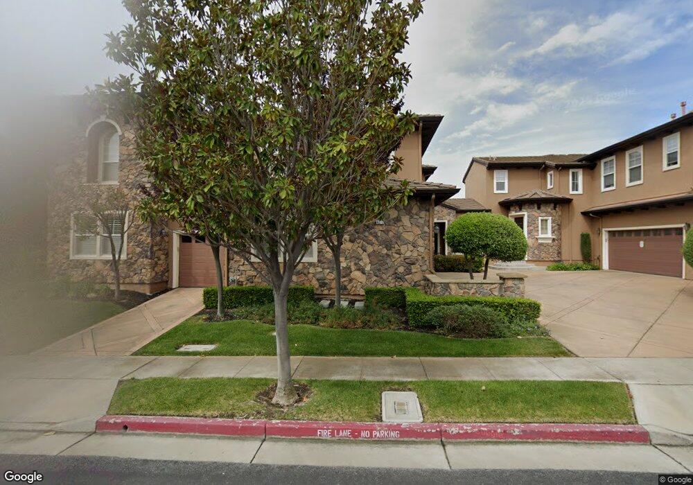
4373 Red Maple Way Unit 39 San Jose, CA 95138
Silver Creek NeighborhoodEstimated Value: $1,457,198 - $1,625,000
3
Beds
3
Baths
2,084
Sq Ft
$741/Sq Ft
Est. Value
About This Home
This home is located at 4373 Red Maple Way Unit 39, San Jose, CA 95138 and is currently estimated at $1,545,050, approximately $741 per square foot. 4373 Red Maple Way Unit 39 is a home located in Santa Clara County with nearby schools including James Franklin Smith Elementary School, Chaboya Middle School, and Silver Creek High School.
Ownership History
Date
Name
Owned For
Owner Type
Purchase Details
Closed on
Sep 22, 2011
Sold by
Wang Mao Tsuan and Lin Carol Yuyun
Bought by
Wang Mao Tsuan and Lin Carol Yuyun
Current Estimated Value
Purchase Details
Closed on
Mar 14, 2007
Sold by
Wang Mao Tsuan and Lin Carol Yuyun
Bought by
Wang Mao Tsuan and Lin Carol Yuyun
Purchase Details
Closed on
Jul 20, 2004
Sold by
William Lyon Homes Inc
Bought by
Wang Mao Tsuan and Lin Carol Yuyun
Home Financials for this Owner
Home Financials are based on the most recent Mortgage that was taken out on this home.
Original Mortgage
$518,500
Outstanding Balance
$240,188
Interest Rate
5.12%
Mortgage Type
Purchase Money Mortgage
Estimated Equity
$1,304,862
Create a Home Valuation Report for This Property
The Home Valuation Report is an in-depth analysis detailing your home's value as well as a comparison with similar homes in the area
Home Values in the Area
Average Home Value in this Area
Purchase History
| Date | Buyer | Sale Price | Title Company |
|---|---|---|---|
| Wang Mao Tsuan | -- | None Available | |
| Wang Mao Tsuan | -- | None Available | |
| Wang Mao Tsuan | $648,500 | First American Title Company |
Source: Public Records
Mortgage History
| Date | Status | Borrower | Loan Amount |
|---|---|---|---|
| Open | Wang Mao Tsuan | $518,500 | |
| Closed | Wang Mao Tsuan | $64,500 |
Source: Public Records
Tax History
| Year | Tax Paid | Tax Assessment Tax Assessment Total Assessment is a certain percentage of the fair market value that is determined by local assessors to be the total taxable value of land and additions on the property. | Land | Improvement |
|---|---|---|---|---|
| 2025 | $12,667 | $903,236 | $327,558 | $575,678 |
| 2024 | $12,667 | $885,527 | $321,136 | $564,391 |
| 2023 | $12,439 | $868,165 | $314,840 | $553,325 |
| 2022 | $12,382 | $851,143 | $308,667 | $542,476 |
| 2021 | $13,721 | $834,455 | $302,615 | $531,840 |
| 2020 | $13,215 | $825,900 | $299,513 | $526,387 |
| 2019 | $12,879 | $809,707 | $293,641 | $516,066 |
| 2018 | $12,848 | $793,832 | $287,884 | $505,948 |
| 2017 | $12,692 | $778,268 | $282,240 | $496,028 |
| 2016 | $12,170 | $763,008 | $276,706 | $486,302 |
| 2015 | $12,036 | $751,548 | $272,550 | $478,998 |
| 2014 | $11,098 | $736,828 | $267,212 | $469,616 |
Source: Public Records
Map
Nearby Homes
- 3854 Deans Place Way
- 584 Giraudo Dr
- 420 Via Primavera Dr
- 621 Via Primavera Ct
- 464 Archglen Way
- 1659 Cedarcreek Ct
- 383 River View Dr
- 3341 Placer Creek Ct
- 350 Otono Ct
- 4535 Lobos Ave
- 404 El Cajon Dr
- 1520 E Capitol Expy Unit 54
- 156 Knightshaven Way
- 429 Osgood Ct
- 3032 Oakbridge Dr Unit 3032
- 240 Santa Rosa Dr
- 2166 Shadow Ridge Way
- 3126 Oakbridge Dr Unit 3126
- 515 Fontanelle Ct
- 3241 Shadow Park Place
- 4367 Red Maple Way Unit 38
- 1359 Trailside Ct
- 1373 Trailside Ct Unit 14
- 1333 Trailside Ct
- 1362 Trailside Ln
- 1358 Trailside Ln
- 4379 Red Maple Way Unit 40
- 4361 Red Maple Way
- 1353 Trailside Ct
- 1339 Trailside Ct Unit 10
- 1370 Trailside Ln Unit 25
- 1379 Trailside Ct Unit 15
- 1346 Trailside Ln
- 1350 Trailside Ln Unit 22
- 1390 Trailside Ln
- 1382 Trailside Ln Unit 27
- 1375 Trailside Ln
- 1363 Trailside Ln
- 1357 Trailside Ln
- 1369 Trailside Ln
Your Personal Tour Guide
Ask me questions while you tour the home.