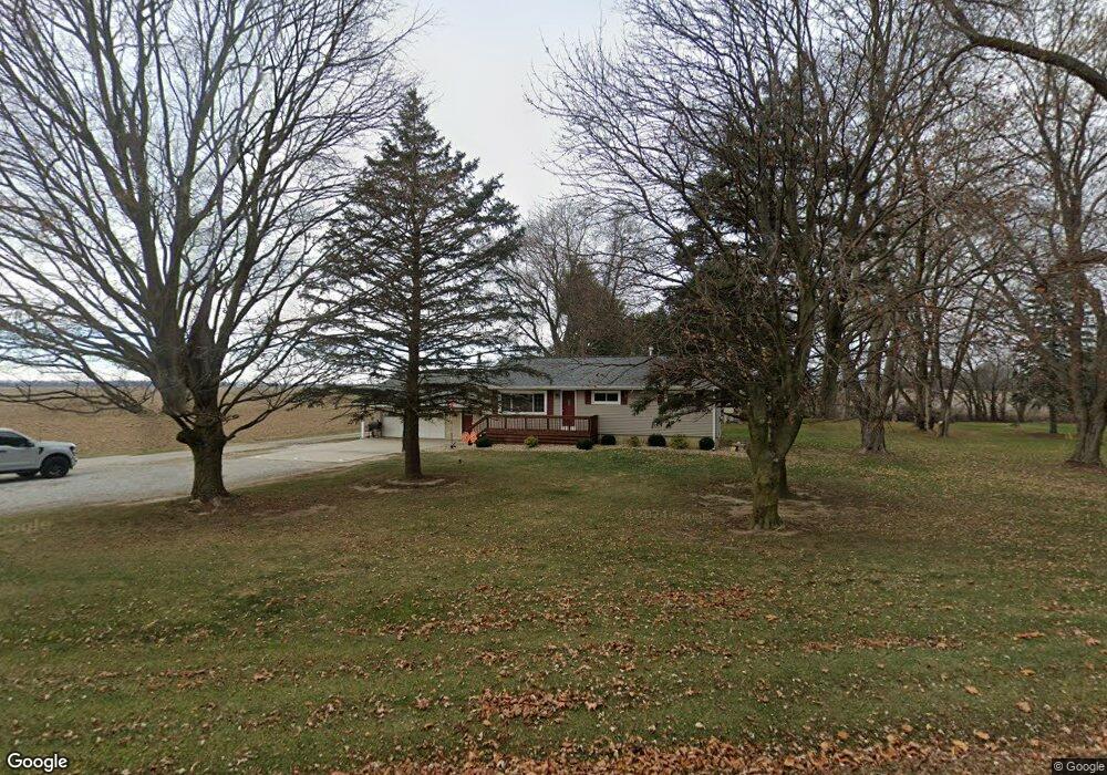
4375 State Route 99 N Monroeville, OH 44847
Estimated Value: $178,446 - $234,000
3
Beds
1
Bath
1,430
Sq Ft
$144/Sq Ft
Est. Value
About This Home
This home is located at 4375 State Route 99 N, Monroeville, OH 44847 and is currently estimated at $205,362, approximately $143 per square foot. 4375 State Route 99 N is a home located in Huron County with nearby schools including Monroeville Elementary School, Monroeville High School, and St Joseph Catholic School.
Ownership History
Date
Name
Owned For
Owner Type
Purchase Details
Closed on
Dec 28, 2017
Sold by
Ackerman Marlene
Bought by
Rckerman Lee and Acerman Samantha
Current Estimated Value
Home Financials for this Owner
Home Financials are based on the most recent Mortgage that was taken out on this home.
Original Mortgage
$101,624
Outstanding Balance
$86,954
Interest Rate
4.5%
Mortgage Type
FHA
Estimated Equity
$118,408
Purchase Details
Closed on
Jul 27, 1989
Bought by
Ackerman Marlene
Create a Home Valuation Report for This Property
The Home Valuation Report is an in-depth analysis detailing your home's value as well as a comparison with similar homes in the area
Home Values in the Area
Average Home Value in this Area
Purchase History
| Date | Buyer | Sale Price | Title Company |
|---|---|---|---|
| Rckerman Lee | $103,500 | None Available | |
| Ackerman Marlene | -- | -- |
Source: Public Records
Mortgage History
| Date | Status | Borrower | Loan Amount |
|---|---|---|---|
| Open | Rckerman Lee | $101,624 |
Source: Public Records
Tax History Compared to Growth
Tax History
| Year | Tax Paid | Tax Assessment Tax Assessment Total Assessment is a certain percentage of the fair market value that is determined by local assessors to be the total taxable value of land and additions on the property. | Land | Improvement |
|---|---|---|---|---|
| 2024 | $2,308 | $57,370 | $7,740 | $49,630 |
| 2023 | $2,308 | $40,950 | $6,010 | $34,940 |
| 2022 | $1,771 | $40,950 | $6,010 | $34,940 |
| 2021 | $1,731 | $40,950 | $6,010 | $34,940 |
| 2020 | $1,551 | $35,100 | $4,850 | $30,250 |
| 2019 | $1,536 | $35,100 | $4,850 | $30,250 |
| 2018 | $1,474 | $35,100 | $4,850 | $30,250 |
| 2017 | $1,321 | $32,140 | $4,850 | $27,290 |
| 2016 | $1,295 | $32,140 | $4,850 | $27,290 |
| 2015 | $941 | $32,150 | $4,860 | $27,290 |
| 2014 | $849 | $32,170 | $4,870 | $27,300 |
| 2013 | $908 | $32,170 | $4,870 | $27,300 |
Source: Public Records
Map
Nearby Homes
- 4391 State Route 99 N
- 4390 State Route 99 N
- 4259 State Route 99 N
- 4516 State Route 99 N
- 4517 State Route 99 N
- 4541 State Route 99 N
- 4539 State Route 99 N
- 4550 State Route 99 N
- 4559 State Route 99 N
- 4216 State Route 99 N
- 289 Sandusky St
- 1531 W Old Sr 20
- 320 Sandusky St
- 3554 Us Highway 20 W
- 4771 State Route 99 N
- 4813 State Route 99 N
- 192 Ridge St N
- 4813 Ohio 99
- 4800 State Route 99 N
- 3674 Us Highway 20 W