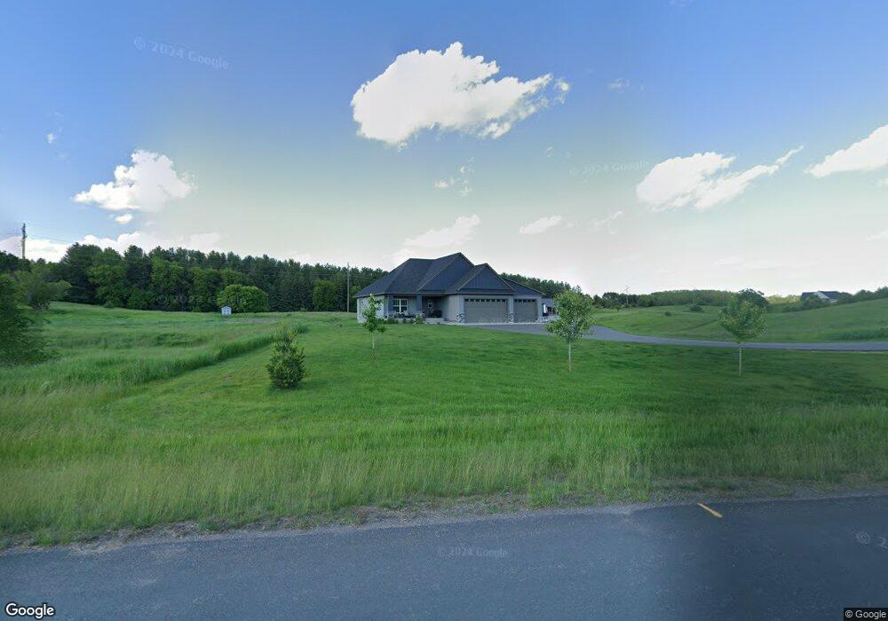
438 Bluebird Dr N Hudson, WI 54016
Saint Joseph NeighborhoodEstimated Value: $95,000 - $706,000
--
Bed
--
Bath
--
Sq Ft
3.01
Acres
About This Home
This home is located at 438 Bluebird Dr N, Hudson, WI 54016 and is currently estimated at $491,579. 438 Bluebird Dr N is a home located in St. Croix County with nearby schools including Houlton Elementary School, Hudson Middle School, and Hudson High School.
Ownership History
Date
Name
Owned For
Owner Type
Purchase Details
Closed on
May 18, 2021
Sold by
Dcci Land Planners Inc
Bought by
Wetterling Megan and Wetterling Brett
Current Estimated Value
Home Financials for this Owner
Home Financials are based on the most recent Mortgage that was taken out on this home.
Original Mortgage
$472,800
Outstanding Balance
$432,809
Interest Rate
3.5%
Mortgage Type
New Conventional
Estimated Equity
$44,213
Purchase Details
Closed on
Feb 23, 2021
Sold by
Derrick Ronald L and Derrick Thomas E
Bought by
Dcci Land Planners Inc
Create a Home Valuation Report for This Property
The Home Valuation Report is an in-depth analysis detailing your home's value as well as a comparison with similar homes in the area
Home Values in the Area
Average Home Value in this Area
Purchase History
| Date | Buyer | Sale Price | Title Company |
|---|---|---|---|
| Wetterling Megan | $84,900 | St Croix County Abstract & T | |
| Dcci Land Planners Inc | -- | None Available | |
| Derrick Ronald L | -- | None Available |
Source: Public Records
Mortgage History
| Date | Status | Borrower | Loan Amount |
|---|---|---|---|
| Open | Wetterling Megan | $472,800 |
Source: Public Records
Tax History Compared to Growth
Tax History
| Year | Tax Paid | Tax Assessment Tax Assessment Total Assessment is a certain percentage of the fair market value that is determined by local assessors to be the total taxable value of land and additions on the property. | Land | Improvement |
|---|---|---|---|---|
| 2024 | $67 | $474,800 | $119,100 | $355,700 |
| 2023 | $4,423 | $474,800 | $119,100 | $355,700 |
| 2022 | $1,246 | $338,100 | $119,100 | $219,000 |
| 2021 | $1,168 | $70,100 | $70,100 | $0 |
| 2020 | $1,160 | $70,100 | $70,100 | $0 |
| 2019 | $1,088 | $70,100 | $70,100 | $0 |
| 2018 | $1,028 | $70,100 | $70,100 | $0 |
| 2017 | $952 | $52,000 | $52,000 | $0 |
| 2016 | $952 | $52,000 | $52,000 | $0 |
| 2015 | $796 | $52,000 | $52,000 | $0 |
| 2014 | $716 | $52,000 | $52,000 | $0 |
| 2013 | $575 | $40,500 | $40,500 | $0 |
Source: Public Records
Map
Nearby Homes
- 1213 54th St
- 10 Acres Highland View
- 1178 56th St
- 1094 Golden Oaks Ln
- 406 134th Ave
- 438 Highland View
- 296 Valley Estates Ct
- 1197 60th St
- 1186 60th St
- 1195 60th St
- 1319 27th St
- 1397 Fox Ridge Trail
- 1334 27th St
- 989 Priester Ln
- 1303 Birch Park Rd
- 329 138th Ave
- 543 Homestead Trail
- 1302 10th St N
- 233 River Heights Trail
- 518 Green Mill Ln
- 440 Bluebird Dr N
- 1200 42nd St
- 446 Bluebird Lane Dr
- 446 Bluebird Lane-Drive-
- 446 Bluebird Dr N
- 1194 42nd St
- 435 Bluebird Dr N
- 1188 42nd St
- 431 Bluebird Dr N
- 1192 42nd St
- 441 Bluebird Dr N
- 447 Bluebird Dr N
- 454 Bluebird Dr N
- 1222 Trout Brook Rd N
- 1187 42nd St
- 1186 42nd St
- 451 Bluebird Dr N
- 464 Bluebird Dr N
- 455 Bluebird Dr N
- 1218 Trout Brook Rd