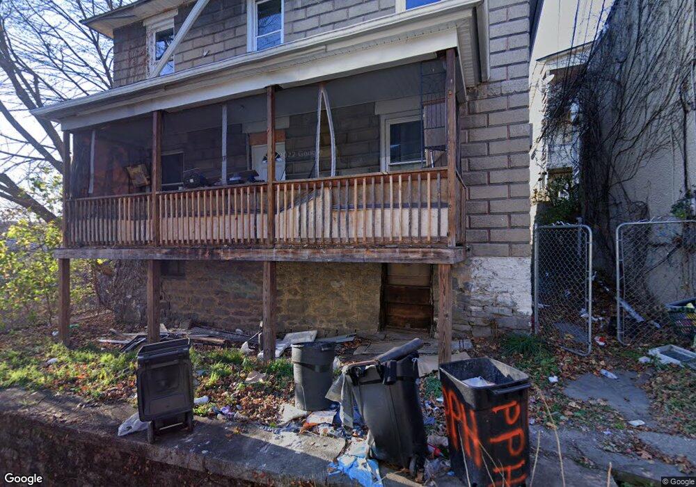
438 N Irving Ave Scranton, PA 18510
Hill Section NeighborhoodEstimated Value: $193,000 - $208,000
4
Beds
2
Baths
1,400
Sq Ft
$145/Sq Ft
Est. Value
About This Home
This home is located at 438 N Irving Ave, Scranton, PA 18510 and is currently estimated at $202,333, approximately $144 per square foot. 438 N Irving Ave is a home located in Lackawanna County with nearby schools including John G. Whittier Elementary School, South Scranton Intermediate, and Scranton High School.
Ownership History
Date
Name
Owned For
Owner Type
Purchase Details
Closed on
Jun 29, 2011
Sold by
Mayer John P and Mayer Lucy S
Bought by
Borgia Samuel and Borgia Anna Rose
Current Estimated Value
Home Financials for this Owner
Home Financials are based on the most recent Mortgage that was taken out on this home.
Original Mortgage
$76,000
Interest Rate
4.62%
Mortgage Type
Future Advance Clause Open End Mortgage
Create a Home Valuation Report for This Property
The Home Valuation Report is an in-depth analysis detailing your home's value as well as a comparison with similar homes in the area
Home Values in the Area
Average Home Value in this Area
Purchase History
| Date | Buyer | Sale Price | Title Company |
|---|---|---|---|
| Borgia Samuel | $75,000 | None Available |
Source: Public Records
Mortgage History
| Date | Status | Borrower | Loan Amount |
|---|---|---|---|
| Closed | Borgia Samuel | $76,000 |
Source: Public Records
Tax History
| Year | Tax Paid | Tax Assessment Tax Assessment Total Assessment is a certain percentage of the fair market value that is determined by local assessors to be the total taxable value of land and additions on the property. | Land | Improvement |
|---|---|---|---|---|
| 2025 | $3,607 | $9,000 | $5,050 | $3,950 |
| 2024 | $3,343 | $9,000 | $5,050 | $3,950 |
| 2023 | $3,343 | $9,000 | $5,050 | $3,950 |
| 2022 | $3,271 | $9,000 | $5,050 | $3,950 |
| 2021 | $3,271 | $9,000 | $5,050 | $3,950 |
| 2020 | $3,223 | $9,000 | $5,050 | $3,950 |
| 2019 | $3,047 | $9,000 | $5,050 | $3,950 |
| 2018 | $3,047 | $9,000 | $5,050 | $3,950 |
| 2017 | $3,005 | $9,000 | $5,050 | $3,950 |
| 2016 | $1,374 | $9,000 | $5,050 | $3,950 |
| 2015 | $2,055 | $9,000 | $5,050 | $3,950 |
| 2014 | -- | $9,000 | $5,050 | $3,950 |
Source: Public Records
Map
Nearby Homes
- 432 Taylor Ave
- 529 Taylor Ave
- 1513 1515 Vine St
- 516 Harrison Ave
- 342 Harrison Ave
- 550 Clay Ave Unit 8C
- 7 Oakwood Place
- 616-618 Harrison Ave
- 718 Taylor Ave
- 0 Colfax Ave
- 617 Arthur Ave
- 619 Arthur Ave
- 0 Colfax and Gibson Ave Unit GSBSC255175
- 1019 Moosic St
- 131 Prospect Ave
- 917 Taylor Ave
- 622 Jefferson Ave
- 825 827 Quincy Ave Unit 825-827
- 217 Crown Ave
- 640 Jefferson Ave
- 434 N Irving Ave
- 442 N Irving Ave Unit 444
- 442 N Irving Ave
- 430 N Irving Ave Unit 432
- 1408 Vine St
- 432 N Irving Ave
- 432 Farber Ct
- 1416 Vine St
- 1402 Vine St
- 428 N Irving Ave
- 429 Prescott Ave
- 433-435 Prescott Ave Unit 435 Rear
- 433-435 Prescott Ave Unit 435 Apt 2
- 422 N Irving Ave
- 437 439 N Irving Ave
- 437 N 439 Irving Ave
- 1 Prescott Place
- 435 N Irving Ave
- 437 N Irving Ave Unit 439
- 431 N Irving Ave Unit 433
Your Personal Tour Guide
Ask me questions while you tour the home.