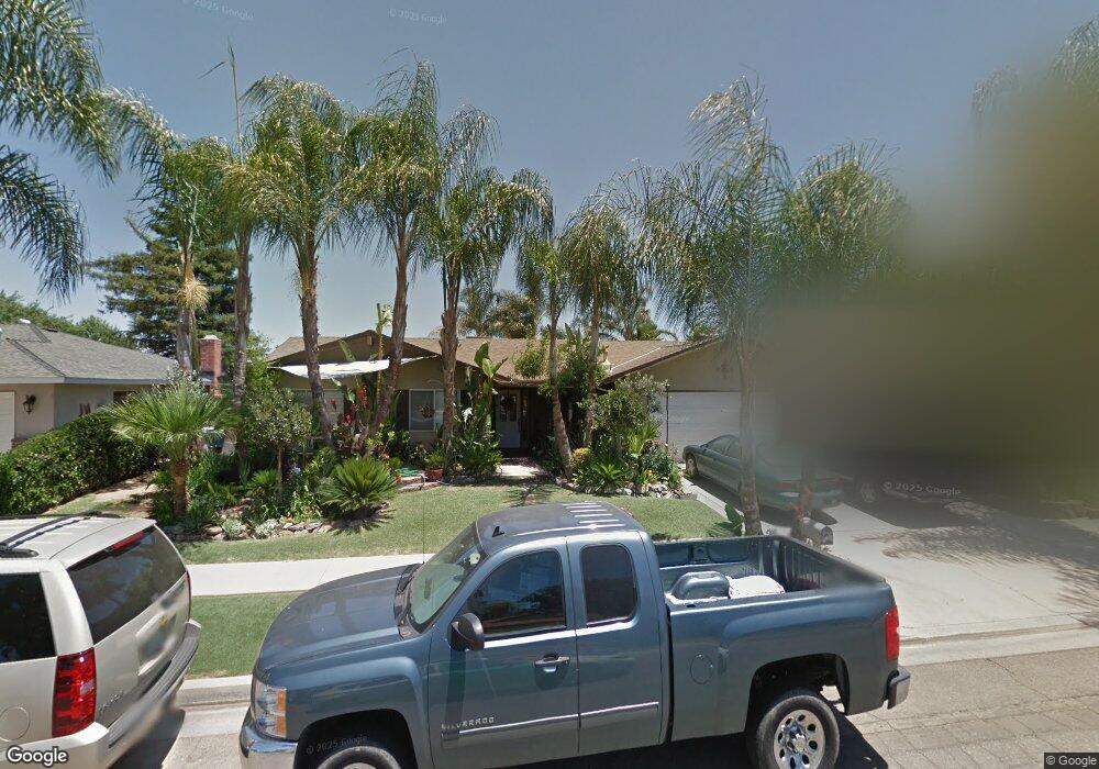
438 N Phillip Ave Fresno, CA 93727
Sunnyside NeighborhoodEstimated Value: $305,000 - $401,000
3
Beds
2
Baths
1,799
Sq Ft
$205/Sq Ft
Est. Value
About This Home
This home is located at 438 N Phillip Ave, Fresno, CA 93727 and is currently estimated at $369,303, approximately $205 per square foot. 438 N Phillip Ave is a home located in Fresno County with nearby schools including Temperance-Kutner Elementary School, Reyburn Intermediate School, and Clovis East High School.
Ownership History
Date
Name
Owned For
Owner Type
Purchase Details
Closed on
Aug 19, 2021
Sold by
Faapouli Porotesano
Bought by
Faapouli Porotesano and Faapouli Katrina
Current Estimated Value
Home Financials for this Owner
Home Financials are based on the most recent Mortgage that was taken out on this home.
Original Mortgage
$255,000
Outstanding Balance
$231,525
Interest Rate
2.8%
Estimated Equity
$137,778
Purchase Details
Closed on
Mar 11, 2004
Sold by
Jefford Norman David and Jefford Carol Sue
Bought by
Faapouli Porotesano
Home Financials for this Owner
Home Financials are based on the most recent Mortgage that was taken out on this home.
Original Mortgage
$153,600
Interest Rate
7.37%
Mortgage Type
Purchase Money Mortgage
Create a Home Valuation Report for This Property
The Home Valuation Report is an in-depth analysis detailing your home's value as well as a comparison with similar homes in the area
Home Values in the Area
Average Home Value in this Area
Purchase History
| Date | Buyer | Sale Price | Title Company |
|---|---|---|---|
| Faapouli Porotesano | -- | First American Title Company | |
| Faapouli Porotesano | $93,000 | Financial Title Company |
Source: Public Records
Mortgage History
| Date | Status | Borrower | Loan Amount |
|---|---|---|---|
| Open | Faapouli Porotesano | $255,000 | |
| Closed | Faapouli Porotesano | $153,600 |
Source: Public Records
Tax History Compared to Growth
Tax History
| Year | Tax Paid | Tax Assessment Tax Assessment Total Assessment is a certain percentage of the fair market value that is determined by local assessors to be the total taxable value of land and additions on the property. | Land | Improvement |
|---|---|---|---|---|
| 2025 | $28 | $155,725 | $46,095 | $109,630 |
| 2023 | $28 | $149,680 | $44,306 | $105,374 |
| 2022 | $28 | $146,746 | $43,438 | $103,308 |
| 2021 | $28 | $143,870 | $42,587 | $101,283 |
| 2020 | $28 | $142,396 | $42,151 | $100,245 |
| 2019 | $30 | $139,605 | $41,325 | $98,280 |
| 2018 | $54 | $136,868 | $40,515 | $96,353 |
| 2017 | $69 | $134,185 | $39,721 | $94,464 |
| 2016 | $76 | $131,555 | $38,943 | $92,612 |
| 2015 | $66 | $129,580 | $38,359 | $91,221 |
| 2014 | $53 | $127,043 | $37,608 | $89,435 |
Source: Public Records
Map
Nearby Homes
- 5771 E Belmont Ave
- 5576 E Belmont Ave
- 5527 E Grant Ave
- 5846 E Grant Ave
- 5882 E Washington Ave
- 5894 E Madison Ave
- 263 N Stanford Ave
- 252 S Kona Ave
- 6080 E Platt Ave
- 350 S Argyle Ave Unit 103
- 350 S Argyle Ave Unit 101
- 6551 E Cresthaven Dr
- 5652 E Dayton Ave
- 6528 E Clingstone Dr
- 6573 E Clingstone Dr
- 6555 E Blushing Dr
- 372 S Argyle Ave Unit 102
- 342 N Minnewawa Ave
- 5407 E Tulare St
- 337 S Stanford Ave
- 428 N Phillip Ave
- 448 N Phillip Ave
- 439 N Marion Ave
- 429 N Marion Ave
- 449 N Marion Ave
- 418 N Phillip Ave
- 437 N Phillip Ave
- 419 N Marion Ave
- 427 N Phillip Ave
- 447 N Phillip Ave
- 417 N Phillip Ave
- 406 N Phillip Ave
- 457 N Phillip Ave
- 409 N Marion Ave
- 5671 E Madison Ave
- 5675 E Madison Ave
- 407 N Phillip Ave
- 5681 E Madison Ave
- 5690 E Madison Ave
- 428 N Marion Ave