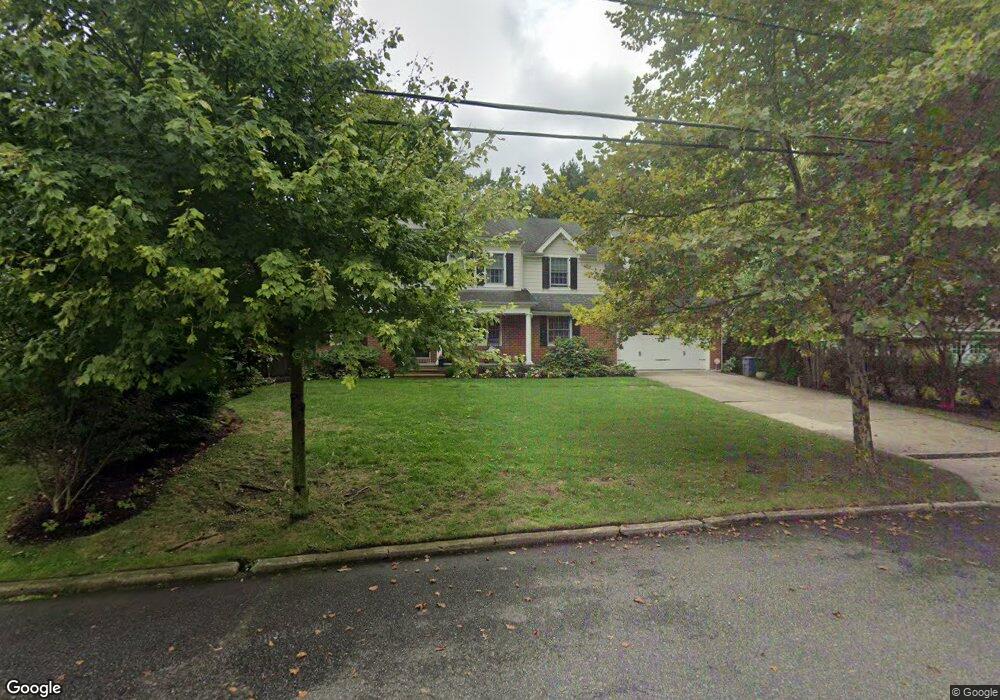
438 W Euclid Ave Haddonfield, NJ 08033
Estimated Value: $1,284,284 - $1,637,000
--
Bed
--
Bath
3,312
Sq Ft
$437/Sq Ft
Est. Value
About This Home
This home is located at 438 W Euclid Ave, Haddonfield, NJ 08033 and is currently estimated at $1,448,095, approximately $437 per square foot. 438 W Euclid Ave is a home located in Camden County with nearby schools including Haddonfield Memorial High School, Christ the King Regional School, and Haddonfield Friends School.
Ownership History
Date
Name
Owned For
Owner Type
Purchase Details
Closed on
Sep 16, 2008
Sold by
Donaldson Norma
Bought by
Barson Jeffrey and Barson Lisa
Current Estimated Value
Home Financials for this Owner
Home Financials are based on the most recent Mortgage that was taken out on this home.
Original Mortgage
$284,000
Outstanding Balance
$189,080
Interest Rate
6.54%
Mortgage Type
New Conventional
Estimated Equity
$1,259,015
Create a Home Valuation Report for This Property
The Home Valuation Report is an in-depth analysis detailing your home's value as well as a comparison with similar homes in the area
Home Values in the Area
Average Home Value in this Area
Purchase History
| Date | Buyer | Sale Price | Title Company |
|---|---|---|---|
| Barson Jeffrey | $355,000 | -- |
Source: Public Records
Mortgage History
| Date | Status | Borrower | Loan Amount |
|---|---|---|---|
| Open | Barson Jeffrey | $284,000 |
Source: Public Records
Tax History Compared to Growth
Tax History
| Year | Tax Paid | Tax Assessment Tax Assessment Total Assessment is a certain percentage of the fair market value that is determined by local assessors to be the total taxable value of land and additions on the property. | Land | Improvement |
|---|---|---|---|---|
| 2025 | $21,402 | $662,400 | $279,700 | $382,700 |
| 2024 | $21,117 | $662,400 | $279,700 | $382,700 |
| 2023 | $21,117 | $662,400 | $279,700 | $382,700 |
| 2022 | $20,952 | $662,400 | $279,700 | $382,700 |
| 2021 | $20,596 | $662,400 | $279,700 | $382,700 |
| 2020 | $20,700 | $662,400 | $279,700 | $382,700 |
| 2019 | $205 | $662,400 | $279,700 | $382,700 |
| 2018 | $20,289 | $662,400 | $279,700 | $382,700 |
| 2017 | $19,806 | $662,400 | $279,700 | $382,700 |
| 2016 | $19,362 | $662,400 | $279,700 | $382,700 |
| 2015 | $18,825 | $662,400 | $279,700 | $382,700 |
| 2014 | $18,408 | $662,400 | $279,700 | $382,700 |
Source: Public Records
Map
Nearby Homes
- 634 W Redman Ave
- 108 Avondale Ave
- 341 Station Ave
- 38 Birchall Dr
- 315 Peyton Ave
- 656 W Crystal Lake Ave
- 33 Estaugh Ave
- 120 Kings Hwy W
- 2 Loucroft Ave
- 63 Truman Ave
- 320 Warwick Rd
- 428 Mansfield Ave
- 351 Bellevue Ave
- 125 W Summit Ave
- 301 Bradshaw Ave
- 233 E Kings Hwy
- 279 Crystal Terrace
- 210 Carlisle Rd
- 408 Westmont Ave
- 162 Princeton Rd
- 440 W Euclid Ave
- 432 W Euclid Ave
- 341 Kings Hwy W
- 100 Homestead Ave
- 426 W Euclid Ave
- 347 Kings Hwy W
- 337 Kings Hwy W
- 444 W Euclid Ave
- 427 W Euclid Ave
- 110 Homestead Ave
- 420 W Euclid Ave
- 335 Kings Hwy W
- 351 Kings Hwy W
- 269 Kings Hwy W
- 653 W Euclid Ave
- 109 Homestead Ave
- 423 W Euclid Ave
- 114 Homestead Ave
- 450 W Euclid Ave
- 412 W Euclid Ave