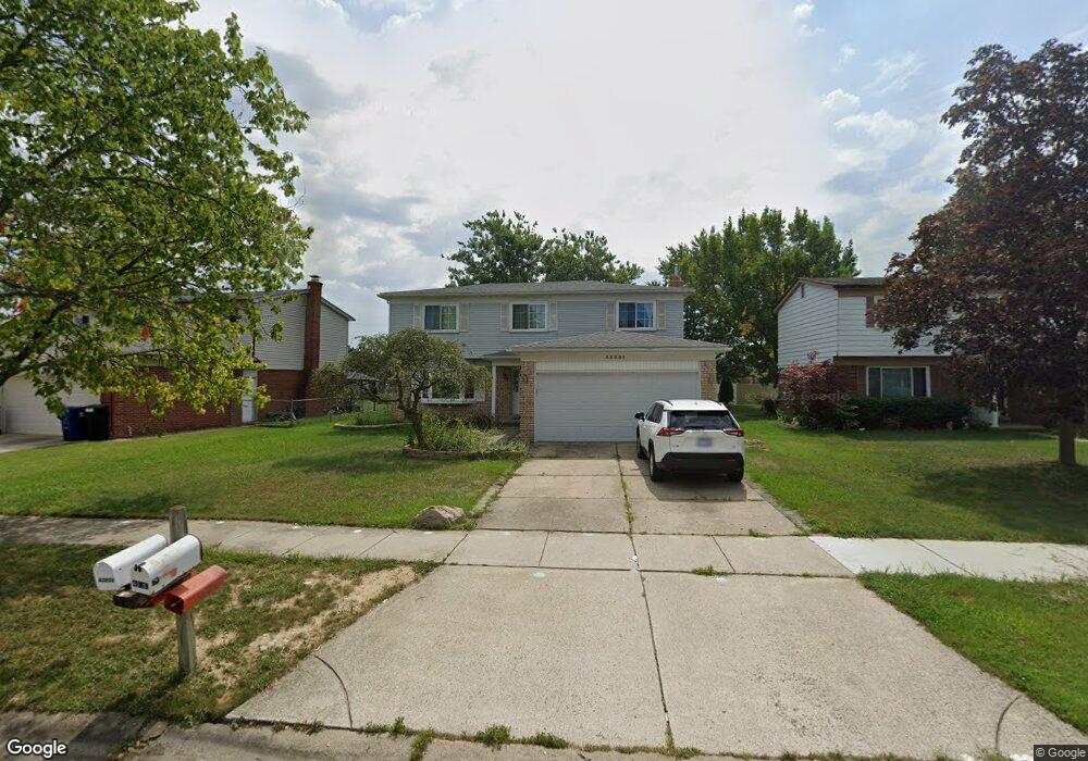
43801 Cranford Ave Canton, MI 48187
Estimated Value: $344,000 - $383,000
--
Bed
2
Baths
1,737
Sq Ft
$209/Sq Ft
Est. Value
About This Home
This home is located at 43801 Cranford Ave, Canton, MI 48187 and is currently estimated at $363,030, approximately $208 per square foot. 43801 Cranford Ave is a home located in Wayne County with nearby schools including Canton High School, Discovery Middle School, and Salem High School.
Ownership History
Date
Name
Owned For
Owner Type
Purchase Details
Closed on
Aug 5, 2019
Sold by
Lin Dong Wei and Chen Xing Mei
Bought by
Lin Dong Wei and Chen Xing Mei
Current Estimated Value
Purchase Details
Closed on
Jun 27, 2000
Sold by
Wagner George B
Bought by
Lin Dong W
Purchase Details
Closed on
Aug 18, 1994
Sold by
Wieserman Andrea F
Bought by
Wagner George B
Home Financials for this Owner
Home Financials are based on the most recent Mortgage that was taken out on this home.
Original Mortgage
$127,205
Interest Rate
8.72%
Mortgage Type
VA
Create a Home Valuation Report for This Property
The Home Valuation Report is an in-depth analysis detailing your home's value as well as a comparison with similar homes in the area
Home Values in the Area
Average Home Value in this Area
Purchase History
| Date | Buyer | Sale Price | Title Company |
|---|---|---|---|
| Lin Dong Wei | -- | None Available | |
| Lin Dong W | $175,000 | -- | |
| Wagner George B | $123,500 | -- |
Source: Public Records
Mortgage History
| Date | Status | Borrower | Loan Amount |
|---|---|---|---|
| Previous Owner | Wagner George B | $127,205 |
Source: Public Records
Tax History Compared to Growth
Tax History
| Year | Tax Paid | Tax Assessment Tax Assessment Total Assessment is a certain percentage of the fair market value that is determined by local assessors to be the total taxable value of land and additions on the property. | Land | Improvement |
|---|---|---|---|---|
| 2025 | $1,414 | $155,500 | $0 | $0 |
| 2024 | $1,414 | $142,200 | $0 | $0 |
| 2023 | $1,348 | $126,200 | $0 | $0 |
| 2022 | $3,022 | $110,700 | $0 | $0 |
| 2021 | $2,931 | $109,500 | $0 | $0 |
| 2020 | $2,893 | $104,500 | $0 | $0 |
| 2019 | $2,840 | $95,850 | $0 | $0 |
| 2018 | $1,145 | $87,890 | $0 | $0 |
| 2017 | $2,960 | $86,900 | $0 | $0 |
| 2016 | $2,591 | $88,900 | $0 | $0 |
| 2015 | $6,294 | $79,650 | $0 | $0 |
| 2013 | $6,097 | $63,330 | $0 | $0 |
| 2010 | -- | $70,950 | $40,542 | $30,408 |
Source: Public Records
Map
Nearby Homes
- 437 Corinne Blvd
- 44150 Duchess Dr
- 278 Cornell St
- 1322 Saltz Ct
- 603 Concord Dr Unit 67
- 42771 Lilley Pointe Dr Unit 154
- 42789 Lilley Pointe Dr Unit 146
- 44893 Fair Oaks Dr
- 1494 Ranier Blvd
- 227 Edington Cir
- 42697 Redfern St
- 550 Concord Dr Unit 75
- 5887 Northford
- 288 Edington Cir Unit 61
- 42479 Redfern St
- 42481 Lilley Pointe Dr Unit 33
- 45030 Glengarry Rd
- 1822 N Sheldon Rd
- 678 Kings Way
- 43592 Champlain Ct
- 43813 Cranford Ave
- 43775 Cranford Ave
- 43759 Cranford Ave
- 43825 Cranford Ave
- 43806 Palisades Dr
- 43770 Palisades Dr
- 43818 Palisades Dr Unit Bldg-Unit
- 43818 Palisades Dr
- 43758 Palisades Dr
- 43837 Cranford Ave
- 43747 Cranford Ave
- 43800 Cranford Ave
- 43830 Palisades Dr
- 43812 Cranford Ave
- 43776 Cranford Ave
- 43824 Cranford Ave
- 43764 Cranford Ave
- 43746 Palisades Dr
- 43848 Palisades Dr
- 43735 Cranford Ave