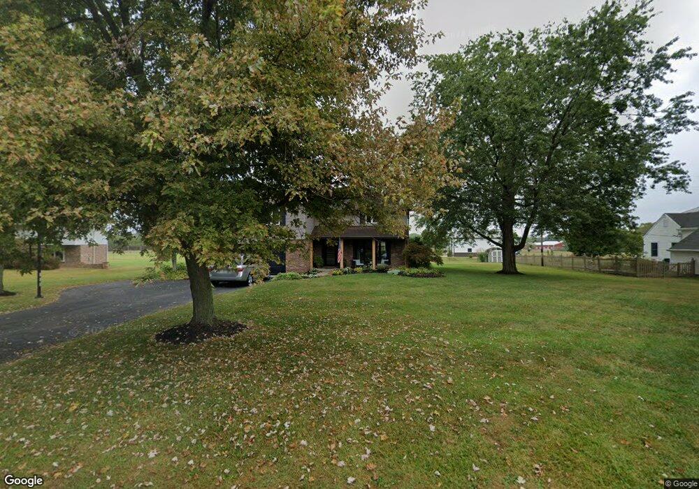
4383 High St Brownsburg, IN 46112
Estimated Value: $346,000 - $409,000
4
Beds
4
Baths
2,576
Sq Ft
$146/Sq Ft
Est. Value
About This Home
This home is located at 4383 High St, Brownsburg, IN 46112 and is currently estimated at $376,734, approximately $146 per square foot. 4383 High St is a home located in Hendricks County with nearby schools including White Lick Elementary School, Brownsburg West Middle School, and Brownsburg High School.
Ownership History
Date
Name
Owned For
Owner Type
Purchase Details
Closed on
May 27, 2015
Sold by
Mlagan John C and Mlagan Mary J
Bought by
Mlagan John C and Mlagan Jody L
Current Estimated Value
Home Financials for this Owner
Home Financials are based on the most recent Mortgage that was taken out on this home.
Original Mortgage
$180,667
Interest Rate
3.88%
Mortgage Type
FHA
Purchase Details
Closed on
Jan 30, 2008
Sold by
Relocation Properties Management Llc
Bought by
Mlagan Ii John C and Mlagan Mary J
Home Financials for this Owner
Home Financials are based on the most recent Mortgage that was taken out on this home.
Original Mortgage
$124,000
Interest Rate
6.11%
Mortgage Type
New Conventional
Purchase Details
Closed on
Sep 25, 2007
Sold by
Eckhardt James W and Eckhardt Patricia S
Bought by
Relocation Properties Management Llc
Create a Home Valuation Report for This Property
The Home Valuation Report is an in-depth analysis detailing your home's value as well as a comparison with similar homes in the area
Home Values in the Area
Average Home Value in this Area
Purchase History
| Date | Buyer | Sale Price | Title Company |
|---|---|---|---|
| Mlagan John C | -- | Chicago Title | |
| Mlagan Ii John C | -- | Indiana Title Services Llc | |
| Relocation Properties Management Llc | -- | None Available |
Source: Public Records
Mortgage History
| Date | Status | Borrower | Loan Amount |
|---|---|---|---|
| Previous Owner | Mlagan John C | $180,667 | |
| Previous Owner | Mlagan Ii John C | $124,000 |
Source: Public Records
Tax History Compared to Growth
Tax History
| Year | Tax Paid | Tax Assessment Tax Assessment Total Assessment is a certain percentage of the fair market value that is determined by local assessors to be the total taxable value of land and additions on the property. | Land | Improvement |
|---|---|---|---|---|
| 2024 | $4,144 | $259,100 | $36,200 | $222,900 |
| 2023 | $2,534 | $247,200 | $34,500 | $212,700 |
| 2022 | $2,349 | $235,400 | $32,900 | $202,500 |
| 2021 | $2,024 | $206,200 | $32,900 | $173,300 |
| 2020 | $1,890 | $194,400 | $32,900 | $161,500 |
| 2019 | $1,656 | $177,200 | $31,400 | $145,800 |
| 2018 | $1,606 | $171,700 | $31,400 | $140,300 |
| 2017 | $1,534 | $164,300 | $30,300 | $134,000 |
| 2016 | $1,523 | $163,800 | $30,300 | $133,500 |
| 2014 | $3,198 | $159,800 | $28,500 | $131,300 |
| 2013 | $3,199 | $159,800 | $28,500 | $131,300 |
Source: Public Records
Map
Nearby Homes
- 5037 Carmine St
- 5523 Sienna Ct
- 4970 Amber Crest Dr
- 5010 Carmine St
- 4919 Amber Crest Dr
- 4928 Amber Crest Dr
- 5015 Carmine St
- 5066 Carmine St
- 4976 Amber Crest Dr
- 5024 Carmine St
- 5040 Carmine St
- 5002 Bergamot Dr
- 4947 Amber Crest Dr
- 5052 Carmine St
- 5026 Bergamot Dr
- 5032 Carmine St
- Glacier II Plan at Auburn Ridge - Legacy Series
- Ainsley II Plan at Auburn Ridge - Prestige Series
- Berkeley Basement Plan at Auburn Ridge - Prestige Series
- Kentmore Basement Plan at Auburn Ridge - Prestige Series
- 4371 High St
- 4401 High St
- 4408 High St
- 4425 High St
- 4372 High St
- 5525 E County Road 450 N
- 4355 High St
- 4287 High Dr
- 4383 High Dr
- 4447 High Dr
- 4447 High St
- 4344 High St
- 4407 High Acres Dr
- 4333 High St
- 5481 E County Road 450 N
- 4377 High Acres Dr
- 5425 E County Road 450 N
- 5415 E County Road 450 N
- 4316 High St
- 4345 High Acres Dr