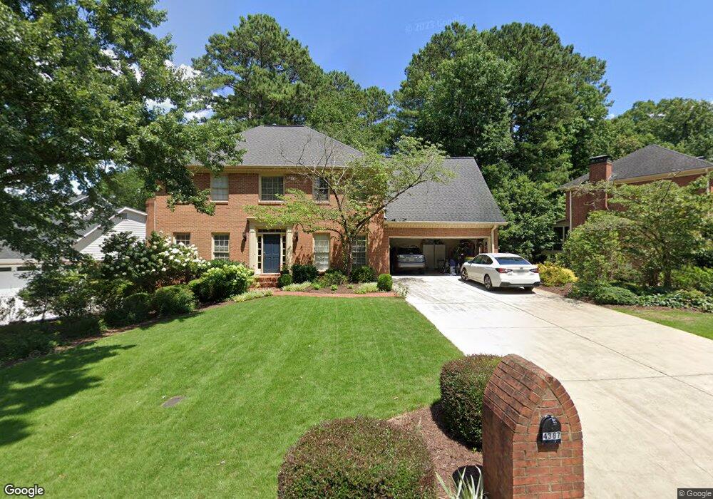
4387 Stilson Cir Unit 13 Norcross, GA 30092
Estimated Value: $670,210 - $788,000
4
Beds
3
Baths
2,838
Sq Ft
$262/Sq Ft
Est. Value
About This Home
This home is located at 4387 Stilson Cir Unit 13, Norcross, GA 30092 and is currently estimated at $743,303, approximately $261 per square foot. 4387 Stilson Cir Unit 13 is a home located in Gwinnett County with nearby schools including Simpson Elementary School, Pinckneyville Middle School, and Norcross High School.
Ownership History
Date
Name
Owned For
Owner Type
Purchase Details
Closed on
Oct 19, 2000
Sold by
Hirai Ryoji
Bought by
Sheffield John R and Sheffield Anne
Current Estimated Value
Home Financials for this Owner
Home Financials are based on the most recent Mortgage that was taken out on this home.
Original Mortgage
$110,000
Outstanding Balance
$39,858
Interest Rate
7.83%
Mortgage Type
New Conventional
Estimated Equity
$703,445
Purchase Details
Closed on
Aug 29, 1996
Sold by
Odaira Jupei
Bought by
Hirai Ryoji
Create a Home Valuation Report for This Property
The Home Valuation Report is an in-depth analysis detailing your home's value as well as a comparison with similar homes in the area
Home Values in the Area
Average Home Value in this Area
Purchase History
| Date | Buyer | Sale Price | Title Company |
|---|---|---|---|
| Sheffield John R | $240,000 | -- | |
| Hirai Ryoji | $212,000 | -- |
Source: Public Records
Mortgage History
| Date | Status | Borrower | Loan Amount |
|---|---|---|---|
| Open | Sheffield John R | $110,000 | |
| Closed | Hirai Ryoji | $0 |
Source: Public Records
Tax History Compared to Growth
Tax History
| Year | Tax Paid | Tax Assessment Tax Assessment Total Assessment is a certain percentage of the fair market value that is determined by local assessors to be the total taxable value of land and additions on the property. | Land | Improvement |
|---|---|---|---|---|
| 2024 | $6,543 | $246,920 | $50,400 | $196,520 |
| 2023 | $6,543 | $205,520 | $44,000 | $161,520 |
| 2022 | $5,303 | $186,320 | $36,000 | $150,320 |
| 2021 | $4,710 | $152,800 | $35,520 | $117,280 |
| 2020 | $4,743 | $152,800 | $35,520 | $117,280 |
| 2019 | $4,585 | $151,120 | $30,000 | $121,120 |
| 2018 | $4,602 | $151,120 | $30,000 | $121,120 |
| 2016 | $4,164 | $132,800 | $24,000 | $108,800 |
| 2015 | $4,204 | $132,800 | $24,000 | $108,800 |
| 2014 | $4,087 | $132,800 | $24,000 | $108,800 |
Source: Public Records
Map
Nearby Homes
- 5568 Fitzpatrick Trace
- 5578 Fitzpatrick Trace
- 5221 W Jones Bridge Rd
- 5350 Wickershire Dr
- 4635 Walden Trace
- 5465 Fort Fisher Way
- 4531 Outer Bank Dr
- 5440 Clinchfield Trail
- 5354 Fox Hill Dr
- 5194 Sunburst Dr
- 4268 Millhouse Ln NW
- 5863 Revington Dr
- 5176 Creek Walk Cir
- 4477 Watervale Way Unit 286
- The Grayson II Plan at Waterside - Townhomes
- The Stafford Plan at Waterside - Single Family
- The Stanley Plan at Waterside - Single Family
- 4407 Stilson Cir
- 4377 Stilson Cir
- 5499 Portal Place
- 4417 Stilson Cir
- 4367 Stilson Cir
- 4396 Stilson Cir
- 4386 Stilson Cir
- 4406 Stilson Cir
- 4376 Stilson Cir Unit 13
- 4427 Stilson Cir
- 5489 Portal Place
- 5488 Portal Place Unit 13
- 4357 Stilson Cir
- 4366 Stilson Cir
- 4416 Stilson Cir Unit 13
- 4372 Fielding Ln
- 4363 Fielding Ln
- 4426 Stilson Cir
- 4356 Stilson Cir Unit 13
- 4437 Stilson Cir