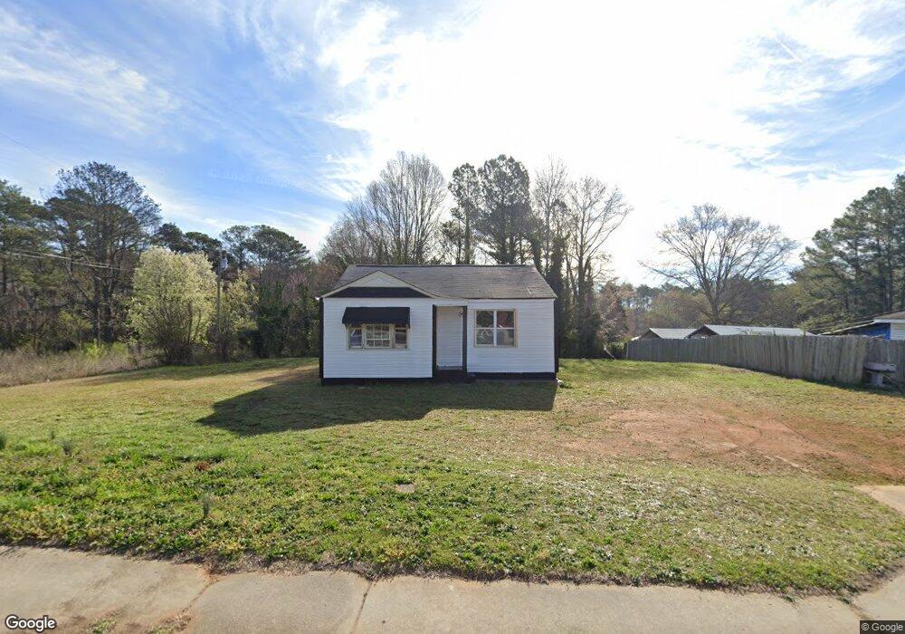
4389 Austell Rd Unit 19100600030 Austell, GA 30106
Estimated Value: $140,260
2
Beds
2
Baths
897
Sq Ft
$156/Sq Ft
Est. Value
About This Home
This home is located at 4389 Austell Rd Unit 19100600030, Austell, GA 30106 and is currently priced at $140,260, approximately $156 per square foot. 4389 Austell Rd Unit 19100600030 is a home located in Cobb County with nearby schools including Deerwood Elementary School, Sunrise Elementary School, and Sanders Elementary School.
Ownership History
Date
Name
Owned For
Owner Type
Purchase Details
Closed on
May 4, 2021
Sold by
Ruso Julio Hugo Penn
Bought by
Creese Yolanda Henderson
Current Estimated Value
Purchase Details
Closed on
Nov 15, 2018
Sold by
Listur Walter
Bought by
Penza Ruso Julio Hugo
Purchase Details
Closed on
Jun 26, 2001
Sold by
Delgado Fernando and Delgado Rosalba
Bought by
Listur Walter and Listur Amanda
Home Financials for this Owner
Home Financials are based on the most recent Mortgage that was taken out on this home.
Original Mortgage
$23,232
Interest Rate
7.16%
Mortgage Type
New Conventional
Purchase Details
Closed on
Dec 29, 1995
Sold by
Boring Shella Lynn
Bought by
Delagdo Fernando Rosalba
Create a Home Valuation Report for This Property
The Home Valuation Report is an in-depth analysis detailing your home's value as well as a comparison with similar homes in the area
Home Values in the Area
Average Home Value in this Area
Purchase History
| Date | Buyer | Sale Price | Title Company |
|---|---|---|---|
| Creese Yolanda Henderson | $100,000 | None Available | |
| Penza Ruso Julio Hugo | -- | -- | |
| Listur Walter | $22,000 | -- | |
| Delagdo Fernando Rosalba | $54,000 | -- |
Source: Public Records
Mortgage History
| Date | Status | Borrower | Loan Amount |
|---|---|---|---|
| Previous Owner | Listur Walter | $23,232 | |
| Closed | Delagdo Fernando Rosalba | $0 |
Source: Public Records
Tax History Compared to Growth
Tax History
| Year | Tax Paid | Tax Assessment Tax Assessment Total Assessment is a certain percentage of the fair market value that is determined by local assessors to be the total taxable value of land and additions on the property. | Land | Improvement |
|---|---|---|---|---|
| 2025 | $1,411 | $46,840 | $42,120 | $4,720 |
| 2024 | $1,410 | $46,760 | $42,120 | $4,640 |
| 2023 | $1,227 | $40,708 | $36,628 | $4,080 |
| 2022 | $1,193 | $39,308 | $35,348 | $3,960 |
| 2021 | $1,154 | $38,020 | $35,348 | $2,672 |
| 2020 | $1,191 | $39,228 | $30,736 | $8,492 |
| 2019 | $1,157 | $38,116 | $30,736 | $7,380 |
| 2018 | $1,157 | $38,116 | $30,736 | $7,380 |
| 2017 | $1,096 | $38,116 | $30,736 | $7,380 |
| 2016 | $369 | $12,844 | $5,404 | $7,440 |
| 2015 | $378 | $12,844 | $5,404 | $7,440 |
| 2014 | $331 | $11,140 | $5,404 | $5,736 |
Source: Public Records
Map
Nearby Homes
- 4349 Kousa Rd Unit 4
- 4470 Austell Rd
- 4390 Chelou Dr
- 1791 Fairview Dr SW
- 2034 Drennon Ave
- 2013 Chesley Dr
- 2081 Lenoa Ln
- 2083 Lenoa Ln
- 2085 Lenoa Ln
- 4582 Austell Rd
- 2072 Mcduffie Rd
- 4420 Pink Rose Ct
- 4192 Rhinehart Dr
- 2110 Plum Ln
- 4287 Keats Ct
- 2163 Willow Ln
- 4200 Citizen Cir Unit 3
- 2300 Anderson Mill Rd
- 4389 Austell Rd
- 4399 Austell Rd
- 4371 Austell Rd
- 4379 Austell Rd
- 1846 Elmwood Dr
- 4415 Austell Rd
- 1834 Elmwood Dr
- 4427 Austell Rd
- 4390 Austell Rd
- 1847 Elmwood Dr
- 1822 Elmwood Dr
- 1835 Elmwood Dr
- 4439 Austell Rd
- 1821 Elmwood Dr
- 1901 Orange Grove Place Unit 44
- 1897 Orange Grove Place
- 1808 Elmwood Dr
- 4351 Kousa Rd
- 4351 Kousa Rd Unit 15
- 1893 Orange Grove Place Unit 42