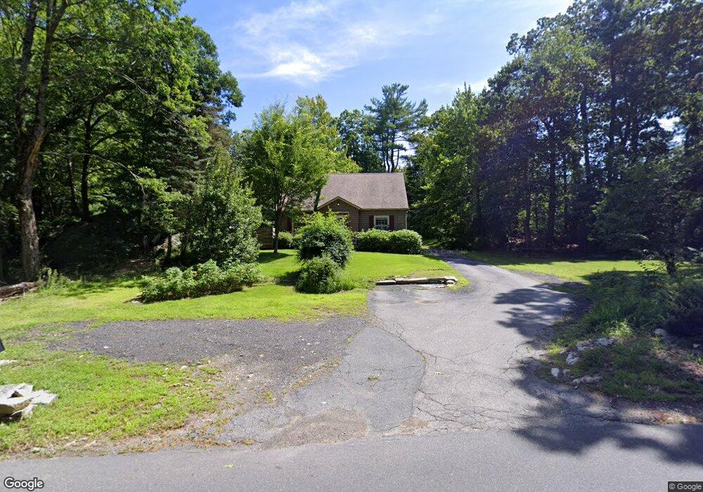
439 Cross St Boylston, MA 01505
Estimated Value: $502,000 - $542,000
3
Beds
1
Bath
1,542
Sq Ft
$334/Sq Ft
Est. Value
About This Home
This home is located at 439 Cross St, Boylston, MA 01505 and is currently estimated at $515,682, approximately $334 per square foot. 439 Cross St is a home located in Worcester County with nearby schools including Tahanto Regional High School.
Ownership History
Date
Name
Owned For
Owner Type
Purchase Details
Closed on
Nov 3, 2020
Sold by
Mcquiston Albert M and Mcquiston Marcia J
Bought by
421 Cross St Realty Llc
Current Estimated Value
Purchase Details
Closed on
Oct 4, 1980
Bought by
Mcquiston Albert M and Mcquiston Marcia J
Create a Home Valuation Report for This Property
The Home Valuation Report is an in-depth analysis detailing your home's value as well as a comparison with similar homes in the area
Home Values in the Area
Average Home Value in this Area
Purchase History
| Date | Buyer | Sale Price | Title Company |
|---|---|---|---|
| 421 Cross St Realty Llc | $325,000 | None Available | |
| Mcquiston Albert M | $59,000 | -- |
Source: Public Records
Mortgage History
| Date | Status | Borrower | Loan Amount |
|---|---|---|---|
| Previous Owner | Mcquiston Albert M | $103,500 | |
| Previous Owner | Mcquiston Albert M | $50,000 |
Source: Public Records
Tax History Compared to Growth
Tax History
| Year | Tax Paid | Tax Assessment Tax Assessment Total Assessment is a certain percentage of the fair market value that is determined by local assessors to be the total taxable value of land and additions on the property. | Land | Improvement |
|---|---|---|---|---|
| 2025 | $6,457 | $466,900 | $211,800 | $255,100 |
| 2024 | $5,648 | $409,000 | $211,800 | $197,200 |
| 2023 | $5,995 | $416,300 | $211,800 | $204,500 |
| 2022 | $5,495 | $346,900 | $211,800 | $135,100 |
| 2021 | $5,678 | $334,400 | $211,800 | $122,600 |
| 2020 | $5,437 | $328,700 | $214,200 | $114,500 |
| 2019 | $5,150 | $321,100 | $212,200 | $108,900 |
| 2018 | $5,287 | $316,000 | $212,200 | $103,800 |
| 2017 | $5,094 | $316,000 | $212,200 | $103,800 |
| 2016 | $4,625 | $282,500 | $172,600 | $109,900 |
| 2015 | $4,918 | $282,500 | $172,600 | $109,900 |
| 2014 | $4,594 | $264,200 | $159,400 | $104,800 |
Source: Public Records
Map
Nearby Homes
- 18 Bay Path Dr
- 48 Perry Rd
- 5 Sewall St Unit 259
- 21 School St
- 2 Harmony Ln Unit 1
- 7 Oakwood Cir Unit 15
- 1 Harmony Ln Unit 4
- 8 Burkhardt Cir Unit 8
- 4 Harmony Ln Unit 2
- 70 Colonial Dr
- 207 Edgebrook Dr Unit 2-11
- 217 Edgebrook Dr
- 20 Rawson Hill Dr
- 34 Joseph Rd
- 26 W Temple St
- 7-11 Reservoir St
- 11 Cranbrook Rd
- 279 Sewall St Unit 279
- 281 Sewall St Unit 281
- 45 Compass Cir Unit 45A