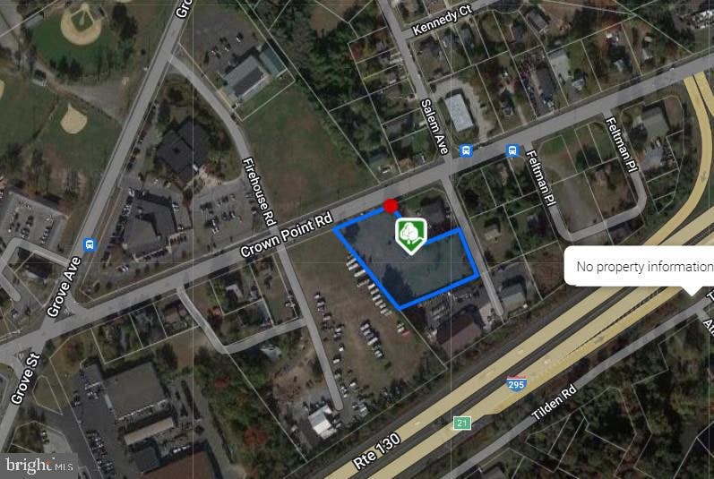
439 Crown Point Rd West Deptford, NJ 08086
West Deptford Township NeighborhoodEstimated payment $3,862/month
Highlights
- 1.54 Acre Lot
- No HOA
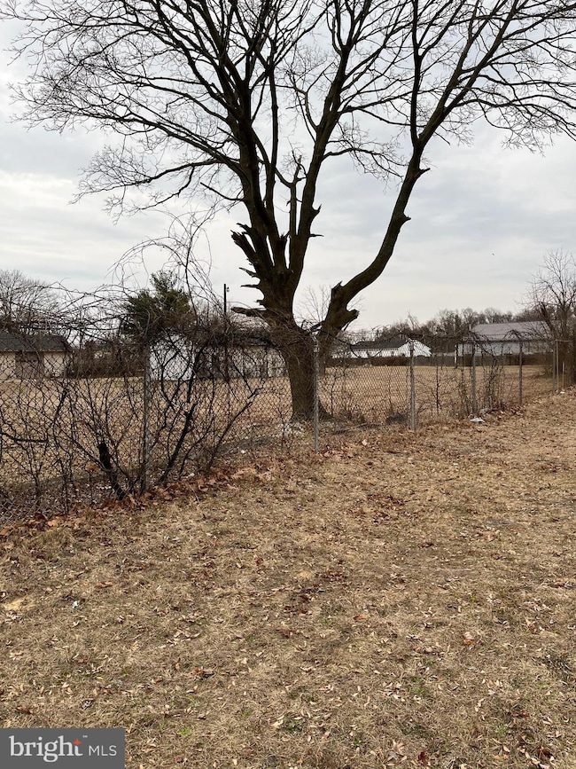
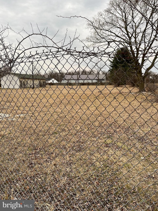
- Level Lot
About This Lot
This 1.54 acres commercial property is truly an exceptional opportunity located on Crown Point Road in West Deptford Township. Property has access to Crown Point Road as well as Salem Avenue which makes this property easily accessible by all types of vehicles. Having access to two roadways should make it easier for Township approvals. Property allows for many uses in Commercial Zones as well as light manufacturing. Water, sewer and gas are also available. We suggest all developers to reach out to the township with any zoning questions and all zoning and building requirements will be the buyers responsibility. Easy access to Interstate 295 with short drive to Philadelphia and Delaware.
Listing Agent
(609) 922-2077 william.mckeever1@verizon.net Century 21 Alliance - Mantua Listed on: 02/28/2024

Property Details
Property Type
- Land
Est. Annual Taxes
- $5,231
Lot Details
- 1.54 Acre Lot
- Level Lot
- Irregular Lot
- Zoning described as Commercial 4A
Schools
- West Deptford High School
Community Details
- No Home Owners Association
Listing and Financial Details
- Tax Lot 00009
- Assessor Parcel Number 20-00252-00009
Map
Home Values in the Area
Average Home Value in this Area
Tax History
| Year | Tax Paid | Tax Assessment Tax Assessment Total Assessment is a certain percentage of the fair market value that is determined by local assessors to be the total taxable value of land and additions on the property. | Land | Improvement |
|---|---|---|---|---|
| 2025 | $5,231 | $149,800 | $148,300 | $1,500 |
| 2024 | $5,164 | $149,800 | $148,300 | $1,500 |
| 2023 | $5,164 | $149,800 | $148,300 | $1,500 |
| 2022 | $5,335 | $149,800 | $148,300 | $1,500 |
| 2021 | $5,479 | $160,300 | $148,300 | $12,000 |
| 2020 | $5,969 | $175,000 | $148,300 | $26,700 |
| 2019 | $5,803 | $175,000 | $148,300 | $26,700 |
| 2018 | $5,646 | $175,000 | $148,300 | $26,700 |
| 2017 | $5,514 | $175,000 | $148,300 | $26,700 |
| 2016 | $5,360 | $175,000 | $148,300 | $26,700 |
| 2015 | $5,107 | $175,000 | $148,300 | $26,700 |
| 2014 | $4,853 | $175,000 | $148,300 | $26,700 |
Property History
| Date | Event | Price | List to Sale | Price per Sq Ft |
|---|---|---|---|---|
| 02/28/2024 02/28/24 | For Sale | $650,000 | -- | -- |
Purchase History
| Date | Type | Sale Price | Title Company |
|---|---|---|---|
| Deed | $263,290 | Franklin Title Agency Inc | |
| Deed | $252,000 | Stewart Title Guaranty Compa | |
| Interfamily Deed Transfer | -- | -- | |
| Interfamily Deed Transfer | -- | -- |
Source: Bright MLS
MLS Number: NJGL2039618
APN: 20-00252-0000-00009
Disclaimer: Certain information contained herein is derived from information provided by parties other than Homes.com. All information provided is deemed reliable, but is not guaranteed to be accurate and should be independently verified.
![]() The data relating to real estate for sale on this website appears in part through the BRIGHT Internet Data Exchange program, a voluntary cooperative exchange of property listing data between licensed real estate brokerage firms, and is provided by BRIGHT through a licensing agreement.
The data relating to real estate for sale on this website appears in part through the BRIGHT Internet Data Exchange program, a voluntary cooperative exchange of property listing data between licensed real estate brokerage firms, and is provided by BRIGHT through a licensing agreement.
Listing information is from various brokers who participate in the Bright MLS IDX program and not all listings may be visible on the site.
The property information being provided on or through the website is for the personal, non-commercial use of consumers and such information may not be used for any purpose other than to identify prospective properties consumers may be interested in purchasing.
Some properties which appear for sale on the website may no longer be available because they are for instance, under contract, sold or are no longer being offered for sale.
Property information displayed is deemed reliable but is not guaranteed.
Copyright 2025 Bright MLS, Inc.
- 433 Crown Point Rd
- 10 Kennedy Ct
- 177 Frederic Ct Unit 177
- 64 Tilden Rd
- 121 Cape May Ave
- 67 Pelican Place
- 38 Pelican Place Unit 38
- 107 Audubon Ave
- 136 Sandpiper Ln
- 400 Audubon Ave
- 97 Church St
- 6 Phoebe Terrace
- 247 Crown Point Rd
- 266 Passaic Ave
- 238 Night Hawk Cir
- 253 Snowy Egret Ln
- 1810 Fernwood Dr
- 8 Starling Ct
- 740 Carter Hill Dr
- 4 Saint Emilion Ct
- 124 Brent Ct
- 370 Grove Ave
- 262 Crown Point Rd Unit A
- 431 Myrtle Ave
- 87 Woodway Dr Unit 87
- 4000 Forest Creek Ln
- 117 Lionheart Ln Unit D117
- 12 Highbridge Ln Unit I2
- 518 W Red Bank Ave Unit 2
- 1100 Wesley Ave Unit 2
- 968 Kings Hwy
- 53 High St Unit 3A
- 53 High St Unit 2A
- 33 High St Unit A
- 121 Oak St
- 517 Tatum St
- 38 Curtis Ave Unit B
- 551 Naomi Ave
- 150 Franklin St
- 63 E Barber Ave Unit B