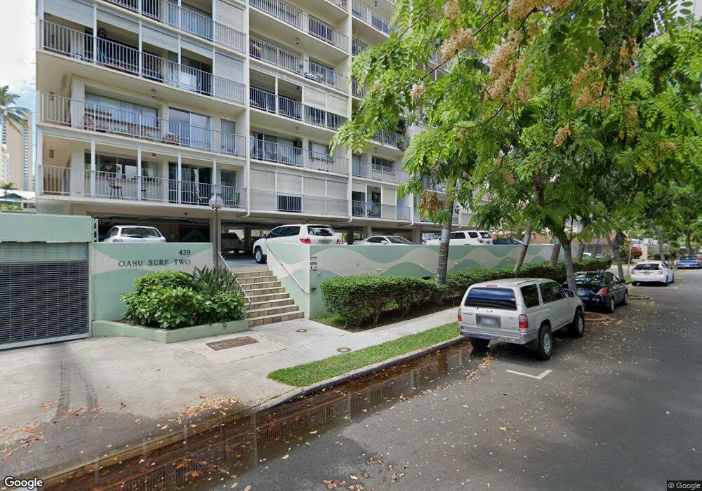
Oahu Surf Two 439 Keoniana St Unit 1005 Honolulu, HI 96815
Waikiki NeighborhoodEstimated Value: $555,869 - $631,000
2
Beds
2
Baths
842
Sq Ft
$698/Sq Ft
Est. Value
About This Home
This home is located at 439 Keoniana St Unit 1005, Honolulu, HI 96815 and is currently estimated at $587,967, approximately $698 per square foot. 439 Keoniana St Unit 1005 is a home located in Honolulu County with nearby schools including Ala Wai Elementary School, President George Washington Middle School, and Kaimuki High School.
Ownership History
Date
Name
Owned For
Owner Type
Purchase Details
Closed on
Jul 24, 2025
Sold by
Au Albert Chi-Keung and Wong Christine Suk-Woon
Bought by
Albert C Au And Christine S W Wong Joint Livi and Au
Current Estimated Value
Purchase Details
Closed on
Nov 13, 1998
Sold by
Ching Yun Kyau and Ching Annabelle Yun Kyau
Bought by
Au Albert Chi Keung and Wong Christine Suk Woon
Home Financials for this Owner
Home Financials are based on the most recent Mortgage that was taken out on this home.
Original Mortgage
$100,000
Interest Rate
6.42%
Purchase Details
Closed on
Aug 31, 1995
Sold by
Ching Annabelle Yuen Kyau and Ching Yu Kyau
Bought by
Ching Yun Kyau and Ching Annabelle Yun Kyau
Create a Home Valuation Report for This Property
The Home Valuation Report is an in-depth analysis detailing your home's value as well as a comparison with similar homes in the area
Home Values in the Area
Average Home Value in this Area
Purchase History
| Date | Buyer | Sale Price | Title Company |
|---|---|---|---|
| Albert C Au And Christine S W Wong Joint Livi | -- | None Listed On Document | |
| Albert C Au And Christine S W Wong Joint Livi | -- | None Listed On Document | |
| Au Albert Chi Keung | $173,000 | -- | |
| Ching Yun Kyau | -- | -- |
Source: Public Records
Mortgage History
| Date | Status | Borrower | Loan Amount |
|---|---|---|---|
| Previous Owner | Au Albert Chi Keung | $100,000 |
Source: Public Records
Tax History Compared to Growth
Tax History
| Year | Tax Paid | Tax Assessment Tax Assessment Total Assessment is a certain percentage of the fair market value that is determined by local assessors to be the total taxable value of land and additions on the property. | Land | Improvement |
|---|---|---|---|---|
| 2025 | $1,504 | $586,500 | $94,200 | $492,300 |
| 2024 | $1,504 | $549,600 | $94,200 | $455,400 |
| 2023 | $1,009 | $488,300 | $92,900 | $395,400 |
| 2022 | $1,207 | $444,800 | $90,300 | $354,500 |
| 2021 | $1,092 | $412,100 | $90,300 | $321,800 |
| 2020 | $1,265 | $461,400 | $85,100 | $376,300 |
| 2019 | $1,331 | $460,400 | $82,600 | $377,800 |
| 2018 | $1,316 | $456,000 | $81,300 | $374,700 |
| 2017 | $1,275 | $444,400 | $77,400 | $367,000 |
| 2016 | $1,210 | $425,600 | $71,000 | $354,600 |
| 2015 | $1,126 | $401,600 | $66,500 | $335,100 |
| 2014 | $957 | $409,600 | $63,900 | $345,700 |
Source: Public Records
About Oahu Surf Two
Map
Nearby Homes
- 439 Keoniana St Unit 1205
- 439 Keoniana St Unit 503
- 448 Kuamoo St
- 454 Kuamoo St
- 2015 Ala Wai Blvd Unit 8A
- 419 Keoniana St Unit 604
- 419 Keoniana St Unit 1003
- 430 Keoniana St Unit 104
- 430 Keoniana St Unit 114
- 430 Keoniana St Unit 204
- 430 Keoniana St Unit 202
- 430 Keoniana St Unit 603
- 430 Keoniana St Unit 1002
- 430 Keoniana St Unit 1010
- 2029 Ala Wai Blvd Unit 304
- 419 Pau St
- 436 Namahana St
- 454 Namahana St Unit 601
- 454 Namahana St Unit 501
- 454 Namahana St Unit 803
- 439 Keoniana St Unit 301
- 439 Keoniana St Unit 1101
- 439 Keoniana St Unit 1203
- 439 Keoniana St Unit PH1
- 439 Keoniana St Unit 201
- 439 Keoniana St Unit 903
- 439 Keoniana St Unit 204
- 439 Keoniana St Unit 404
- 439 Keoniana St Unit 602
- 439 Keoniana St Unit 1002
- 439 Keoniana St Unit 1003
- 439 Keoniana St Unit 402
- 439 Keoniana St Unit 804
- 439 Keoniana St Unit 805
- 439 Keoniana St Unit 702
- 439 Keoniana St Unit 502
- 439 Keoniana St Unit 701
- 439 Keoniana St Unit 905
- 439 Keoniana St Unit 703
- 439 Keoniana St Unit 1001