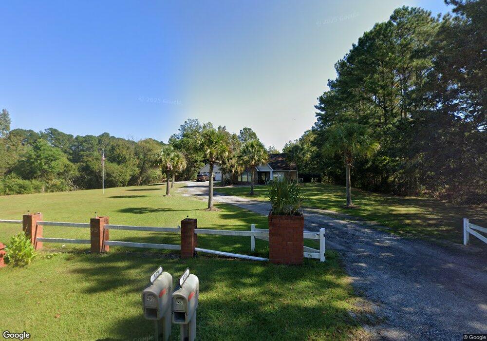
439 Lazy Hill Rd Moncks Corner, SC 29461
Estimated Value: $364,000 - $557,306
4
Beds
6
Baths
2,000
Sq Ft
$244/Sq Ft
Est. Value
About This Home
This home is located at 439 Lazy Hill Rd, Moncks Corner, SC 29461 and is currently estimated at $488,577, approximately $244 per square foot. 439 Lazy Hill Rd is a home located in Berkeley County with nearby schools including Whitesville Elementary School, Berkeley Middle School, and Berkeley High School.
Ownership History
Date
Name
Owned For
Owner Type
Purchase Details
Closed on
May 13, 2022
Sold by
Ribbon Home Spv Ii Llc
Bought by
Newton Christopher Keith and Newton Kari Lynn
Current Estimated Value
Home Financials for this Owner
Home Financials are based on the most recent Mortgage that was taken out on this home.
Original Mortgage
$375,300
Outstanding Balance
$354,605
Interest Rate
4.67%
Mortgage Type
New Conventional
Estimated Equity
$133,972
Purchase Details
Closed on
Mar 10, 2022
Sold by
Hometown Investors Llc
Bought by
Ribbon Home Spv Ii Llc
Purchase Details
Closed on
May 1, 2006
Sold by
Axenfield Allen and Axenfield Therese
Bought by
Bunch Transport Inc
Purchase Details
Closed on
Jul 1, 2004
Sold by
Stewart Keith R and Stewart Nancy A
Bought by
Axenfield Allen and Axenfield Therese
Create a Home Valuation Report for This Property
The Home Valuation Report is an in-depth analysis detailing your home's value as well as a comparison with similar homes in the area
Home Values in the Area
Average Home Value in this Area
Purchase History
| Date | Buyer | Sale Price | Title Company |
|---|---|---|---|
| Newton Christopher Keith | $417,000 | Hankin & Pack Pllc | |
| Ribbon Home Spv Ii Llc | $417,000 | None Listed On Document | |
| Bunch Transport Inc | $359,500 | None Available | |
| Axenfield Allen | $269,000 | -- |
Source: Public Records
Mortgage History
| Date | Status | Borrower | Loan Amount |
|---|---|---|---|
| Open | Newton Christopher Keith | $375,300 |
Source: Public Records
Tax History Compared to Growth
Tax History
| Year | Tax Paid | Tax Assessment Tax Assessment Total Assessment is a certain percentage of the fair market value that is determined by local assessors to be the total taxable value of land and additions on the property. | Land | Improvement |
|---|---|---|---|---|
| 2025 | $1,978 | $510,600 | $178,453 | $332,147 |
| 2024 | $1,904 | $20,424 | $7,138 | $13,286 |
| 2023 | $1,904 | $20,424 | $7,138 | $13,286 |
| 2022 | $5,500 | $17,760 | $6,660 | $11,100 |
| 2021 | $4,630 | $17,110 | $4,482 | $12,630 |
| 2020 | $4,648 | $17,112 | $4,482 | $12,630 |
| 2019 | $4,638 | $17,112 | $4,482 | $12,630 |
| 2018 | $4,358 | $15,126 | $3,534 | $11,592 |
| 2017 | $4,359 | $15,126 | $3,534 | $11,592 |
| 2016 | $4,400 | $15,120 | $3,530 | $11,590 |
| 2015 | $4,187 | $15,120 | $3,530 | $11,590 |
| 2014 | $3,913 | $15,120 | $3,530 | $11,590 |
| 2013 | -- | $15,120 | $3,530 | $11,590 |
Source: Public Records
Map
Nearby Homes
- 220 New Oak Ln
- 607 Lazy Hill Rd
- 240 Groomsville Rd
- Emerson Plan at High Point at Foxbank
- 508 Eagleview Dr
- 428 Eagleview Dr
- 420 Eagleview Dr
- 312 Red Leaf Blvd
- 117 Forest Springs Rd
- 221 Old Grove Ave
- 332 Southern Sugar Ave
- 519 Eagleview Dr
- 293 Red Leaf Blvd
- 661 Black Pine Rd
- 659 Black Pine Rd
- 327 Hillman Trail Dr
- 193 Cypress Forest Dr
- 655 Black Pine Rd
- 173 Cypress Forest Dr
- 417 Tallow Ct
- 446 Lazy Hill Rd
- 449 Lazy Hill Rd
- 433 Lazy Hill Rd
- 116 New Oak Ln
- 422 Lazy Hill Rd
- 140 New Oak Ln
- 419 Lazy Hill Rd
- 459 Lazy Hill Rd
- 423 Lazy Hill Rd
- 431 Lazy Hill Rd
- 420 Lazy Hill Rd
- 413 Lazy Hill Rd
- 160 New Oak Ln
- 127 New Oak Ln
- 119 New Oak Ln
- 141 New Oak Ln
- 122 Deer Track Ln
- 111 New Oak Ln
- 412 Lazy Hill Rd
- 502 Lazy Hill Rd