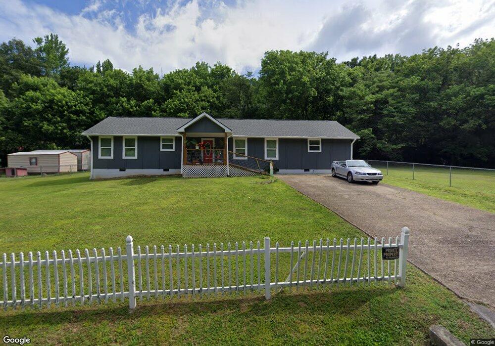
439 Old Whiteside Rd Whiteside, TN 37396
Estimated Value: $221,000 - $399,000
--
Bed
1
Bath
1,584
Sq Ft
$180/Sq Ft
Est. Value
About This Home
This home is located at 439 Old Whiteside Rd, Whiteside, TN 37396 and is currently estimated at $284,801, approximately $179 per square foot. 439 Old Whiteside Rd is a home with nearby schools including Jasper Elementary School, South Pittsburg Elementary School, and Monteagle Elementary School.
Ownership History
Date
Name
Owned For
Owner Type
Purchase Details
Closed on
Oct 27, 2020
Sold by
Mcnabb Larenza D and Mcnabb Joyce
Bought by
Tuders Renee
Current Estimated Value
Purchase Details
Closed on
Feb 20, 2018
Sold by
Shirley Betty
Bought by
Mcnabb Lorenza and Mcnabb Joyce
Purchase Details
Closed on
Dec 18, 2017
Sold by
Mcnabb Lorenza D and Estate Of Charles Edward Mcnab
Bought by
Mcnabb Lorenza D and Shirley Betty
Purchase Details
Closed on
Apr 21, 1984
Bought by
Mcnabb Charles and Mcnabb Ruth
Create a Home Valuation Report for This Property
The Home Valuation Report is an in-depth analysis detailing your home's value as well as a comparison with similar homes in the area
Home Values in the Area
Average Home Value in this Area
Purchase History
| Date | Buyer | Sale Price | Title Company |
|---|---|---|---|
| Tuders Renee | $5,000 | None Available | |
| Mcnabb Lorenza | $10,000 | None Available | |
| Mcnabb Lorenza D | -- | None Available | |
| Mcnabb Charles | -- | -- |
Source: Public Records
Tax History Compared to Growth
Tax History
| Year | Tax Paid | Tax Assessment Tax Assessment Total Assessment is a certain percentage of the fair market value that is determined by local assessors to be the total taxable value of land and additions on the property. | Land | Improvement |
|---|---|---|---|---|
| 2024 | $897 | $50,950 | $1,550 | $49,400 |
| 2023 | $897 | $50,950 | $0 | $0 |
| 2022 | $569 | $32,300 | $1,550 | $30,750 |
| 2021 | $457 | $25,950 | $1,550 | $24,400 |
| 2020 | $314 | $25,950 | $1,550 | $24,400 |
| 2019 | $314 | $14,475 | $1,475 | $13,000 |
| 2018 | $314 | $14,475 | $1,475 | $13,000 |
| 2017 | $314 | $14,475 | $1,475 | $13,000 |
| 2016 | $314 | $14,475 | $0 | $0 |
| 2015 | $365 | $14,475 | $0 | $0 |
| 2014 | $365 | $16,827 | $0 | $0 |
Source: Public Records
Map
Nearby Homes
- 0 Egypt Hollow Rd
- 0 Veterans Rd Unit 15134719
- 1975 Highway 134
- 616 Stallings Rd
- 10350 Mullins Cove Rd
- 9794 Mullins Cove Rd
- 6180 Slygo Rd
- 190 Farm Rd
- 0 Tennessee 134 Unit 1396901
- 1375 Split Rail Way
- 76 Pineway Cir
- 56 Pineway Dr
- Lot 1205 Big View Rd
- 1098 Birds Eye Way
- 4545 Split Rail Way Unit Lot 1142
- 4545 Split Rail Way
- 3741 Split Rail Way Unit Lot 1124
- 3741 Split Rail Way
- 0 Slygo Rd Unit 10409260
- 0 Slygo Rd Unit 7479663
- 419 Old Whiteside Rd
- 465 Old Whiteside Rd
- 401 Old Whiteside Rd
- 00 Old Whiteside Rd
- 207 Pulltight Rd
- 225 Old Whiteside Rd
- 197 Old Whiteside Rd
- 211 Water Tank Rd
- 181 Water Tank Rd
- 165 Water Tank Rd
- 129 Old Whiteside Rd
- 0 Old Whiteside Rd Unit RTC2724593
- 0 Old Whiteside Rd Unit RTC2339519
- 4633 Highway 134
- 4481 Tennessee 134
- 4481 Highway 134
- 4481 Highway 134
- 4489 Highway 134
- 4441 Highway 134
- 4427 Highway 134