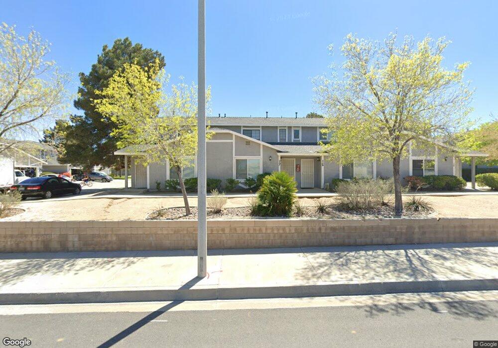
43950 Bobby Jones Dr Unit 20 Lancaster, CA 93536
West Lancaster NeighborhoodEstimated Value: $336,715 - $344,000
2
Beds
2
Baths
1,010
Sq Ft
$337/Sq Ft
Est. Value
About This Home
This home is located at 43950 Bobby Jones Dr Unit 20, Lancaster, CA 93536 and is currently estimated at $339,929, approximately $336 per square foot. 43950 Bobby Jones Dr Unit 20 is a home located in Los Angeles County with nearby schools including West Wind Elementary School, Amargosa Creek Middle School, and Lancaster High School.
Ownership History
Date
Name
Owned For
Owner Type
Purchase Details
Closed on
Aug 11, 2020
Sold by
Group Xiii Properties Lp
Bought by
Golden Opportunity I Holdings Lp
Current Estimated Value
Purchase Details
Closed on
Feb 6, 2019
Sold by
Group Xiii Properties Lp
Bought by
Golden Opportunity I Holdings Lp
Home Financials for this Owner
Home Financials are based on the most recent Mortgage that was taken out on this home.
Original Mortgage
$13,500,000
Interest Rate
4.4%
Mortgage Type
Commercial
Purchase Details
Closed on
Jan 5, 2018
Sold by
Woodbridge Apartments
Bought by
Group Xiii Properties Lp
Home Financials for this Owner
Home Financials are based on the most recent Mortgage that was taken out on this home.
Original Mortgage
$2,750,000
Interest Rate
3.93%
Mortgage Type
Commercial
Create a Home Valuation Report for This Property
The Home Valuation Report is an in-depth analysis detailing your home's value as well as a comparison with similar homes in the area
Home Values in the Area
Average Home Value in this Area
Purchase History
| Date | Buyer | Sale Price | Title Company |
|---|---|---|---|
| Golden Opportunity I Holdings Lp | -- | Pacific Coast Title Company | |
| Golden Opportunity I Holdings Lp | -- | Pacific Coast Title Co | |
| Group Xiii Properties Lp | $2,750,000 | Lawyers Title Company |
Source: Public Records
Mortgage History
| Date | Status | Borrower | Loan Amount |
|---|---|---|---|
| Previous Owner | Golden Opportunity I Holdings Lp | $13,500,000 | |
| Previous Owner | Group Xiii Properties Lp | $2,750,000 |
Source: Public Records
Tax History Compared to Growth
Tax History
| Year | Tax Paid | Tax Assessment Tax Assessment Total Assessment is a certain percentage of the fair market value that is determined by local assessors to be the total taxable value of land and additions on the property. | Land | Improvement |
|---|---|---|---|---|
| 2025 | $2,665 | $167,323 | $16,731 | $150,592 |
| 2024 | $2,665 | $164,043 | $16,403 | $147,640 |
| 2023 | $2,615 | $160,828 | $16,082 | $144,746 |
| 2022 | $2,570 | $157,675 | $15,767 | $141,908 |
| 2021 | $2,530 | $154,584 | $15,458 | $139,126 |
| 2020 | $2,486 | $151,690 | $16,438 | $135,252 |
| 2019 | $2,698 | $161,160 | $16,116 | $145,044 |
| 2018 | $1,924 | $98,683 | $10,755 | $87,928 |
| 2016 | $1,604 | $94,853 | $10,339 | $84,514 |
| 2015 | $1,586 | $93,429 | $10,184 | $83,245 |
| 2014 | $1,586 | $91,600 | $9,985 | $81,615 |
Source: Public Records
Map
Nearby Homes
- 3207 Jonathon St
- 43840 Bobby Jones Dr
- 43840 Bobby Jones Dr Unit 1
- 43920 33rd St W
- 44128 Fine Cir
- 2838 W Avenue J 9
- 2838 W Avenue j9
- 44114 30th St W
- 3021 W Avenue j4
- 3311 W Avenue j3
- 3529 W Avenue j13
- 2822 Springfield Place
- 44150 30th St W
- 2904 W Avenue j4
- 3515 W Avenue j4
- 3541 W Avenue j13
- 44154 Planet Cir
- 43856 Windsor Place
- 3359 W Avenue j2
- 43659 Home Place Dr
- 43950 Bobby Jones Dr Unit 22
- 43950 Bobby Jones Dr Unit 19
- 43950 Bobby Jones Dr Unit 18
- 43950 Bobby Jones Dr Unit 17
- 43950 Bobby Jones Dr Unit 15
- 43950 Bobby Jones Dr Unit 13
- 43950 Bobby Jones Dr Unit 12
- 43950 Bobby Jones Dr Unit 11
- 43950 Bobby Jones Dr Unit 10
- 43950 Bobby Jones Dr Unit 9
- 43950 Bobby Jones Dr Unit 8
- 43950 Bobby Jones Dr Unit 7
- 43950 Bobby Jones Dr Unit 5
- 43950 Bobby Jones Dr Unit 4
- 43950 Bobby Jones Dr Unit 3
- 43950 Bobby Jones Dr Unit 2
- 43950 Bobby Jones Dr Unit 21
- 43950 Bobby Jones Dr Unit 6
- 43950 Bobby Jones Dr Unit 16
- 43950 Bobby Jones Dr Unit 14