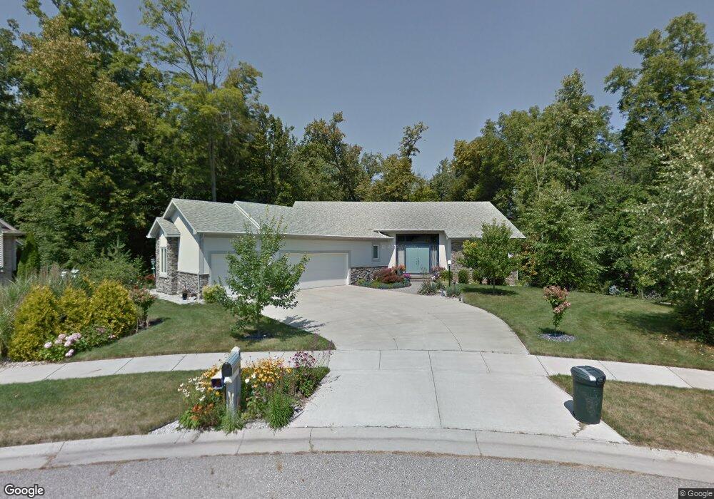
4399 Foxtail Cir Grand Ledge, MI 48837
Estimated Value: $432,000 - $568,000
3
Beds
3
Baths
2,400
Sq Ft
$205/Sq Ft
Est. Value
About This Home
This home is located at 4399 Foxtail Cir, Grand Ledge, MI 48837 and is currently estimated at $491,844, approximately $204 per square foot. 4399 Foxtail Cir is a home located in Eaton County with nearby schools including Beagle Middle School, Leon W. Hayes Middle School, and Grand Ledge High School.
Ownership History
Date
Name
Owned For
Owner Type
Purchase Details
Closed on
Apr 28, 2009
Sold by
Kamminga Gary D and Kamminga Ruthie A
Bought by
Kamminga Gary D and Kamminga Ruth A
Current Estimated Value
Home Financials for this Owner
Home Financials are based on the most recent Mortgage that was taken out on this home.
Original Mortgage
$114,000
Outstanding Balance
$30,288
Interest Rate
5.05%
Mortgage Type
New Conventional
Estimated Equity
$461,556
Purchase Details
Closed on
Oct 5, 2006
Sold by
Four Ms
Bought by
Kamminga Gary D and Kamminga Ruthie A
Create a Home Valuation Report for This Property
The Home Valuation Report is an in-depth analysis detailing your home's value as well as a comparison with similar homes in the area
Home Values in the Area
Average Home Value in this Area
Purchase History
| Date | Buyer | Sale Price | Title Company |
|---|---|---|---|
| Kamminga Gary D | -- | None Available | |
| Kamminga Gary D | $55,000 | Armstrong |
Source: Public Records
Mortgage History
| Date | Status | Borrower | Loan Amount |
|---|---|---|---|
| Open | Kamminga Gary D | $114,000 |
Source: Public Records
Tax History Compared to Growth
Tax History
| Year | Tax Paid | Tax Assessment Tax Assessment Total Assessment is a certain percentage of the fair market value that is determined by local assessors to be the total taxable value of land and additions on the property. | Land | Improvement |
|---|---|---|---|---|
| 2025 | $7,617 | $281,100 | $0 | $0 |
| 2024 | $2,175 | $291,500 | $0 | $0 |
| 2023 | $2,072 | $255,500 | $0 | $0 |
| 2022 | $6,736 | $218,700 | $0 | $0 |
| 2021 | $6,300 | $201,700 | $0 | $0 |
| 2020 | $6,227 | $185,500 | $0 | $0 |
| 2019 | $5,812 | $187,300 | $0 | $0 |
| 2018 | $5,342 | $168,400 | $26,900 | $141,500 |
| 2017 | $5,233 | $168,400 | $26,900 | $141,500 |
| 2016 | $154,326 | $168,400 | $26,900 | $141,500 |
| 2015 | $154,326 | $168,400 | $26,900 | $141,500 |
| 2014 | -- | $151,896 | $0 | $0 |
| 2013 | -- | $155,900 | $0 | $0 |
Source: Public Records
Map
Nearby Homes
- 11723 W Andre Dr
- The Maplewood Plan at Fieldstone Farms - Fieldstone Farm
- The Madison Plan at Fieldstone Farms - Fieldstone Farm
- The Windsor Plan at Fieldstone Farms - Fieldstone Farm
- The Woodbury Plan at Fieldstone Farms - Fieldstone Farm
- The Waverly Plan at Fieldstone Farms - Fieldstone Farm
- The Newcastle Plan at Fieldstone Farms - Fieldstone Farm
- The Manchester Plan at Fieldstone Farms - Fieldstone Farm
- The Nantucket Plan at Fieldstone Farms - Fieldstone Farm
- The Maxwell Plan at Fieldstone Farms - Fieldstone Farm
- The Westwood Plan at Fieldstone Farms - Fieldstone Farm
- The Newton Plan at Fieldstone Farms - Fieldstone Farm
- The Prescott Plan at Fieldstone Farms - Fieldstone Farm
- The Norway Plan at Fieldstone Farms - Fieldstone Farm
- The Mackinaw Plan at Fieldstone Farms - Fieldstone Farm
- The Mayberry Plan at Fieldstone Farms - Fieldstone Farm
- 11830 Shady Pines Dr
- 708 Fieldview Dr
- 715 Fieldview Dr
- 11954 E Andre Dr
- 4471 Foxtail Cir
- 4294 Foxtail Cir
- 4442 Foxtail Cir
- 4491 Foxtail Cir
- 4432 Fieldview Dr
- 4484 Foxtail Cir
- 4414 Fieldview Dr
- 4396 Fieldview Dr
- 4468 Foxtail Cir
- 4382 Fieldview Dr
- 4468 Fieldview Dr
- 4496 Fieldview Dr
- 4366 Fieldview Dr
- 4517 Foxtail Cir
- 4350 Fieldview Dr
- 4498 Foxtail Cir
- 4512 Fieldview Dr
- 4546 Foxtail Cir
- 4336 Fieldview Dr
- 4516 Foxtail Cir