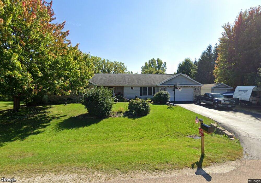
43W481 Kenmar Ct Elburn, IL 60119
Estimated Value: $477,292 - $550,000
3
Beds
2
Baths
2,019
Sq Ft
$247/Sq Ft
Est. Value
About This Home
This home is located at 43W481 Kenmar Ct, Elburn, IL 60119 and is currently estimated at $499,573, approximately $247 per square foot. 43W481 Kenmar Ct is a home located in Kane County with nearby schools including Kaneland Blackberry Creek Elementary School, Harter Middle School, and Kaneland Senior High School.
Ownership History
Date
Name
Owned For
Owner Type
Purchase Details
Closed on
Nov 22, 2005
Sold by
Dewitte Alan T and Dewitte Gail
Bought by
Dewitte Joseph A and Dewitte Chamberlin D
Current Estimated Value
Home Financials for this Owner
Home Financials are based on the most recent Mortgage that was taken out on this home.
Original Mortgage
$260,800
Outstanding Balance
$144,030
Interest Rate
6.17%
Mortgage Type
Fannie Mae Freddie Mac
Estimated Equity
$355,543
Create a Home Valuation Report for This Property
The Home Valuation Report is an in-depth analysis detailing your home's value as well as a comparison with similar homes in the area
Home Values in the Area
Average Home Value in this Area
Purchase History
| Date | Buyer | Sale Price | Title Company |
|---|---|---|---|
| Dewitte Joseph A | $326,000 | Chicago Title Insurance Comp |
Source: Public Records
Mortgage History
| Date | Status | Borrower | Loan Amount |
|---|---|---|---|
| Open | Dewitte Joseph A | $260,800 |
Source: Public Records
Tax History Compared to Growth
Tax History
| Year | Tax Paid | Tax Assessment Tax Assessment Total Assessment is a certain percentage of the fair market value that is determined by local assessors to be the total taxable value of land and additions on the property. | Land | Improvement |
|---|---|---|---|---|
| 2024 | $10,235 | $135,574 | $19,642 | $115,932 |
| 2023 | $9,874 | $122,359 | $17,727 | $104,632 |
| 2022 | $8,794 | $104,707 | $16,269 | $88,438 |
| 2021 | $8,511 | $100,217 | $15,571 | $84,646 |
| 2020 | $8,368 | $97,868 | $15,206 | $82,662 |
| 2019 | $8,384 | $96,431 | $14,983 | $81,448 |
| 2018 | $7,132 | $81,355 | $14,983 | $66,372 |
| 2017 | $7,141 | $80,430 | $14,813 | $65,617 |
| 2016 | $7,617 | $83,057 | $19,171 | $63,886 |
| 2015 | -- | $75,175 | $18,423 | $56,752 |
| 2014 | -- | $81,447 | $20,500 | $60,947 |
| 2013 | -- | $81,447 | $20,500 | $60,947 |
Source: Public Records
Map
Nearby Homes
- 43W451 Kenmar Ct
- 43W503 Kenmar Ct
- 43W461 Kenmar Ct
- 43W502 Kenmar Ct
- 0S131 Kenmar Ct
- 43W547 Kenmar Ct
- 0S107 Kenmar Ct
- 43W463 Kenmar Dr
- 43W501 Kenmar Dr
- S107 Kenmar Ct
- 43W542 Kenmar Dr
- 43W409 Kenmar Dr
- LOT 90 Kenmar Dr
- 43W371 Kenmar Dr
- 43W561 Kenmar Dr
- 43W480 Kenmar Dr
- 43W510 Kenmar Dr
- 43W450 Kenmar Dr
- 43W420 Kenmar Dr
- 43W575 Kenmar Dr