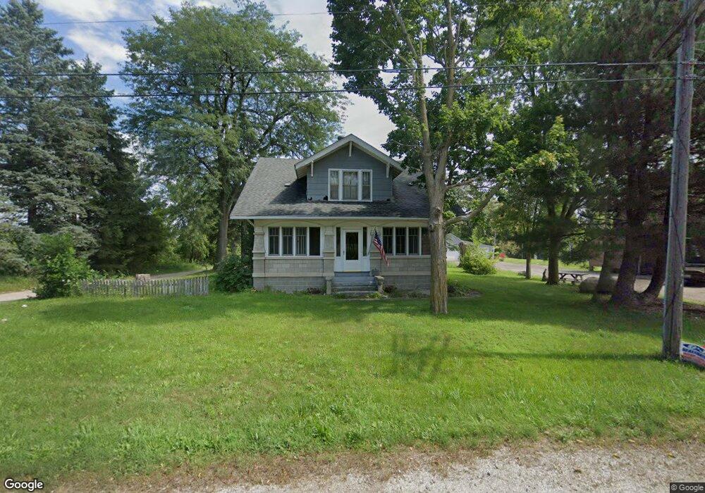
43W498 Il Route 72 Hampshire, IL 60140
Estimated Value: $309,000 - $338,000
--
Bed
1
Bath
1,953
Sq Ft
$165/Sq Ft
Est. Value
About This Home
This home is located at 43W498 Il Route 72, Hampshire, IL 60140 and is currently estimated at $322,589, approximately $165 per square foot. 43W498 Il Route 72 is a home with nearby schools including Gary D. Wright Elementary School, Hampshire Middle School, and Hampshire High School.
Ownership History
Date
Name
Owned For
Owner Type
Purchase Details
Closed on
Feb 5, 2021
Sold by
Dumoulin Douglas G
Bought by
Douglas G Dumoulin Declaration Of Trust
Current Estimated Value
Purchase Details
Closed on
Dec 19, 2000
Sold by
Erboe Colleen A and Deverall Colleen A
Bought by
Erboe Robert D
Home Financials for this Owner
Home Financials are based on the most recent Mortgage that was taken out on this home.
Original Mortgage
$45,998
Interest Rate
7.69%
Create a Home Valuation Report for This Property
The Home Valuation Report is an in-depth analysis detailing your home's value as well as a comparison with similar homes in the area
Home Values in the Area
Average Home Value in this Area
Purchase History
| Date | Buyer | Sale Price | Title Company |
|---|---|---|---|
| Douglas G Dumoulin Declaration Of Trust | -- | Law Office Of James M Bolz Llc | |
| Erboe Robert D | -- | -- |
Source: Public Records
Mortgage History
| Date | Status | Borrower | Loan Amount |
|---|---|---|---|
| Previous Owner | Erboe Robert D | $45,998 |
Source: Public Records
Tax History Compared to Growth
Tax History
| Year | Tax Paid | Tax Assessment Tax Assessment Total Assessment is a certain percentage of the fair market value that is determined by local assessors to be the total taxable value of land and additions on the property. | Land | Improvement |
|---|---|---|---|---|
| 2024 | $4,741 | $90,668 | $17,774 | $72,894 |
| 2023 | $4,475 | $81,993 | $16,073 | $65,920 |
| 2022 | $4,484 | $75,597 | $14,819 | $60,778 |
| 2021 | $4,332 | $71,103 | $13,938 | $57,165 |
| 2020 | $4,247 | $69,288 | $13,582 | $55,706 |
| 2019 | $4,132 | $66,502 | $13,036 | $53,466 |
| 2018 | $3,971 | $62,414 | $12,235 | $50,179 |
| 2017 | $3,842 | $59,436 | $11,651 | $47,785 |
| 2016 | $3,801 | $56,584 | $11,092 | $45,492 |
| 2015 | -- | $53,442 | $10,476 | $42,966 |
| 2014 | -- | $51,974 | $10,476 | $41,498 |
| 2013 | -- | $52,927 | $10,668 | $42,259 |
Source: Public Records
Map
Nearby Homes
- 2368 Alison Ave
- 2307 Upland Rd
- 2463 Bella Dr
- 43W428 U S 20
- 1929 Diamond Head Trail
- 43w916 Us Highway 20
- 1840 Spinnaker St
- 1740 Spinnaker St
- 1192 Alta Vista Dr
- 1701 Windward Dr
- 1641 Sandcastle Ln
- 1385 Broadland Dr
- 1173 Sonoma Ct
- 1286 Newport Cir
- 1482 Hollow Tree Ln
- 1157 Clearwater Dr
- 14N924 White Pines Ln
- 1731 Dempsey Cir
- 1533 Yosemite Way
- 1464 Sequoia Way
- 43W478 Il Route 72
- 43W478 Illinois 72
- 2430 Aurora Dr
- 2442 Aurora Dr
- 2432 Aurora Dr
- 2444 Aurora Dr
- 2450 Aurora Dr
- 2434 Aurora Dr
- 2440 Aurora Dr
- 2420 Aurora Dr
- 2446 Aurora Dr
- 2436 Aurora Dr
- 2452 Aurora Dr
- 2454 Aurora Dr
- 2422 Aurora Dr
- 2456 Aurora Dr
- 2424 Aurora Dr
- 2426 Aurora Dr
- 2470 Alison Ave
- 2448 Alison Ave Unit 2485