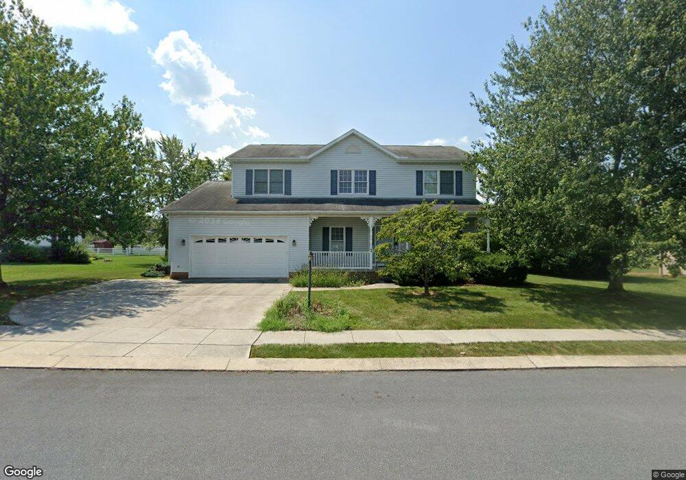
44 Ashfield Dr Unit 53 Littlestown, PA 17340
Estimated Value: $412,196 - $522,000
4
Beds
3
Baths
2,468
Sq Ft
$184/Sq Ft
Est. Value
About This Home
This home is located at 44 Ashfield Dr Unit 53, Littlestown, PA 17340 and is currently estimated at $454,799, approximately $184 per square foot. 44 Ashfield Dr Unit 53 is a home located in Adams County with nearby schools including Rolling Acres El School, Maple Avenue Middle School, and Littlestown Senior High School.
Ownership History
Date
Name
Owned For
Owner Type
Purchase Details
Closed on
Jun 17, 2022
Sold by
Miller Beverley A
Bought by
Miller Brian E and Miller Beverley A
Current Estimated Value
Purchase Details
Closed on
Sep 7, 1994
Bought by
Miller Bernard T and Miller Marguerite E
Create a Home Valuation Report for This Property
The Home Valuation Report is an in-depth analysis detailing your home's value as well as a comparison with similar homes in the area
Home Values in the Area
Average Home Value in this Area
Purchase History
| Date | Buyer | Sale Price | Title Company |
|---|---|---|---|
| Miller Brian E | -- | None Listed On Document | |
| Miller Bernard T | $175,000 | -- |
Source: Public Records
Tax History Compared to Growth
Tax History
| Year | Tax Paid | Tax Assessment Tax Assessment Total Assessment is a certain percentage of the fair market value that is determined by local assessors to be the total taxable value of land and additions on the property. | Land | Improvement |
|---|---|---|---|---|
| 2025 | $5,500 | $290,600 | $56,200 | $234,400 |
| 2024 | $5,258 | $290,600 | $56,200 | $234,400 |
| 2023 | $5,154 | $290,600 | $56,200 | $234,400 |
| 2022 | $5,151 | $290,600 | $56,200 | $234,400 |
| 2021 | $4,969 | $290,600 | $56,200 | $234,400 |
| 2020 | $4,898 | $290,600 | $56,200 | $234,400 |
| 2019 | $4,794 | $290,600 | $56,200 | $234,400 |
| 2018 | $4,689 | $290,600 | $56,200 | $234,400 |
| 2017 | $4,528 | $290,600 | $56,200 | $234,400 |
| 2016 | -- | $290,600 | $56,200 | $234,400 |
| 2015 | -- | $290,600 | $56,200 | $234,400 |
| 2014 | -- | $290,600 | $56,200 | $234,400 |
Source: Public Records
Map
Nearby Homes
- 43 Ashfield Dr Unit 14
- 5 Manor Cir Unit 103
- 567 Lumber St
- 559 Lumber St
- 535 Lumber St
- 449 Glenwyn Dr
- 349 Basehoar School Rd Unit 5
- 41 Smith Cir
- 211 E King St
- 162 Newark St
- 61 E King St
- LOT 9 Mehring Rd
- 115 Charles St
- 117 Charles St
- 440 N Queen St
- 140 Apple Grove Ln Unit 425
- 135 Apple Grove Ln Unit 438
- 58 N Gala Unit 397
- 129 W King St
- 0 Locust Dr Unit PAAD2015910
- 40 Ashfield Dr Unit 52
- 46 Ashfield Dr Unit 54
- 20 Ashfield Dr Unit 46
- 38 Ashfield Dr Unit 51
- 18 Ashfield Dr Unit 45
- 45 Ashfield Dr Unit 13
- 22 Ashfield Dr Unit 47
- 41 Ashfield Dr Unit 15
- 47 Ashfield Dr Unit 12
- 24 Ashfield Dr Unit 48
- 16 Ashfield Dr Unit 44
- 50 Ashfield Dr Unit 56
- 39 Ashfield Dr Unit 16
- 49 Ashfield Dr Unit 11
- 34 Ashfield Dr Unit 50
- 37 Ashfield Dr Unit 17
- 655 Basehoar School Rd Unit 5
- 645 Basehoar School Rd Unit 6
- 28 Ashfield Dr Unit 49
- 665 Basehoar School Rd Unit 4