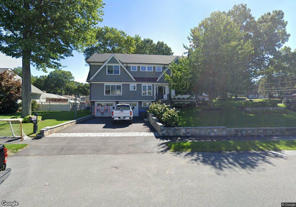
44 Azalea Rd Waltham, MA 02452
Piety Corner NeighborhoodEstimated Value: $1,427,000 - $2,175,000
3
Beds
3
Baths
2,356
Sq Ft
$707/Sq Ft
Est. Value
About This Home
This home is located at 44 Azalea Rd, Waltham, MA 02452 and is currently estimated at $1,665,580, approximately $706 per square foot. 44 Azalea Rd is a home located in Middlesex County with nearby schools including Northeast Elementary School, John F Kennedy Middle School, and Waltham Sr High School.
Ownership History
Date
Name
Owned For
Owner Type
Purchase Details
Closed on
Apr 19, 2016
Sold by
Arone Daniel A
Bought by
Arone Daniel A
Current Estimated Value
Home Financials for this Owner
Home Financials are based on the most recent Mortgage that was taken out on this home.
Original Mortgage
$425,000
Outstanding Balance
$329,905
Interest Rate
3%
Mortgage Type
Adjustable Rate Mortgage/ARM
Estimated Equity
$1,335,675
Purchase Details
Closed on
Oct 4, 2010
Sold by
Azalea Road Nt
Bought by
Arone Daniel A
Home Financials for this Owner
Home Financials are based on the most recent Mortgage that was taken out on this home.
Original Mortgage
$476,000
Interest Rate
4.44%
Mortgage Type
Purchase Money Mortgage
Purchase Details
Closed on
Mar 17, 2010
Sold by
Oleary Eleanor M
Bought by
Azalea Road Nt
Create a Home Valuation Report for This Property
The Home Valuation Report is an in-depth analysis detailing your home's value as well as a comparison with similar homes in the area
Home Values in the Area
Average Home Value in this Area
Purchase History
| Date | Buyer | Sale Price | Title Company |
|---|---|---|---|
| Arone Daniel A | -- | -- | |
| Arone Daniel A | $595,000 | -- | |
| Azalea Road Nt | -- | -- |
Source: Public Records
Mortgage History
| Date | Status | Borrower | Loan Amount |
|---|---|---|---|
| Open | Arone Daniel A | $425,000 | |
| Previous Owner | Arone Daniel A | $476,000 |
Source: Public Records
Tax History Compared to Growth
Tax History
| Year | Tax Paid | Tax Assessment Tax Assessment Total Assessment is a certain percentage of the fair market value that is determined by local assessors to be the total taxable value of land and additions on the property. | Land | Improvement |
|---|---|---|---|---|
| 2025 | $11,634 | $1,184,700 | $519,800 | $664,900 |
| 2024 | $11,096 | $1,151,000 | $495,500 | $655,500 |
| 2023 | $11,071 | $1,072,800 | $450,500 | $622,300 |
| 2022 | $11,267 | $1,011,400 | $414,400 | $597,000 |
| 2021 | $10,248 | $905,300 | $396,400 | $508,900 |
| 2020 | $4,781 | $777,200 | $369,400 | $407,800 |
| 2019 | $8,615 | $680,500 | $364,900 | $315,600 |
| 2018 | $4,322 | $590,300 | $337,800 | $252,500 |
| 2017 | $7,019 | $558,800 | $306,300 | $252,500 |
| 2016 | $6,619 | $540,800 | $288,300 | $252,500 |
| 2015 | $7,122 | $542,400 | $283,800 | $258,600 |
Source: Public Records
Map
Nearby Homes
- 70 Rosewood Dr
- 116 Raffaele Dr
- 511 Lexington St
- 28 College Farm Rd Unit 2
- 49 Lincoln St
- 34 Cedar Hill Ln
- 266 Linden St
- 155 Marguerite Ave
- 44 Sachem St
- 326 Bacon St
- 214 Church St
- 158 Church St
- 55 Circle Dr
- 14 Piedmont Ave
- 16 Winter St Unit 26C
- 65 Montclair Ave
- 750 Trapelo Rd
- 129 Lake St
- 23 Wight St
- 30 Jacqueline Rd Unit C