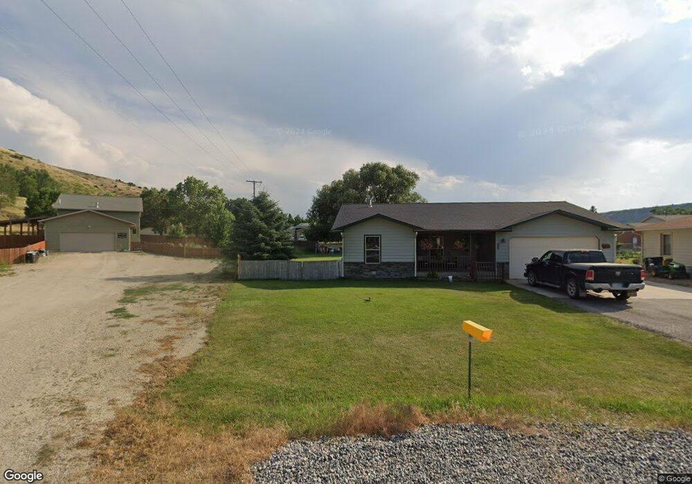
44 Brunckhorst Ln Absarokee, MT 59001
Estimated Value: $347,925 - $379,000
3
Beds
2
Baths
1,744
Sq Ft
$208/Sq Ft
Est. Value
About This Home
This home is located at 44 Brunckhorst Ln, Absarokee, MT 59001 and is currently estimated at $363,231, approximately $208 per square foot. 44 Brunckhorst Ln is a home with nearby schools including Absarokee School, Absarokee Junior High School, and Absarokee High School.
Ownership History
Date
Name
Owned For
Owner Type
Purchase Details
Closed on
Apr 2, 2018
Bought by
Braswell Carl Patrick
Current Estimated Value
Purchase Details
Closed on
Mar 25, 2011
Sold by
Gauthier Terri Dawn and Crabtree Terri Dawn
Bought by
Crabtree David Allan
Create a Home Valuation Report for This Property
The Home Valuation Report is an in-depth analysis detailing your home's value as well as a comparison with similar homes in the area
Home Values in the Area
Average Home Value in this Area
Purchase History
| Date | Buyer | Sale Price | Title Company |
|---|---|---|---|
| Braswell Carl Patrick | -- | -- | |
| Crabtree David Allan | -- | -- |
Source: Public Records
Tax History Compared to Growth
Tax History
| Year | Tax Paid | Tax Assessment Tax Assessment Total Assessment is a certain percentage of the fair market value that is determined by local assessors to be the total taxable value of land and additions on the property. | Land | Improvement |
|---|---|---|---|---|
| 2025 | $2,134 | $405,800 | $0 | $0 |
| 2024 | $2,661 | $310,400 | $0 | $0 |
| 2023 | $2,636 | $310,400 | $0 | $0 |
| 2022 | $2,270 | $219,600 | $0 | $0 |
| 2021 | $1,303 | $219,600 | $0 | $0 |
| 2020 | $1,913 | $202,700 | $0 | $0 |
| 2019 | $1,851 | $202,700 | $0 | $0 |
| 2018 | $1,934 | $206,600 | $0 | $0 |
| 2017 | $1,941 | $206,600 | $0 | $0 |
| 2016 | $1,768 | $207,000 | $0 | $0 |
| 2015 | $1,288 | $207,000 | $0 | $0 |
| 2014 | $1,055 | $89,782 | $0 | $0 |
Source: Public Records
Map
Nearby Homes
- 12 Avis St
- 10 S Woodard Ave
- A Johnson Dr Unit A
- 221 W School St
- 2994 Highway 78
- 20 Crow Child Trail
- 2825 & 2830 Highway 78 S
- 47 Lower Hawk Valley Rd
- 91 Upper Hawk Valley Rd
- 37 Barham Rd
- 79 Meyers Rd
- 79 Myers Rd
- Lot 56 Hearts & Diamonds 2
- 564a Countryman Creek Rd
- 26 Yates Rd
- TBD Brumfield RD Brumfield Rd
- 26 O'Dare Dr
- 27 Kestel Trail
- LOT 215 Coyote Pass
- 51 Haystack Coulee Rd