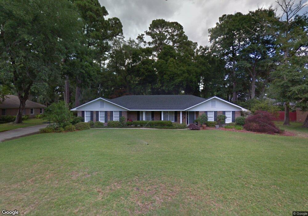
44 Clarendon Rd Savannah, GA 31410
Estimated Value: $667,917 - $744,000
4
Beds
3
Baths
2,742
Sq Ft
$258/Sq Ft
Est. Value
About This Home
This home is located at 44 Clarendon Rd, Savannah, GA 31410 and is currently estimated at $707,729, approximately $258 per square foot. 44 Clarendon Rd is a home located in Chatham County with nearby schools including Howard Elementary School, Coastal Middle School, and Islands High School.
Ownership History
Date
Name
Owned For
Owner Type
Purchase Details
Closed on
Oct 24, 2011
Sold by
Carlton Wanda L
Bought by
Cetti Joseph A
Current Estimated Value
Home Financials for this Owner
Home Financials are based on the most recent Mortgage that was taken out on this home.
Original Mortgage
$240,000
Outstanding Balance
$164,162
Interest Rate
4.16%
Mortgage Type
New Conventional
Estimated Equity
$543,567
Purchase Details
Closed on
Aug 30, 2010
Sold by
Carlton Jerold C
Bought by
Carlton Wanda L
Create a Home Valuation Report for This Property
The Home Valuation Report is an in-depth analysis detailing your home's value as well as a comparison with similar homes in the area
Home Values in the Area
Average Home Value in this Area
Purchase History
| Date | Buyer | Sale Price | Title Company |
|---|---|---|---|
| Cetti Joseph A | $300,000 | -- | |
| Cetti Joseph A | $300,000 | -- | |
| Carlton Wanda L | -- | -- |
Source: Public Records
Mortgage History
| Date | Status | Borrower | Loan Amount |
|---|---|---|---|
| Open | Cetti Joseph A | $240,000 |
Source: Public Records
Tax History Compared to Growth
Tax History
| Year | Tax Paid | Tax Assessment Tax Assessment Total Assessment is a certain percentage of the fair market value that is determined by local assessors to be the total taxable value of land and additions on the property. | Land | Improvement |
|---|---|---|---|---|
| 2025 | $9,502 | $249,160 | $36,040 | $213,120 |
| 2024 | $9,502 | $189,320 | $36,040 | $153,280 |
| 2023 | $6,269 | $172,720 | $36,040 | $136,680 |
| 2022 | $4,268 | $159,760 | $36,040 | $123,720 |
| 2021 | $6,522 | $130,080 | $36,040 | $94,040 |
| 2020 | $4,375 | $130,040 | $36,040 | $94,000 |
| 2019 | $6,673 | $130,040 | $36,040 | $94,000 |
| 2018 | $4,503 | $128,480 | $36,040 | $92,440 |
| 2017 | $3,986 | $117,200 | $36,040 | $81,160 |
| 2016 | $3,732 | $116,680 | $36,040 | $80,640 |
| 2015 | $5,736 | $119,400 | $35,640 | $83,760 |
| 2014 | $5,903 | $123,080 | $0 | $0 |
Source: Public Records
Map
Nearby Homes
- 35 Clarendon Rd
- 17 N Cromwell Rd
- 229 Island Creek Ln
- 235 Island Creek Ln
- 127 Druid Cir
- 12 Cromwell Place
- 11 Mary Musgrove Dr
- 209 Deerwood Rd
- 412 Olde Towne Rd
- 128 Mary Musgrove Dr
- 401 N Cromwell Rd Unit 2Q
- 401 N Cromwell Rd Unit F6
- 401 N Cromwell Rd Unit T-5
- 401 N Cromwell Rd Unit Q2
- 401 N Cromwell Rd Unit F-5
- 401 N Cromwell Rd Unit Q7
- 302 Gloucester Rd
- 111 Carlton Rd
- 127 Penn Station
- 700 Wilmington Island Rd Unit 200
- 106 Millward Ct
- 106 Millward Ct
- 46 Clarendon Rd
- 104 Millward Ct
- 43 Clarendon Rd
- 45 Clarendon Rd
- 41 Clarendon Rd
- 40 Clarendon Rd
- 108 Millward Ct
- 108 Millward Ct
- 108 Millward Ct
- 113 Millward Ct
- 113 N Millward Rd
- 39 Clarendon Rd
- 101 Millward Ct
- 38 Clarendon Rd
- 103 Millward Ct
- 47 Clarendon Rd
- 105 Dombey Ct
- 110 Millward Ct