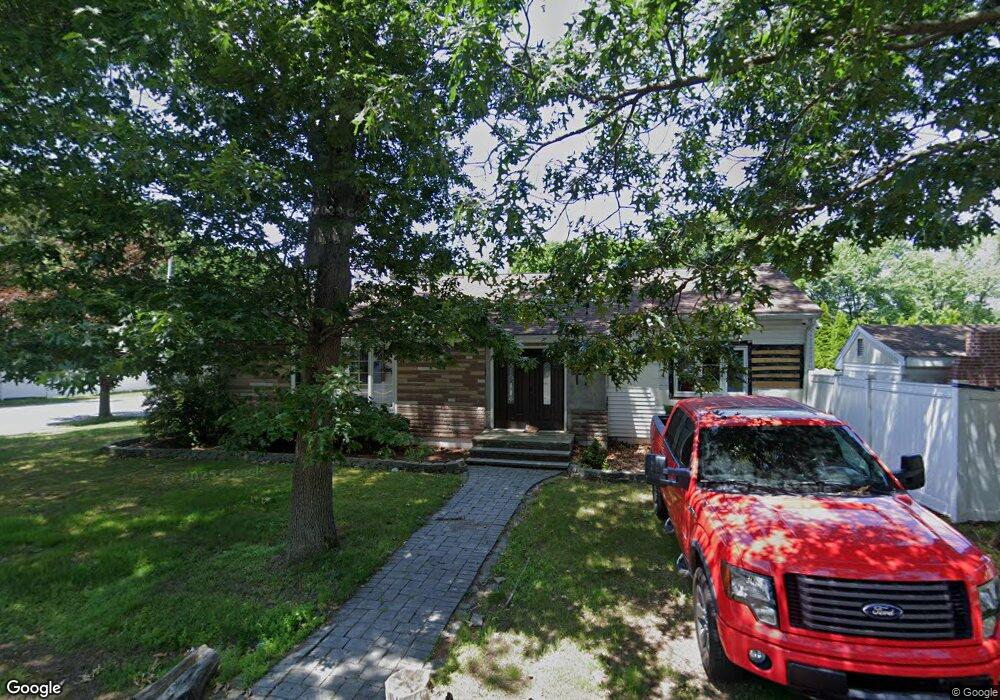
44 Forest St Saugus, MA 01906
Oakland Vale NeighborhoodEstimated Value: $701,000 - $887,000
3
Beds
2
Baths
1,452
Sq Ft
$554/Sq Ft
Est. Value
About This Home
This home is located at 44 Forest St, Saugus, MA 01906 and is currently estimated at $804,925, approximately $554 per square foot. 44 Forest St is a home located in Essex County with nearby schools including Saugus High School, Pioneer Charter School Of Science II, and Melrose Montessori School.
Ownership History
Date
Name
Owned For
Owner Type
Purchase Details
Closed on
Aug 23, 2010
Sold by
Deutsche Bank Natl T C
Bought by
Falcone David
Current Estimated Value
Home Financials for this Owner
Home Financials are based on the most recent Mortgage that was taken out on this home.
Original Mortgage
$315,748
Outstanding Balance
$209,688
Interest Rate
4.63%
Mortgage Type
Purchase Money Mortgage
Estimated Equity
$595,237
Purchase Details
Closed on
Jun 8, 2009
Sold by
Petricone Anne Marie and Tzannos Mark
Bought by
Deutsche Bank Natl T C
Purchase Details
Closed on
Sep 22, 2005
Sold by
Forest Street Rt and Morello Frank J
Bought by
Tzannos Mark and Petricone Anne Marie
Home Financials for this Owner
Home Financials are based on the most recent Mortgage that was taken out on this home.
Original Mortgage
$422,320
Interest Rate
5.92%
Mortgage Type
Purchase Money Mortgage
Create a Home Valuation Report for This Property
The Home Valuation Report is an in-depth analysis detailing your home's value as well as a comparison with similar homes in the area
Home Values in the Area
Average Home Value in this Area
Purchase History
| Date | Buyer | Sale Price | Title Company |
|---|---|---|---|
| Falcone David | $320,000 | -- | |
| Deutsche Bank Natl T C | $252,000 | -- | |
| Tzannos Mark | $527,900 | -- |
Source: Public Records
Mortgage History
| Date | Status | Borrower | Loan Amount |
|---|---|---|---|
| Open | Tzannos Mark | $315,748 | |
| Previous Owner | Tzannos Mark | $422,320 | |
| Previous Owner | Tzannos Mark | $105,580 |
Source: Public Records
Tax History Compared to Growth
Tax History
| Year | Tax Paid | Tax Assessment Tax Assessment Total Assessment is a certain percentage of the fair market value that is determined by local assessors to be the total taxable value of land and additions on the property. | Land | Improvement |
|---|---|---|---|---|
| 2025 | $7,100 | $664,800 | $342,300 | $322,500 |
| 2024 | $6,929 | $650,600 | $333,100 | $317,500 |
| 2023 | $6,735 | $598,100 | $291,400 | $306,700 |
| 2022 | $6,472 | $538,900 | $271,100 | $267,800 |
| 2021 | $6,079 | $492,600 | $224,800 | $267,800 |
| 2020 | $5,619 | $471,400 | $213,700 | $257,700 |
| 2019 | $5,480 | $449,900 | $203,500 | $246,400 |
| 2018 | $4,999 | $431,700 | $194,300 | $237,400 |
| 2017 | $4,577 | $379,800 | $185,000 | $194,800 |
| 2016 | $4,391 | $359,900 | $175,800 | $184,100 |
| 2015 | $4,124 | $343,100 | $167,400 | $175,700 |
| 2014 | $3,973 | $342,200 | $167,400 | $174,800 |
Source: Public Records
Map
Nearby Homes
- 16 Breakheart Rd
- 148 Forest St
- 2 Oaklandvale Ave
- 80 Forest St
- 9 Thomas St Unit 5
- 409 Lynn Fells Pkwy
- 14 Kayla Dr
- 1203 Sheffield Way
- 1607 Lewis o Gray Dr
- 1104 Lewis o Gray Dr
- 49 David Dr
- 86 Lynn Fells Pkwy
- 95 Main St
- 56 Summer St
- 5 Hammersmith Dr
- 29 Prospect St
- 57 Vine St
- 15 Appleton St
- 11 Parker St
- 14 Prospect St