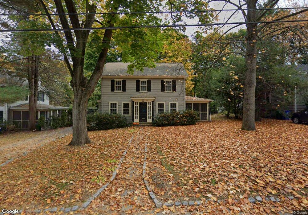
44 Jameson Rd Newton, MA 02458
Newton Corner NeighborhoodEstimated Value: $1,276,000 - $1,555,000
3
Beds
2
Baths
1,630
Sq Ft
$889/Sq Ft
Est. Value
About This Home
This home is located at 44 Jameson Rd, Newton, MA 02458 and is currently estimated at $1,448,463, approximately $888 per square foot. 44 Jameson Rd is a home located in Middlesex County with nearby schools including Ward Elementary School, Underwood Elementary School, and Bigelow Middle School.
Ownership History
Date
Name
Owned For
Owner Type
Purchase Details
Closed on
Feb 19, 2009
Sold by
Tracy Susan M
Bought by
Brodhead Doris and Tracy Susan M
Current Estimated Value
Home Financials for this Owner
Home Financials are based on the most recent Mortgage that was taken out on this home.
Original Mortgage
$25,000
Interest Rate
5.06%
Mortgage Type
Purchase Money Mortgage
Purchase Details
Closed on
Jul 19, 2004
Sold by
Brodhead Doris and Tracy Susan M
Bought by
Tracy Susan M
Purchase Details
Closed on
Feb 10, 2004
Sold by
Steinberg Adam L and Kalis Sheryl I
Bought by
Brodhead Doris and Tracy Susan M
Purchase Details
Closed on
May 1, 1998
Sold by
Dagostino Frank J and Dagostino Elizbeth T
Bought by
Steinberg Adam L and Kalis Sheryl I
Create a Home Valuation Report for This Property
The Home Valuation Report is an in-depth analysis detailing your home's value as well as a comparison with similar homes in the area
Home Values in the Area
Average Home Value in this Area
Purchase History
| Date | Buyer | Sale Price | Title Company |
|---|---|---|---|
| Brodhead Doris | -- | -- | |
| Tracy Susan M | -- | -- | |
| Brodhead Doris | $1,000 | -- | |
| Brodhead Doris | $665,000 | -- | |
| Steinberg Adam L | $422,000 | -- |
Source: Public Records
Mortgage History
| Date | Status | Borrower | Loan Amount |
|---|---|---|---|
| Open | Steinberg Adam L | $25,000 | |
| Open | Steinberg Adam L | $417,000 | |
| Closed | Brodhead Doris | $25,000 |
Source: Public Records
Tax History Compared to Growth
Tax History
| Year | Tax Paid | Tax Assessment Tax Assessment Total Assessment is a certain percentage of the fair market value that is determined by local assessors to be the total taxable value of land and additions on the property. | Land | Improvement |
|---|---|---|---|---|
| 2025 | $11,565 | $1,180,100 | $1,020,900 | $159,200 |
| 2024 | $11,182 | $1,145,700 | $991,200 | $154,500 |
| 2023 | $10,593 | $1,040,600 | $757,800 | $282,800 |
| 2022 | $10,136 | $963,500 | $701,700 | $261,800 |
| 2021 | $9,781 | $909,000 | $662,000 | $247,000 |
| 2020 | $9,490 | $909,000 | $662,000 | $247,000 |
| 2019 | $9,222 | $882,500 | $642,700 | $239,800 |
| 2018 | $1,202 | $816,000 | $580,700 | $235,300 |
| 2017 | $8,560 | $769,800 | $547,800 | $222,000 |
| 2016 | $8,187 | $719,400 | $512,000 | $207,400 |
| 2015 | $7,805 | $672,300 | $478,500 | $193,800 |
Source: Public Records
Map
Nearby Homes
- 59 Hyde Ave
- 686 Centre St
- 35 George St Unit 35
- 37 George St Unit 37
- 642 Centre St
- 206 Franklin St
- 23 Francis St Unit 23-1
- 548 Centre St Unit 5
- 21 Francis St Unit 21A
- 106 Farlow Rd
- 44 Irving St
- 5 Merrill Rd
- 14 Summit St
- 1004 Centre St
- 44 Blake St Unit 2
- 68 Vernon St
- 127-129 Withington Rd Unit 1
- 12 Richardson St Unit 14
- 9 Baldwin St Unit 15C
- 3 Cedar St