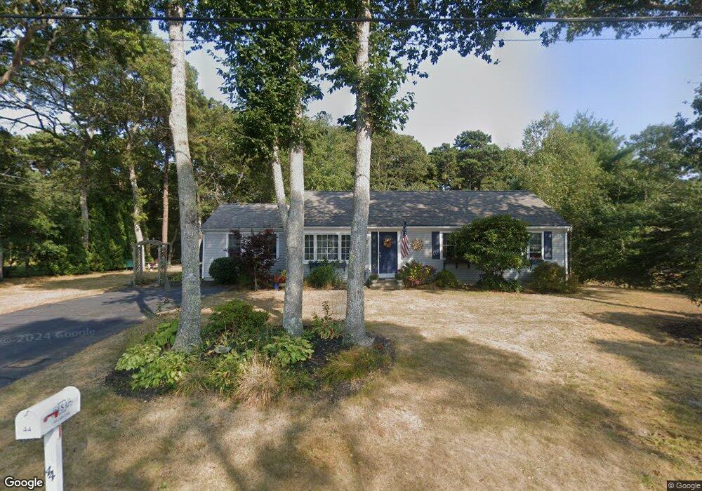
44 Liam Ln Centerville, MA 02632
Centerville NeighborhoodEstimated Value: $666,000 - $702,000
3
Beds
2
Baths
1,001
Sq Ft
$679/Sq Ft
Est. Value
About This Home
This home is located at 44 Liam Ln, Centerville, MA 02632 and is currently estimated at $679,189, approximately $678 per square foot. 44 Liam Ln is a home located in Barnstable County with nearby schools including Centerville Elementary School, Barnstable United Elementary School, and Barnstable Intermediate School.
Ownership History
Date
Name
Owned For
Owner Type
Purchase Details
Closed on
Jun 16, 1997
Sold by
Talerman Robert A and Talerman Elizabeth M
Bought by
Spillane Stephen A and Spillane Anne E
Current Estimated Value
Home Financials for this Owner
Home Financials are based on the most recent Mortgage that was taken out on this home.
Original Mortgage
$96,000
Outstanding Balance
$13,726
Interest Rate
7.97%
Mortgage Type
Purchase Money Mortgage
Estimated Equity
$665,463
Purchase Details
Closed on
Mar 25, 1994
Sold by
Zaloga Stephen J and Zaloga Dorothy D
Bought by
Talerman Robert A and Talerman Eliz M
Home Financials for this Owner
Home Financials are based on the most recent Mortgage that was taken out on this home.
Original Mortgage
$80,000
Interest Rate
7.15%
Mortgage Type
Purchase Money Mortgage
Purchase Details
Closed on
Jun 17, 1988
Sold by
Joyce John J
Bought by
Zaloga Stephen J
Home Financials for this Owner
Home Financials are based on the most recent Mortgage that was taken out on this home.
Original Mortgage
$100,000
Interest Rate
10.24%
Mortgage Type
Purchase Money Mortgage
Create a Home Valuation Report for This Property
The Home Valuation Report is an in-depth analysis detailing your home's value as well as a comparison with similar homes in the area
Home Values in the Area
Average Home Value in this Area
Purchase History
| Date | Buyer | Sale Price | Title Company |
|---|---|---|---|
| Spillane Stephen A | $120,000 | -- | |
| Talerman Robert A | $105,000 | -- | |
| Zaloga Stephen J | $132,500 | -- |
Source: Public Records
Mortgage History
| Date | Status | Borrower | Loan Amount |
|---|---|---|---|
| Open | Spillane Stephen A | $96,000 | |
| Previous Owner | Zaloga Stephen J | $16,000 | |
| Previous Owner | Talerman Robert A | $80,000 | |
| Previous Owner | Zaloga Stephen J | $100,000 |
Source: Public Records
Tax History
| Year | Tax Paid | Tax Assessment Tax Assessment Total Assessment is a certain percentage of the fair market value that is determined by local assessors to be the total taxable value of land and additions on the property. | Land | Improvement |
|---|---|---|---|---|
| 2025 | $4,835 | $597,600 | $185,400 | $412,200 |
| 2024 | $4,635 | $593,500 | $185,400 | $408,100 |
| 2023 | $4,444 | $532,900 | $183,200 | $349,700 |
| 2022 | $4,186 | $434,200 | $130,300 | $303,900 |
| 2021 | $3,935 | $375,100 | $130,300 | $244,800 |
| 2020 | $4,114 | $375,400 | $130,300 | $245,100 |
| 2019 | $3,883 | $344,200 | $130,300 | $213,900 |
| 2018 | $3,606 | $321,400 | $142,900 | $178,500 |
| 2017 | $3,366 | $312,800 | $142,900 | $169,900 |
| 2016 | $3,402 | $312,100 | $142,200 | $169,900 |
| 2015 | $3,367 | $310,300 | $141,500 | $168,800 |
Source: Public Records
Map
Nearby Homes
- 200 Lumbert Mill Rd
- 351 Swift Ave
- 51 Larch Ln
- 53 Meadow Farm Rd
- 103 Pine Tree Dr
- 52 Meadow Farm Rd
- 818 S Main St
- 122 Park Ave
- 117 Parsley Ln
- 31 Galahad Cir
- 369 Bumps River Rd
- 53 Spice Ln
- 156 S Main St
- 77 Robbins St
- 40 Waterfield Rd
- 7 Ebenezer
- 1060 Craigville Beach Rd
- 19 Marrick Ct
- 315 Prince Hinckley Rd
- 29 Oak Ridge Rd
Your Personal Tour Guide
Ask me questions while you tour the home.