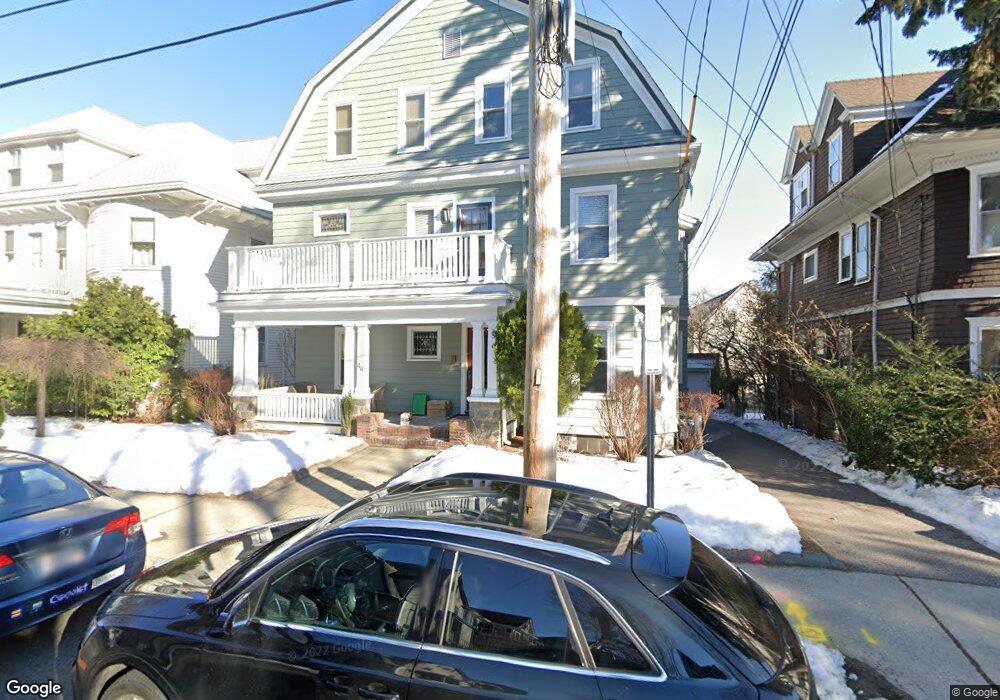
44 Liberty Ave Unit 2 Somerville, MA 02144
Ball Square NeighborhoodEstimated Value: $834,000 - $935,000
2
Beds
2
Baths
1,120
Sq Ft
$784/Sq Ft
Est. Value
About This Home
This home is located at 44 Liberty Ave Unit 2, Somerville, MA 02144 and is currently estimated at $878,586, approximately $784 per square foot. 44 Liberty Ave Unit 2 is a home located in Middlesex County with nearby schools including Somerville High School, St. Clement Elementary School, and Wild Rose Montessori School.
Ownership History
Date
Name
Owned For
Owner Type
Purchase Details
Closed on
Apr 12, 2005
Sold by
44 Liberty Avenue Rt
Bought by
Mckenna Catherine A
Current Estimated Value
Home Financials for this Owner
Home Financials are based on the most recent Mortgage that was taken out on this home.
Original Mortgage
$316,200
Outstanding Balance
$162,324
Interest Rate
5.7%
Mortgage Type
Purchase Money Mortgage
Estimated Equity
$716,262
Create a Home Valuation Report for This Property
The Home Valuation Report is an in-depth analysis detailing your home's value as well as a comparison with similar homes in the area
Home Values in the Area
Average Home Value in this Area
Purchase History
| Date | Buyer | Sale Price | Title Company |
|---|---|---|---|
| Mckenna Catherine A | $527,000 | -- |
Source: Public Records
Mortgage History
| Date | Status | Borrower | Loan Amount |
|---|---|---|---|
| Open | Mckenna Catherine A | $316,200 |
Source: Public Records
Tax History Compared to Growth
Tax History
| Year | Tax Paid | Tax Assessment Tax Assessment Total Assessment is a certain percentage of the fair market value that is determined by local assessors to be the total taxable value of land and additions on the property. | Land | Improvement |
|---|---|---|---|---|
| 2025 | $8,049 | $737,800 | $0 | $737,800 |
| 2024 | $7,608 | $723,200 | $0 | $723,200 |
| 2023 | $7,413 | $716,900 | $0 | $716,900 |
| 2022 | $7,028 | $690,400 | $0 | $690,400 |
| 2021 | $6,885 | $675,700 | $0 | $675,700 |
| 2020 | $6,604 | $654,500 | $0 | $654,500 |
| 2019 | $6,827 | $634,500 | $0 | $634,500 |
| 2018 | $6,858 | $606,400 | $0 | $606,400 |
| 2017 | $6,424 | $550,500 | $0 | $550,500 |
| 2016 | $6,177 | $493,000 | $0 | $493,000 |
| 2015 | $5,648 | $447,900 | $0 | $447,900 |
Source: Public Records
Map
Nearby Homes
- 26 Warner St
- 39 Rogers Ave
- 31 Rogers Ave
- 23 Highland Rd
- 371 Highland Ave
- 69 Boston Ave
- 79 Willow Ave
- 27 Boston Ave
- 15 Colby St
- 353 Summer St Unit 310
- 595 Broadway Unit 302
- 595 Broadway Unit 101
- 595 Broadway Unit 202
- 20 Electric Ave Unit 2
- 12 Windsor Rd Unit 1
- 3 Fairlee St
- 23 Ossipee Rd
- 13 Warwick St
- 561 Broadway Unit C1
- 34 Day St
- 44 Liberty Ave Unit 3
- 44 Liberty Ave Unit 1
- 42 Liberty Ave
- 42 Liberty Ave Unit 3
- 48 Liberty Ave
- 45 Bay State Ave
- 45 Bay State Ave Unit 45
- 45 Bay State Ave Unit 3
- 45 Bay State Ave Unit 1
- 41 Bay State Ave
- 41 Bay State Ave Unit 41
- 41 Bay State Ave
- 41 Bay State Ave Unit 3
- 36 Liberty Ave Unit 1
- 36 Liberty Ave
- 36 Liberty Ave Unit 2
- 52 Liberty Ave
- 47 Bay State Ave
- 47-2 Bay State Ave Unit 47
- 39 Powder House Terrace