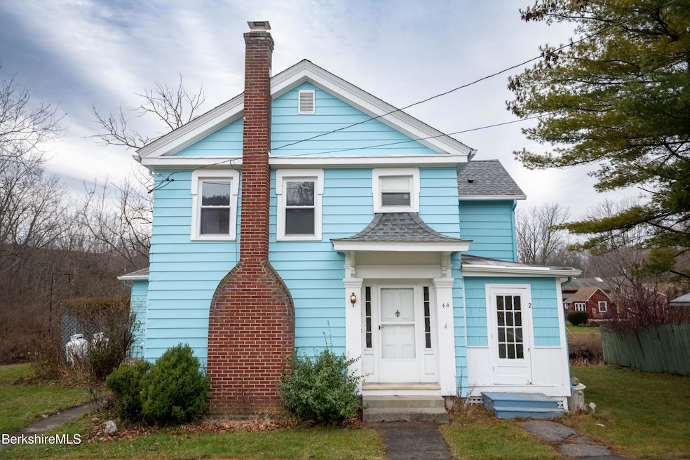


44 Main St West Stockbridge, MA 01266
Estimated payment $2,135/month
Highlights
- Water Views
- Colonial Architecture
- Wood Flooring
- Monument Mountain Regional High School Rated A-
- Deck
- Fireplace
About This Home
Discover the charm of downtown living in this Colonial home located in the heart of West Stockbridge. This home features four bedrooms, two full baths, kitchen, living room, dining room and a deck overlooking the river. In addition to the main living area the property also includes an in-law or studio apartment with it's own kitchen and bathroom. With a nice flat yard for outdoor activities, outdoor shed for extra storage and backing up to the picturesque Williams River makes this a wonderful opportunity. Come to the open house on Saturday, November 29th 10:30am - 12:30pm!
Home Details
Home Type
- Single Family
Est. Annual Taxes
- $3,509
Year Built
- 1836
Lot Details
- 0.29 Acre Lot
- Property is zoned Multi
Home Design
- Colonial Architecture
- Wood Frame Construction
- Asphalt Shingled Roof
- Fiberglass Roof
- Aluminum Siding
- Asbestos Siding
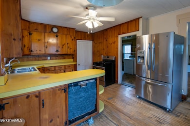
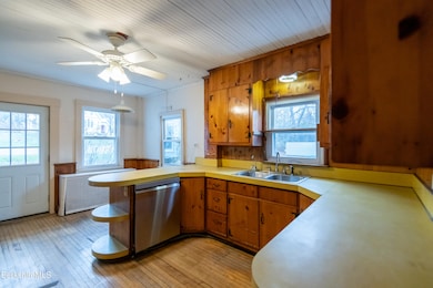
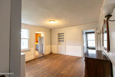
Interior Spaces
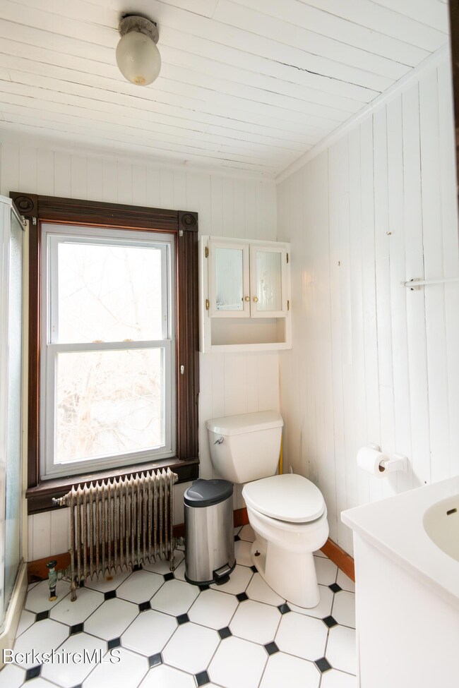
- 2,276 Sq Ft Home
- Fireplace
- Water Views
- Basement Fills Entire Space Under The House
Kitchen
- Range
- Dishwasher
Flooring
- Wood
- Carpet
- Ceramic Tile
Bedrooms and Bathrooms
- 4 Bedrooms
- In-Law or Guest Suite
- 3 Full Bathrooms
Laundry
- Dryer
- Washer
Parking
- No Garage
- Off-Street Parking
Outdoor Features
- Deck
- Outbuilding
Location
- In Flood Plain
- Flood Risk
Schools
- Muddy Brook Reg. Elementary School
- Monument Valley Reg. Middle School
- Monument Mountain High School
Utilities
- Hot Water Heating System
- Boiler Heating System
- Propane Water Heater
Map
Home Values in the Area
Average Home Value in this Area
Tax History
| Year | Tax Paid | Tax Assessment Tax Assessment Total Assessment is a certain percentage of the fair market value that is determined by local assessors to be the total taxable value of land and additions on the property. | Land | Improvement |
|---|---|---|---|---|
| 2025 | $3,509 | $364,800 | $67,500 | $297,300 |
| 2024 | $4,714 | $492,100 | $77,700 | $414,400 |
| 2023 | $4,034 | $391,300 | $74,000 | $317,300 |
| 2022 | $3,801 | $302,600 | $74,000 | $228,600 |
| 2021 | $0 | $234,800 | $74,000 | $160,800 |
| 2020 | $0 | $234,800 | $74,000 | $160,800 |
| 2019 | $3,588 | $234,900 | $74,000 | $160,900 |
| 2018 | $3,744 | $234,900 | $74,000 | $160,900 |
| 2017 | $2,452 | $234,900 | $74,000 | $160,900 |
| 2016 | $2,921 | $236,900 | $74,000 | $162,900 |
| 2015 | $2,805 | $236,900 | $74,000 | $162,900 |
| 2014 | $2,634 | $236,900 | $74,000 | $162,900 |
Property History
| Date | Event | Price | List to Sale | Price per Sq Ft |
|---|---|---|---|---|
| 11/26/2025 11/26/25 | For Sale | $349,000 | -- | $153 / Sq Ft |
Purchase History
| Date | Type | Sale Price | Title Company |
|---|---|---|---|
| Quit Claim Deed | -- | None Available |
Source: Berkshire County Board of REALTORS®
MLS Number: 248332
APN: WSTO-000104-000000-000008
Disclaimer: Certain information contained herein is derived from information provided by parties other than Homes.com. All information provided is deemed reliable, but is not guaranteed to be accurate and should be independently verified.
![]() IDX information is provided exclusively for consumers' personal, non-commercial use, that it may not be used for any purpose other than to identify prospective properties consumers may be interested in purchasing. Information deemed to be reliable but not guaranteed.
IDX information is provided exclusively for consumers' personal, non-commercial use, that it may not be used for any purpose other than to identify prospective properties consumers may be interested in purchasing. Information deemed to be reliable but not guaranteed.
The data relating to real estate for sale on this website comes from Berkshire County Board of Realtors and the Broker Reciprocity Program.
Copyright 2025 Berkshire County Board of Realtors. All rights reserved.
- 35 Main St
- 29 Main St
- 4 Main St
- 21 Stockbridge Rd
- 16 Swamp Rd
- 26 Lenox Rd
- 19 Washington Square
- 45 Swamp
- 30 Great Barrington Rd
- 7 Silver Mine Ln
- 51 Albany Rd
- 17 Iron Mine Rd
- 76 Lenox Rd
- 0 Lenox Rd Unit 246122
- 0 Furnace Rd
- 2650 Swamp Rd
- 55 & 0 Maple Hill Rd
- 1 Old Tree Farm Rd
- 36 W Center Rd
- 88 Great Barrington Rd
- 1292 Lenox Rd Unit 1
- 230 Middle Rd
- 208 Cunningham Hill Rd
- 68 Kemble St
- 2 Depot Rd
- 34 Church St Unit 2B
- 27 Housatonic St Unit 1
- 109 Housatonic St
- 207 Pleasant St
- 165 Stockbridge Rd
- 66 Brushwood Way
- 1579 Pleasant St
- 1579 Pleasant St
- 1579 Pleasant St
- 121 Queechy Lake Dr
- 73 W Center St
- 125 Center St Unit 2
- 1-6 Meadow Ln Unit 7-4
- 703 W Housatonic St
- 12 Applewood Ln Unit 12
