Estimated Value: $1,450,540
--
Bed
1
Bath
8,856
Sq Ft
$164/Sq Ft
Est. Value
About This Home
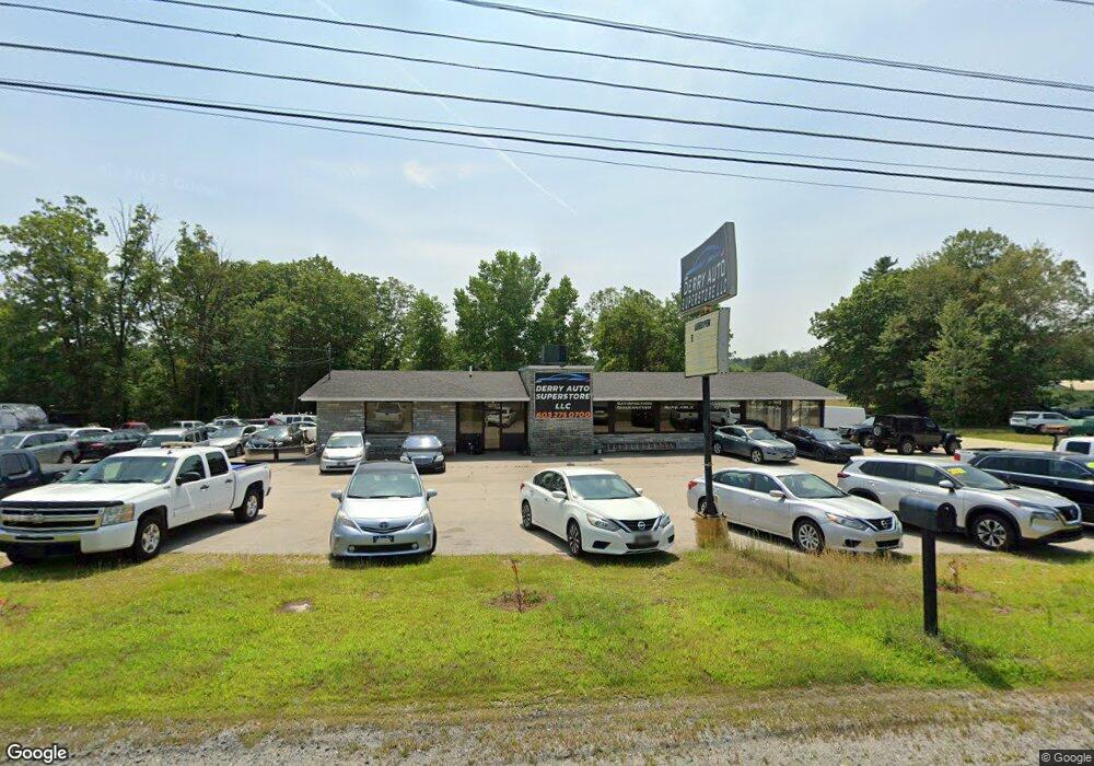
This home is located at 44 Manchester Rd, Derry, NH 03038 and is currently estimated at $1,450,540, approximately $163 per square foot. 44 Manchester Rd is a home located in Rockingham County with nearby schools including Ernest P. Barka Elementary School, Gilbert H. Hood Middle School, and Pinkerton Academy.
Ownership History
Date
Name
Owned For
Owner Type
Purchase Details
Closed on
Nov 6, 2012
Sold by
Nault and Nault Heller T
Bought by
Kkjp & C Real Estate Hld
Current Estimated Value
Purchase Details
Closed on
Dec 16, 2011
Sold by
Lynch Robert E and Lynch Judith A
Bought by
T Nault and Heller T
Create a Home Valuation Report for This Property
The Home Valuation Report is an in-depth analysis detailing your home's value as well as a comparison with similar homes in the area
Home Values in the Area
Average Home Value in this Area
Purchase History
| Date | Buyer | Sale Price | Title Company |
|---|---|---|---|
| Kkjp & C Real Estate Hld | $640,000 | -- | |
| Kkjp & C Real Estate Hld | $640,000 | -- | |
| T Nault | $400,000 | -- | |
| Nault | $400,000 | -- |
Source: Public Records
Mortgage History
| Date | Status | Borrower | Loan Amount |
|---|---|---|---|
| Previous Owner | Nault | $598,000 | |
| Previous Owner | Nault | $253,500 | |
| Previous Owner | Nault | $200,000 |
Source: Public Records
Tax History Compared to Growth
Tax History
| Year | Tax Paid | Tax Assessment Tax Assessment Total Assessment is a certain percentage of the fair market value that is determined by local assessors to be the total taxable value of land and additions on the property. | Land | Improvement |
|---|---|---|---|---|
| 2024 | $16,085 | $860,600 | $419,600 | $441,000 |
| 2023 | $14,435 | $698,000 | $472,000 | $226,000 |
| 2022 | $13,290 | $698,000 | $472,000 | $226,000 |
| 2021 | $16,426 | $663,400 | $472,000 | $191,400 |
| 2020 | $16,147 | $663,400 | $472,000 | $191,400 |
| 2019 | $17,022 | $651,700 | $437,600 | $214,100 |
| 2018 | $16,964 | $651,700 | $437,600 | $214,100 |
| 2017 | $12,909 | $447,300 | $265,000 | $182,300 |
| 2016 | $11,844 | $437,700 | $265,000 | $172,700 |
| 2015 | $12,569 | $430,000 | $262,800 | $167,200 |
| 2014 | $12,651 | $430,000 | $262,800 | $167,200 |
| 2013 | $13,626 | $432,700 | $262,800 | $169,900 |
Source: Public Records
Map
Nearby Homes
- 3 Exeter St
- 5 Tsienneto Rd Unit 10
- 5 Tsienneto Rd Unit 127
- 5 Tsienneto Rd Unit 170
- 5 Tsienneto Rd Unit 41
- 5 Tsienneto Rd Unit 151
- 80 Bypass 28
- 8 Laurel St
- 27 Mount Pleasant St Unit R
- 75 Rockingham Rd
- 4 Newells Meadow Ln Unit 2
- 12 Perley Rd Unit 21
- 24 Jefferson St
- 84 E Broadway
- 18 Maple St Unit 1
- 5 Nesmith St
- 2 Pembroke Dr Unit 21
- 8 Birch St
- 103 Rockingham Rd Unit 1
- 103 Rockingham Rd Unit 2
- 42 Manchester Rd Unit 1
- 42 Manchester Rd
- 10 Rockingham Rd
- 40 Manchester Rd
- 40 Manchester Rd Unit 2
- 40 Manchester Rd Unit 2
- 40 Manchester Rd Unit 2
- 40 Manchester Rd
- 40 Manchester Rd
- 40 Manchester Rd
- 38 Manchester Rd
- 7 Rockingham Rd
- 7 Rockingham Rd
- 7 Rockingham Rd
- 7 Rockingham Rd Unit center
- 7 Rockingham Rd Unit left
- 7 Rockingham Rd Unit Ret 080
- 7 Rockingham Rd Unit right Ret 080
- 7 Rockingham Rd Unit Ret 070