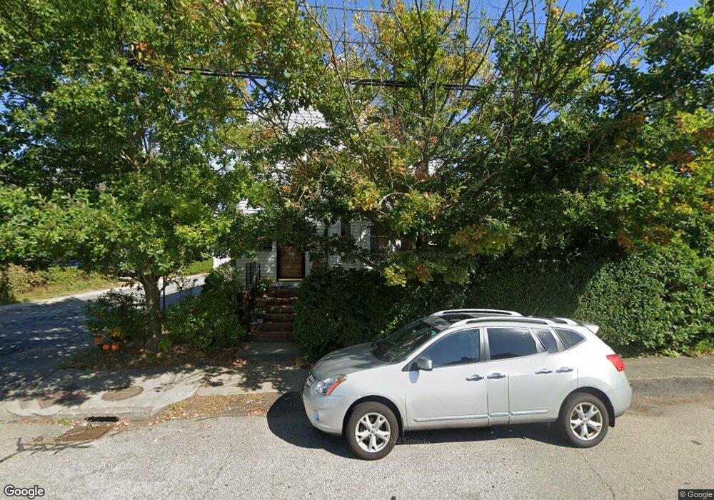
44 Middleton Ave Newport, RI 02840
Memorial Boulevard NeighborhoodEstimated Value: $765,176 - $1,047,000
4
Beds
2
Baths
1,362
Sq Ft
$644/Sq Ft
Est. Value
About This Home
This home is located at 44 Middleton Ave, Newport, RI 02840 and is currently estimated at $876,544, approximately $643 per square foot. 44 Middleton Ave is a home located in Newport County with nearby schools including Rogers High School, St Michael's Country Day School, and St George's School.
Ownership History
Date
Name
Owned For
Owner Type
Purchase Details
Closed on
Jan 8, 2026
Sold by
Tvrtko Ceric
Bought by
Tvrtko Ceric Ret and Ceric
Current Estimated Value
Purchase Details
Closed on
Jul 1, 2024
Sold by
Zettmar Mats and Ceric
Bought by
Ceric Tvrtko
Purchase Details
Closed on
Apr 1, 1999
Sold by
Monumental Life Ins
Bought by
Zetttmer Kerstin M
Purchase Details
Closed on
Jun 3, 1992
Sold by
Earley Patricia S
Bought by
Block Steven P
Create a Home Valuation Report for This Property
The Home Valuation Report is an in-depth analysis detailing your home's value as well as a comparison with similar homes in the area
Home Values in the Area
Average Home Value in this Area
Purchase History
| Date | Buyer | Sale Price | Title Company |
|---|---|---|---|
| Tvrtko Ceric Ret | -- | -- | |
| Ceric Tvrtko | -- | None Available | |
| Ceric Tvrtko | -- | None Available | |
| Zettmar Mats | -- | None Available | |
| Zetttmer Kerstin M | $117,000 | -- | |
| Block Steven P | $115,000 | -- | |
| Zetttmer Kerstin M | $117,000 | -- | |
| Block Steven P | $115,000 | -- |
Source: Public Records
Mortgage History
| Date | Status | Borrower | Loan Amount |
|---|---|---|---|
| Previous Owner | Block Steven P | $111,350 | |
| Previous Owner | Block Steven P | $150,000 | |
| Previous Owner | Block Steven P | $91,000 |
Source: Public Records
Tax History
| Year | Tax Paid | Tax Assessment Tax Assessment Total Assessment is a certain percentage of the fair market value that is determined by local assessors to be the total taxable value of land and additions on the property. | Land | Improvement |
|---|---|---|---|---|
| 2025 | $4,925 | $686,000 | $373,900 | $312,100 |
| 2024 | $4,781 | $686,000 | $373,900 | $312,100 |
| 2023 | $4,481 | $451,700 | $244,400 | $207,300 |
| 2022 | $4,341 | $451,700 | $244,400 | $207,300 |
| 2021 | $4,214 | $451,700 | $244,400 | $207,300 |
| 2020 | $4,039 | $392,900 | $219,800 | $173,100 |
| 2019 | $4,039 | $392,900 | $219,800 | $173,100 |
| 2018 | $3,925 | $392,900 | $219,800 | $173,100 |
| 2017 | $3,560 | $317,600 | $157,200 | $160,400 |
| 2016 | $3,471 | $317,600 | $157,200 | $160,400 |
| 2015 | $3,389 | $317,600 | $157,200 | $160,400 |
| 2014 | $3,612 | $299,500 | $133,600 | $165,900 |
Source: Public Records
Map
Nearby Homes
- 5 Lowndes St
- 26 Freebody St
- 19 Slocum St
- 21 Slocum St
- 20 Berkeley Ave Unit 2
- 5 Dresser St
- 10 Ocean Lawn Ln
- 7 Red Cross Ave
- 20 East St Unit 2A
- 1 Oakwood Terrace Unit 7
- 24 Old Beach Rd
- 2 Perry St
- 4 Red Cross Ave Unit 4
- 27 Dean Ave
- 75 Pelham St Unit B
- 20 Fair St
- 66 Webster St Unit 9
- 5 Lee's Wharf
- 26 Franklin St
- 5 Lee's
- 31 Weaver Ave
- 0 Middleton Ave
- 36 Weaver Ave
- 29 Middleton Ave
- 38 Middleton Ave Unit 40
- 31 Middleton Ave
- 27 Middleton Ave
- 54 E Bowery St
- 50R E Bowery St
- 50 E Bowery St Unit R
- 38 Weaver Ave
- 27 Weaver Ave
- 27 Weaver Ave Unit B
- 27 Weaver Ave Unit A
- 52 E Bowery St
- 33 Middleton Ave Unit 3
- 33 Middleton Ave Unit 1
- 33 Middleton Ave Unit 2
- 33 Middleton Ave
- 28 Weaver Ave