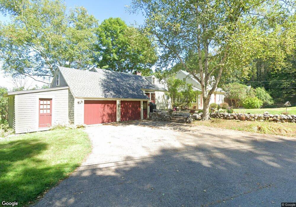
44 Randall Rd Moultonborough, NH 03254
Estimated Value: $740,000 - $1,561,000
4
Beds
4
Baths
3,824
Sq Ft
$266/Sq Ft
Est. Value
About This Home
This home is located at 44 Randall Rd, Moultonborough, NH 03254 and is currently estimated at $1,016,736, approximately $265 per square foot. 44 Randall Rd is a home located in Carroll County with nearby schools including Moultonborough Central School and Moultonborough Academy High School.
Ownership History
Date
Name
Owned For
Owner Type
Purchase Details
Closed on
Apr 28, 2005
Sold by
Ladd 3Rd Alexander H and Ladd Kathleen
Bought by
Morse Jeannette L
Current Estimated Value
Create a Home Valuation Report for This Property
The Home Valuation Report is an in-depth analysis detailing your home's value as well as a comparison with similar homes in the area
Home Values in the Area
Average Home Value in this Area
Purchase History
| Date | Buyer | Sale Price | Title Company |
|---|---|---|---|
| Morse Jeannette L | $699,000 | -- |
Source: Public Records
Mortgage History
| Date | Status | Borrower | Loan Amount |
|---|---|---|---|
| Open | Morse Jeannette L | $15,000 |
Source: Public Records
Tax History Compared to Growth
Tax History
| Year | Tax Paid | Tax Assessment Tax Assessment Total Assessment is a certain percentage of the fair market value that is determined by local assessors to be the total taxable value of land and additions on the property. | Land | Improvement |
|---|---|---|---|---|
| 2024 | $4,075 | $721,279 | $149,479 | $571,800 |
| 2023 | $3,859 | $676,974 | $114,774 | $562,200 |
| 2022 | $2,926 | $612,174 | $104,374 | $507,800 |
| 2021 | $3,696 | $529,513 | $85,913 | $443,600 |
| 2020 | $3,781 | $530,277 | $85,977 | $444,300 |
| 2019 | $3,412 | $477,179 | $86,879 | $390,300 |
| 2018 | $3,587 | $464,679 | $80,979 | $383,700 |
| 2017 | $3,638 | $442,579 | $78,179 | $364,400 |
| 2016 | $3,693 | $422,530 | $77,930 | $344,600 |
| 2015 | $3,613 | $401,042 | $78,242 | $322,800 |
| 2014 | $3,553 | $401,042 | $78,242 | $322,800 |
| 2013 | $3,486 | $401,096 | $78,296 | $322,800 |
Source: Public Records
Map
Nearby Homes
- 284 Ossipee Mountain Rd
- 17 Whitehouse Farm Ln
- 66 Hayes Ln
- 11 Harriet Ln
- 139 Skyline Dr
- 16 Buckingham Terrace
- 538 Governor Wentworth Hwy
- 7 Eden Ln
- 2 Garland Pond Rd
- 0 Garland Pond Rd Unit 76
- 22 Sundorf St
- 0 States Landing Rd Unit 4
- 16 Myrtle Dr
- 00 Sundorf St Unit 117
- 122-1 Gwh Hwy
- 0 Moose Walk
- 72 Sundorf St
- 00 Grande St Unit 44
- 28 Moose Walk
- 69 Buoniello Rd
- 45 Randall Rd
- 81 Randall Rd
- 30 Randall Rd
- 33 Randall Rd
- 193 Ossipee Mountain Rd
- 199 Ossipee Mountain Rd
- 101 Randall Rd
- 15 Randall Rd
- 147 Ossipee Mountain Rd
- 83 Randall Rd
- 9 Randall Rd
- 167 Ossipee Mountain Rd
- 23 Wool Wakefield Ln
- 131 Ossipee Mountain Rd
- 123 Randall Rd
- 142 Ossipee Mt Rd
- 142 Ossipee Mountain Rd
- 31 Wool Wakefield Ln
- 198 Ossipee Mountain Rd
- 92 Randall Rd