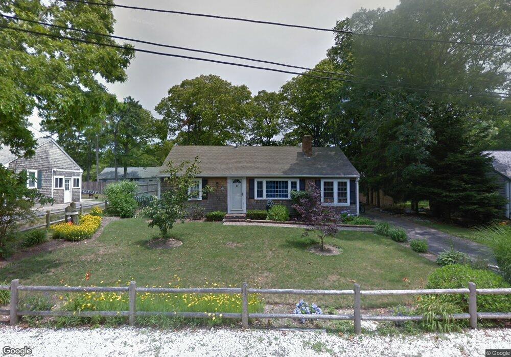
44 Security St Hyannis, MA 02601
Estimated Value: $484,277 - $535,000
2
Beds
1
Bath
1,008
Sq Ft
$517/Sq Ft
Est. Value
About This Home
This home is located at 44 Security St, Hyannis, MA 02601 and is currently estimated at $520,819, approximately $516 per square foot. 44 Security St is a home located in Barnstable County with nearby schools including Hyannis West Elementary School, Barnstable United Elementary School, and Barnstable Intermediate School.
Ownership History
Date
Name
Owned For
Owner Type
Purchase Details
Closed on
Dec 20, 2018
Sold by
Renzi Joseph M and Renzi Randi B
Bought by
Renzi Joseph M
Current Estimated Value
Purchase Details
Closed on
Jul 31, 2006
Sold by
Vanetten Marianella
Bought by
Renzi Joseph M
Home Financials for this Owner
Home Financials are based on the most recent Mortgage that was taken out on this home.
Original Mortgage
$228,000
Interest Rate
6.67%
Mortgage Type
Purchase Money Mortgage
Purchase Details
Closed on
Mar 5, 2003
Sold by
Gordon-Lyons Lisa
Bought by
Vanetten Marianella
Home Financials for this Owner
Home Financials are based on the most recent Mortgage that was taken out on this home.
Original Mortgage
$183,000
Interest Rate
5.95%
Mortgage Type
Purchase Money Mortgage
Purchase Details
Closed on
May 27, 1999
Sold by
Lange Carole Ann
Bought by
Gordon Lisa C
Purchase Details
Closed on
Aug 11, 1998
Sold by
Caterino Raymond W
Bought by
Lange Carole Ann
Purchase Details
Closed on
May 1, 1998
Sold by
Lebasi Nt
Bought by
Caterino Raymond W
Create a Home Valuation Report for This Property
The Home Valuation Report is an in-depth analysis detailing your home's value as well as a comparison with similar homes in the area
Home Values in the Area
Average Home Value in this Area
Purchase History
| Date | Buyer | Sale Price | Title Company |
|---|---|---|---|
| Renzi Joseph M | -- | -- | |
| Renzi Joseph M | $285,000 | -- | |
| Vanetten Marianella | $213,000 | -- | |
| Gordon Lisa C | $94,000 | -- | |
| Lange Carole Ann | $80,000 | -- | |
| Caterino Raymond W | $76,000 | -- |
Source: Public Records
Mortgage History
| Date | Status | Borrower | Loan Amount |
|---|---|---|---|
| Previous Owner | Renzi Joseph M | $228,000 | |
| Previous Owner | Renzi Joseph M | $28,400 | |
| Previous Owner | Caterino Raymond W | $9,784 | |
| Previous Owner | Caterino Raymond W | $183,000 | |
| Previous Owner | Caterino Raymond W | $111,000 |
Source: Public Records
Tax History
| Year | Tax Paid | Tax Assessment Tax Assessment Total Assessment is a certain percentage of the fair market value that is determined by local assessors to be the total taxable value of land and additions on the property. | Land | Improvement |
|---|---|---|---|---|
| 2025 | $3,433 | $370,300 | $139,600 | $230,700 |
| 2024 | $3,329 | $367,900 | $139,600 | $228,300 |
| 2023 | $3,071 | $320,900 | $126,900 | $194,000 |
| 2022 | $2,997 | $259,000 | $94,000 | $165,000 |
| 2021 | $2,695 | $226,300 | $94,000 | $132,300 |
| 2020 | $2,741 | $222,300 | $94,000 | $128,300 |
| 2019 | $2,574 | $204,600 | $94,000 | $110,600 |
| 2018 | $2,235 | $181,700 | $98,900 | $82,800 |
| 2017 | $2,109 | $175,900 | $98,900 | $77,000 |
| 2016 | $2,127 | $181,300 | $104,300 | $77,000 |
| 2015 | $2,004 | $173,200 | $97,200 | $76,000 |
Source: Public Records
Map
Nearby Homes
- 20 Sunset Terrace
- 36 Grouse Ln
- 15 Glen Rd
- 83 Peacock Dr
- 14 Marston Ave
- 260 Tobey Way
- 135 W Main St Unit 7
- 50 Redwood Ln
- 140 6th Ave
- 33 Edgewood Rd
- 46 Washington Ave
- 18 Mount Vernon Ave
- 292 Megan Rd
- 172 Irving Ave
- 179 Sudbury Ln
- 125 Sea St
- 75 Olander Dr
- 75 Olander Dr
- 432 Sea St Unit 8D
- 432 Sea St Unit 8D
- 52 Security St
- 52 Security St Unit Winter
- 36 Security St
- 52 Security
- 101 Homeport Dr
- 95 Homeport Dr
- 109 Homeport Dr
- 28 Security St
- 60 Security St
- 45 Security St
- 39 Security St
- 87 Homeport Dr
- 55 Security St
- 31 Security St
- 20 Security St
- 63 Security St
- 100 Homeport Dr
- 51 Old School House Rd
- 79 Homeport Dr
- 41 Old School House Rd
Your Personal Tour Guide
Ask me questions while you tour the home.