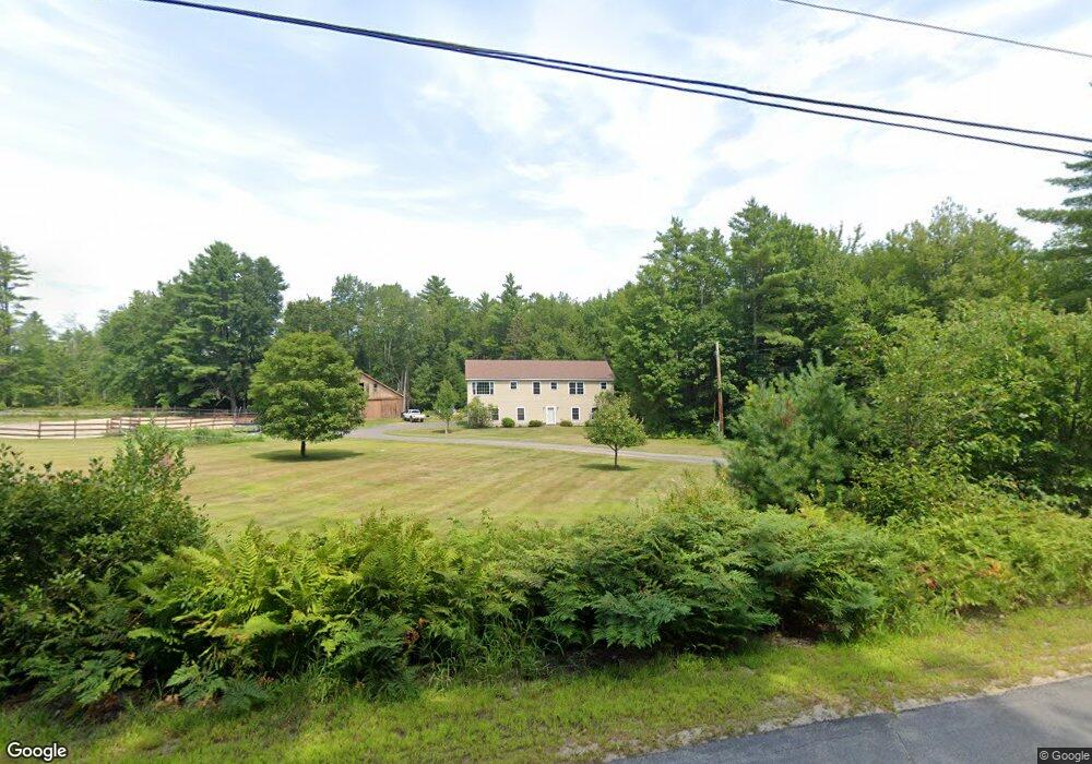
44 Smith Rd Parsonsfield, ME 04047
Estimated Value: $280,176 - $482,000
--
Bed
--
Bath
1,568
Sq Ft
$248/Sq Ft
Est. Value
About This Home
This home is located at 44 Smith Rd, Parsonsfield, ME 04047 and is currently estimated at $389,294, approximately $248 per square foot. 44 Smith Rd is a home.
Ownership History
Date
Name
Owned For
Owner Type
Purchase Details
Closed on
Sep 5, 2012
Sold by
Smith Danielle D and Smith Darren R
Bought by
Taylor Gary L and Smith Danielle
Current Estimated Value
Purchase Details
Closed on
Jul 7, 2010
Sold by
Smith Darren R
Bought by
Smith Danielle D and Smith Darren R
Home Financials for this Owner
Home Financials are based on the most recent Mortgage that was taken out on this home.
Original Mortgage
$176,841
Outstanding Balance
$117,689
Interest Rate
4.75%
Mortgage Type
FHA
Estimated Equity
$271,605
Create a Home Valuation Report for This Property
The Home Valuation Report is an in-depth analysis detailing your home's value as well as a comparison with similar homes in the area
Home Values in the Area
Average Home Value in this Area
Purchase History
| Date | Buyer | Sale Price | Title Company |
|---|---|---|---|
| Taylor Gary L | -- | -- | |
| Smith Danielle D | -- | -- |
Source: Public Records
Mortgage History
| Date | Status | Borrower | Loan Amount |
|---|---|---|---|
| Open | Smith Danielle D | $176,841 | |
| Previous Owner | Smith Danielle D | $80,000 |
Source: Public Records
Tax History Compared to Growth
Tax History
| Year | Tax Paid | Tax Assessment Tax Assessment Total Assessment is a certain percentage of the fair market value that is determined by local assessors to be the total taxable value of land and additions on the property. | Land | Improvement |
|---|---|---|---|---|
| 2024 | $3,186 | $189,636 | $58,820 | $130,816 |
| 2023 | $3,072 | $189,636 | $58,820 | $130,816 |
| 2022 | $2,939 | $189,636 | $58,820 | $130,816 |
| 2021 | $2,930 | $189,636 | $58,820 | $130,816 |
| 2020 | $2,873 | $189,636 | $58,820 | $130,816 |
| 2019 | $2,826 | $189,636 | $58,820 | $130,816 |
| 2017 | $2,826 | $189,636 | $58,820 | $130,816 |
| 2016 | $2,826 | $189,636 | $58,820 | $130,816 |
| 2015 | $2,845 | $189,636 | $58,820 | $130,816 |
| 2013 | $2,769 | $189,636 | $58,820 | $130,816 |
Source: Public Records
Map
Nearby Homes
- 199 Stagecoach Rd
- 104 Bailey Rd
- 106 Stevens Rd Unit 1
- 88 Stevens Rd
- Lot 69 Glen Ave
- 288 Bonnyman Rd
- 43 Ambrose Ave
- 225 Simon Hill Rd
- 175 Molly Philbrick Rd
- 142 Snow Rd
- 209 Lost Mile Rd
- Lot 6 Pick Pocket Rd
- 0 Province Lake Rd Unit 22854991
- 0 Clough Rd Unit 28 5041865
- 0 Clough Rd
- 275 Granite Rd
- 3 Simon Hill Rd
- Lot 1 Moulton Hill Rd
- 190 Circuit Rd
- 15 Circuit Rd
- 39 Smith Rd
- 52 Smith Rd
- 25-B Smith Rd
- 20 Smith Rd
- 0 Bailey Rd Unit 4078566
- 0 Bailey Rd Unit 4431292
- 0 Bailey Rd Unit 4723528
- 0 Bailey Rd
- 119 Lost Mile Rd
- Lot 1 Kingman Dr
- 0 Kingman Dr
- 14 Smith Rd
- 13 Franks Place
- 9 Kingman Dr
- 1679 Province Lake Rd
- 1691 Province Lake Rd
- 1703 Province Lake Rd
- 1673 Province Lake Rd
- 25 Franks Place
- 1692 Province Lake Rd