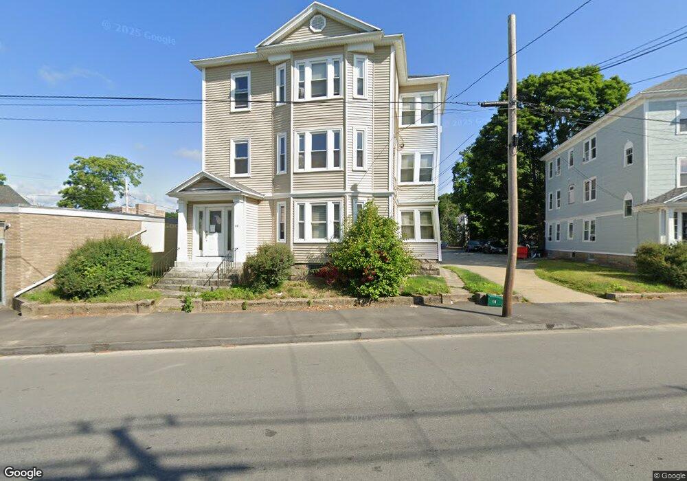
44 Stafford St Unit 1 Worcester, MA 01603
Webster Square NeighborhoodEstimated Value: $657,986 - $764,000
2
Beds
1
Bath
1,275
Sq Ft
$549/Sq Ft
Est. Value
About This Home
This home is located at 44 Stafford St Unit 1, Worcester, MA 01603 and is currently estimated at $699,747, approximately $548 per square foot. 44 Stafford St Unit 1 is a home located in Worcester County with nearby schools including Gates Lane, Jacob Hiatt Magnet School, and Chandler Magnet.
Ownership History
Date
Name
Owned For
Owner Type
Purchase Details
Closed on
May 10, 2023
Sold by
Maka Peter M
Bought by
Kansal Mohit and Agnihotri Parul
Current Estimated Value
Home Financials for this Owner
Home Financials are based on the most recent Mortgage that was taken out on this home.
Original Mortgage
$427,500
Outstanding Balance
$414,671
Interest Rate
6.38%
Mortgage Type
Purchase Money Mortgage
Estimated Equity
$285,076
Purchase Details
Closed on
Apr 28, 2022
Sold by
Hoyt Raymond B
Bought by
Maka Peter M
Home Financials for this Owner
Home Financials are based on the most recent Mortgage that was taken out on this home.
Original Mortgage
$403,125
Interest Rate
4.16%
Mortgage Type
Purchase Money Mortgage
Purchase Details
Closed on
May 17, 2018
Sold by
Plouffe Phyllis H Est and Hoyt
Bought by
Hoyt Raymond B
Create a Home Valuation Report for This Property
The Home Valuation Report is an in-depth analysis detailing your home's value as well as a comparison with similar homes in the area
Home Values in the Area
Average Home Value in this Area
Purchase History
| Date | Buyer | Sale Price | Title Company |
|---|---|---|---|
| Kansal Mohit | $570,000 | None Available | |
| Maka Peter M | $562,500 | None Available | |
| Hoyt Raymond B | -- | -- | |
| Hoyt Raymond B | -- | -- |
Source: Public Records
Mortgage History
| Date | Status | Borrower | Loan Amount |
|---|---|---|---|
| Open | Kansal Mohit | $427,500 | |
| Previous Owner | Maka Peter M | $403,125 |
Source: Public Records
Tax History Compared to Growth
Tax History
| Year | Tax Paid | Tax Assessment Tax Assessment Total Assessment is a certain percentage of the fair market value that is determined by local assessors to be the total taxable value of land and additions on the property. | Land | Improvement |
|---|---|---|---|---|
| 2025 | $8,237 | $624,500 | $98,400 | $526,100 |
| 2024 | $7,620 | $554,200 | $98,400 | $455,800 |
| 2023 | $7,300 | $509,100 | $85,500 | $423,600 |
| 2022 | $6,370 | $418,800 | $68,400 | $350,400 |
| 2021 | $5,656 | $347,400 | $54,800 | $292,600 |
| 2020 | $5,253 | $309,000 | $54,400 | $254,600 |
| 2019 | $3,555 | $197,500 | $47,500 | $150,000 |
| 2018 | $3,510 | $185,600 | $47,500 | $138,100 |
| 2017 | $3,333 | $173,400 | $47,500 | $125,900 |
| 2016 | $3,118 | $151,300 | $33,800 | $117,500 |
| 2015 | $3,037 | $151,300 | $33,800 | $117,500 |
| 2014 | $2,956 | $151,300 | $33,800 | $117,500 |
Source: Public Records
Map
Nearby Homes
- 3 Arbor Vitae St
- 23 Lakewood St
- 28 Baker St
- 40 Lakewood St
- 114 Henshaw St
- 170 Stafford St
- 68 Crest Cir
- 35 Genessee St Unit I
- 21 Hitchcock Rd
- 12 Stoneland Rd
- 19 Monticello Dr
- 5 Stoneland Rd
- 1022 Main St
- 45 Wildwood Ave
- 24 Meena Dr
- 141 Cambridge St
- 21 Healy Rd
- 53 James St
- 5 Freeland Terrace
- 21 Clement St
- 44 Stafford St
- 42 Stafford St
- 7 Young St
- 47 Stafford St
- 41 Stafford St
- 41 Stafford St Unit 3
- 41 Stafford St Unit 2
- 41 Stafford St Unit 2
- 51 Stafford St
- 10 Young St
- 39 Stafford St
- 43 Stafford St
- 54 Stafford St
- 37 Stafford St
- 55 Stafford St
- 57 Stafford St
- 35 Stafford St
- 1211 Main St
- 1213 Main St Unit 1
- 1213 Main St