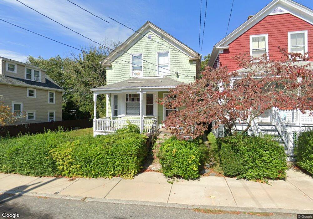
44 Webster St Newport, RI 02840
Fifth Ward NeighborhoodEstimated Value: $819,228 - $1,309,000
3
Beds
2
Baths
1,152
Sq Ft
$946/Sq Ft
Est. Value
About This Home
This home is located at 44 Webster St, Newport, RI 02840 and is currently estimated at $1,089,807, approximately $946 per square foot. 44 Webster St is a home located in Newport County with nearby schools including Rogers High School, St Michael's Country Day School, and St George's School.
Ownership History
Date
Name
Owned For
Owner Type
Purchase Details
Closed on
Oct 15, 2020
Sold by
Newport City Of
Bought by
Woods Robert R
Current Estimated Value
Purchase Details
Closed on
Dec 6, 2019
Sold by
Lynch John W
Bought by
Rigp Newport 5-19
Purchase Details
Closed on
Oct 7, 2019
Sold by
Newport City Of
Bought by
Lynch John W
Purchase Details
Closed on
Nov 19, 2018
Sold by
Newport City Of
Bought by
Jones Tora Yoshida C and Bell Nikka T
Create a Home Valuation Report for This Property
The Home Valuation Report is an in-depth analysis detailing your home's value as well as a comparison with similar homes in the area
Home Values in the Area
Average Home Value in this Area
Purchase History
| Date | Buyer | Sale Price | Title Company |
|---|---|---|---|
| Woods Robert R | $4,187 | None Available | |
| Rigp Newport 5-19 | -- | None Available | |
| Lynch John W | $4,830 | -- | |
| Jones Tora Yoshida C | $3,586 | -- |
Source: Public Records
Tax History Compared to Growth
Tax History
| Year | Tax Paid | Tax Assessment Tax Assessment Total Assessment is a certain percentage of the fair market value that is determined by local assessors to be the total taxable value of land and additions on the property. | Land | Improvement |
|---|---|---|---|---|
| 2025 | $6,147 | $707,500 | $448,500 | $259,000 |
| 2024 | $4,931 | $707,500 | $448,500 | $259,000 |
| 2023 | $4,548 | $458,500 | $293,200 | $165,300 |
| 2022 | $4,406 | $458,500 | $293,200 | $165,300 |
| 2021 | $4,278 | $458,500 | $293,200 | $165,300 |
| 2020 | $4,187 | $407,300 | $231,700 | $175,600 |
| 2019 | $4,187 | $407,300 | $231,700 | $175,600 |
| 2018 | $4,069 | $407,300 | $231,700 | $175,600 |
| 2017 | $3,678 | $328,100 | $165,800 | $162,300 |
| 2016 | $3,586 | $328,100 | $165,800 | $162,300 |
| 2015 | $3,501 | $328,100 | $165,800 | $162,300 |
| 2014 | $3,479 | $288,500 | $140,900 | $147,600 |
Source: Public Records
Map
Nearby Homes
- 66 Webster St Unit 9
- 17 Meikle Ave Unit 19
- 0 Meikle Ave
- 39 Connection St
- 604 Thames & 4 Dixon St
- 26 Atlantic St
- 6 Sharon Ct
- 57 Clinton St Unit 57C
- 70 Carroll Ave Unit 510
- 13 Dean Ave
- 63 Coggeshall Ave
- 91 Houston Ave
- 364 Bellevue Ave Unit A1
- 364 Bellevue Ave Unit D7
- 30 S Baptist St
- 8 Sylvan St
- 73 Old Fort Rd Unit 75
- 20 Berkeley Ave Unit 2
- 207 Ruggles Ave
- 19 Slocum St
- 46 Webster St
- 42 Webster St Unit 1
- 42 Webster St
- 40 Webster St Unit 42
- 40 Webster St Unit 1
- 40 Webster St Unit B
- 40 Webster St Unit A
- 0 Webster Ct
- 49 Webster St
- 33 Carey St
- 35 Carey St
- 38 Webster St
- 37 Carey St
- 50 Webster St
- 31 Carey St
- 36 Webster St Unit 38
- 39 Webster St Unit 41
- 45 Webster St
- 43 Webster St
- 35 Webster St Unit 37