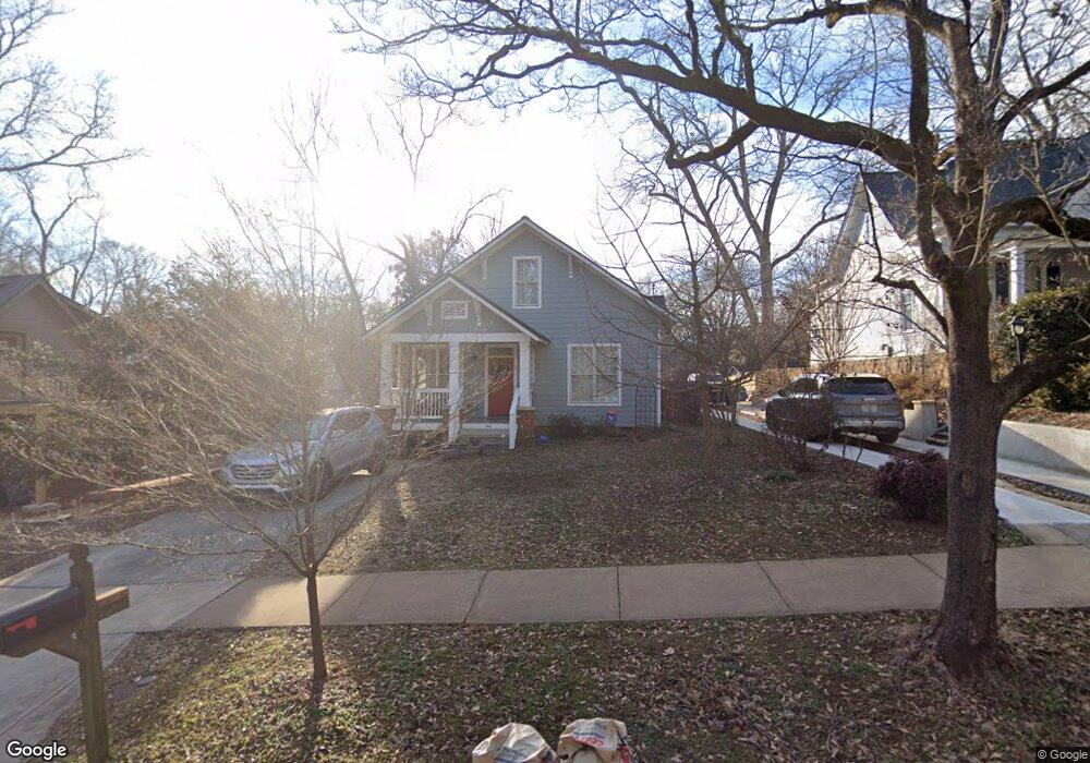
440 Bloomfield St Athens, GA 30605
Midtown-Bloomfield NeighborhoodEstimated Value: $426,000 - $1,087,000
1
Bed
2
Baths
702
Sq Ft
$1,188/Sq Ft
Est. Value
About This Home
This home is located at 440 Bloomfield St, Athens, GA 30605 and is currently estimated at $834,223, approximately $1,188 per square foot. 440 Bloomfield St is a home located in Clarke County with nearby schools including Barrow Elementary School, Clarke Middle School, and Clarke Central High School.
Ownership History
Date
Name
Owned For
Owner Type
Purchase Details
Closed on
Jul 25, 2025
Sold by
Totten John E
Bought by
Totten Family Revocable Living Trust Dat and Totten Susan G Tr
Current Estimated Value
Purchase Details
Closed on
Jun 18, 2010
Sold by
Brown R H
Bought by
Totten John E
Home Financials for this Owner
Home Financials are based on the most recent Mortgage that was taken out on this home.
Original Mortgage
$92,000
Interest Rate
6%
Mortgage Type
New Conventional
Purchase Details
Closed on
Jun 24, 1991
Sold by
Hailey Sue A
Bought by
Brown Brown R and Brown Patricia C
Purchase Details
Closed on
Sep 18, 1990
Sold by
Stephens Thomas W
Bought by
Hailey Sue A
Create a Home Valuation Report for This Property
The Home Valuation Report is an in-depth analysis detailing your home's value as well as a comparison with similar homes in the area
Home Values in the Area
Average Home Value in this Area
Purchase History
| Date | Buyer | Sale Price | Title Company |
|---|---|---|---|
| Totten Family Revocable Living Trust Dat | $962,888 | -- | |
| Totten John E | $137,000 | -- | |
| Brown Brown R | $43,000 | -- | |
| Hailey Sue A | -- | -- |
Source: Public Records
Mortgage History
| Date | Status | Borrower | Loan Amount |
|---|---|---|---|
| Previous Owner | Totten John E | $92,000 |
Source: Public Records
Tax History Compared to Growth
Tax History
| Year | Tax Paid | Tax Assessment Tax Assessment Total Assessment is a certain percentage of the fair market value that is determined by local assessors to be the total taxable value of land and additions on the property. | Land | Improvement |
|---|---|---|---|---|
| 2025 | $3,433 | $385,155 | $50,000 | $335,155 |
| 2024 | $3,433 | $351,375 | $40,000 | $311,375 |
| 2023 | $3,629 | $323,038 | $40,000 | $283,038 |
| 2022 | $3,382 | $283,757 | $40,000 | $243,757 |
| 2021 | $2,996 | $240,834 | $40,000 | $200,834 |
| 2020 | $3,140 | $225,424 | $40,000 | $185,424 |
| 2019 | $3,009 | $202,166 | $40,000 | $162,166 |
| 2018 | $2,959 | $187,423 | $40,000 | $147,423 |
| 2017 | $2,921 | $175,544 | $40,000 | $135,544 |
| 2016 | $2,310 | $148,991 | $40,000 | $108,991 |
| 2015 | $1,695 | $49,843 | $40,000 | $9,843 |
| 2014 | $1,752 | $51,449 | $34,000 | $17,449 |
Source: Public Records
Map
Nearby Homes
- 50 Springdale St
- 255 Bloomfield St
- 997 S Milledge Ave Unit 2
- 997 S Milledge Ave Unit 3
- 997 S Milledge Ave Unit 1
- 997 S Milledge Ave Unit 4
- 265 Springdale St
- 338 Springdale St
- 494 Baxter St Unit 32
- 577 W Cloverhurst Ave
- 495 Woodlawn Ave
- 365 S Church St Unit 1A, 1B, 1C
- 1055 Baxter St Unit 504
- 221 University Dr
- 597 Dearing St
- 500 Dearing St Unit 6
- 490 Mcwhorter Dr
- 1226 W Broad St
- 169 Fortson Cir
- 206 Fortson Dr
- 424 Bloomfield St
- 120 W Cloverhurst Ave
- 130 W Cloverhurst Ave
- 120.5 Cloverhurst Ave W
- 124 W Cloverhurst Ave
- 420 Bloomfield St
- 117 Springdale St
- 166 W Cloverhurst Ave
- 188 W Cloverhurst Ave
- 0 Bloomfield St Unit 7259420
- 437 Bloomfield St
- 441 Bloomfield St
- 121 Springdale St
- 427 Bloomfield St
- 45 Mell St
- 449 Bloomfield St
- 190 W Cloverhurst Ave
- 475 Bloomfield St
- 127 Springdale St
- 397 Bloomfield St Unit 3