440 E Hwy 10 Big Timber, MT 59011
Estimated payment $4,442/month
Highlights
- 61 Acre Lot
- No HOA
- Lot Has A Rolling Slope
- Big Timber Junior High School Rated A-
- Property is near a preserve or public land
About This Lot
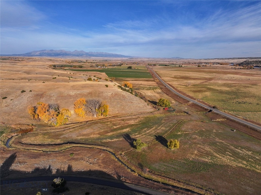
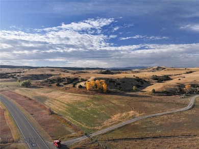
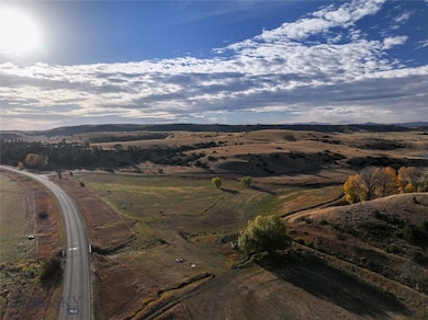
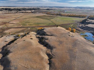
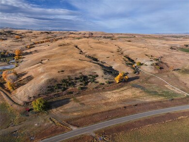
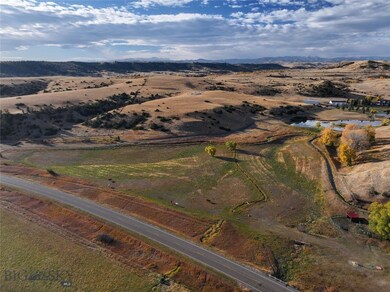
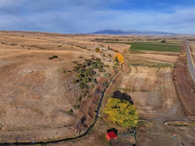
440 Hwy 10 E offers 61 acres of easily accessed blank canvas for whatever future projects one can envision.
Bring your livestock and a swather if you'd like because this parcel offers 11 acres of flood irrigated hay field and 50 acres of pasture. There is power, a well, and a frost free water source located in the center of the property.
A road has been brought in along the west edge of the property to a speculative building site.
Come take a look at this great offering in “the last best place.”
Property Details
Property Type
- Land
Est. Annual Taxes
- $197
Lot Details
- 61 Acre Lot
- Barbed Wire
- Lot Has A Rolling Slope
- Sprinkler System
- Zoning described as CALL - Call Listing Agent for Details
Utilities
- Well
Community Details
- No Home Owners Association
- Property is near a preserve or public land
Listing and Financial Details
- Assessor Parcel Number 0001R07860
Map
Home Values in the Area
Average Home Value in this Area
Tax History
| Year | Tax Paid | Tax Assessment Tax Assessment Total Assessment is a certain percentage of the fair market value that is determined by local assessors to be the total taxable value of land and additions on the property. | Land | Improvement |
|---|---|---|---|---|
| 2024 | $197 | $3,079 | $0 | $0 |
| 2023 | $186 | $3,079 | $0 | $0 |
| 2022 | $213 | $3,094 | $0 | $0 |
| 2021 | $219 | $3,094 | $0 | $0 |
| 2020 | $205 | $2,879 | $0 | $0 |
| 2019 | $206 | $2,879 | $0 | $0 |
| 2018 | $199 | $2,690 | $0 | $0 |
| 2017 | $206 | $2,690 | $0 | $0 |
| 2016 | $190 | $2,489 | $0 | $0 |
| 2015 | $183 | $2,489 | $0 | $0 |
| 2014 | $270 | $3,230 | $0 | $0 |
Property History
| Date | Event | Price | Change | Sq Ft Price |
|---|---|---|---|---|
| 07/09/2025 07/09/25 | Price Changed | $699,000 | -12.5% | -- |
| 11/13/2024 11/13/24 | For Sale | $799,000 | +211.9% | -- |
| 12/16/2013 12/16/13 | Sold | -- | -- | -- |
| 11/16/2013 11/16/13 | Pending | -- | -- | -- |
| 10/22/2013 10/22/13 | For Sale | $256,200 | -- | -- |
Purchase History
| Date | Type | Sale Price | Title Company |
|---|---|---|---|
| Warranty Deed | -- | Sweet Grass Title Co |
Source: Big Sky Country MLS
MLS Number: 398055
APN: 40-1021-34-3-03-01-0000
Disclaimer: Certain information contained herein is derived from information provided by parties other than Homes.com. All information provided is deemed reliable, but is not guaranteed to be accurate and should be independently verified.
![]() IDX information is provided exclusively for consumers' personal, non-commercial use, that it may not be used for any purpose other than to identify prospective properties consumers may be interested in purchasing, and that the data is deemed reliable but is not guaranteed accurate by the MLS.
IDX information is provided exclusively for consumers' personal, non-commercial use, that it may not be used for any purpose other than to identify prospective properties consumers may be interested in purchasing, and that the data is deemed reliable but is not guaranteed accurate by the MLS.
