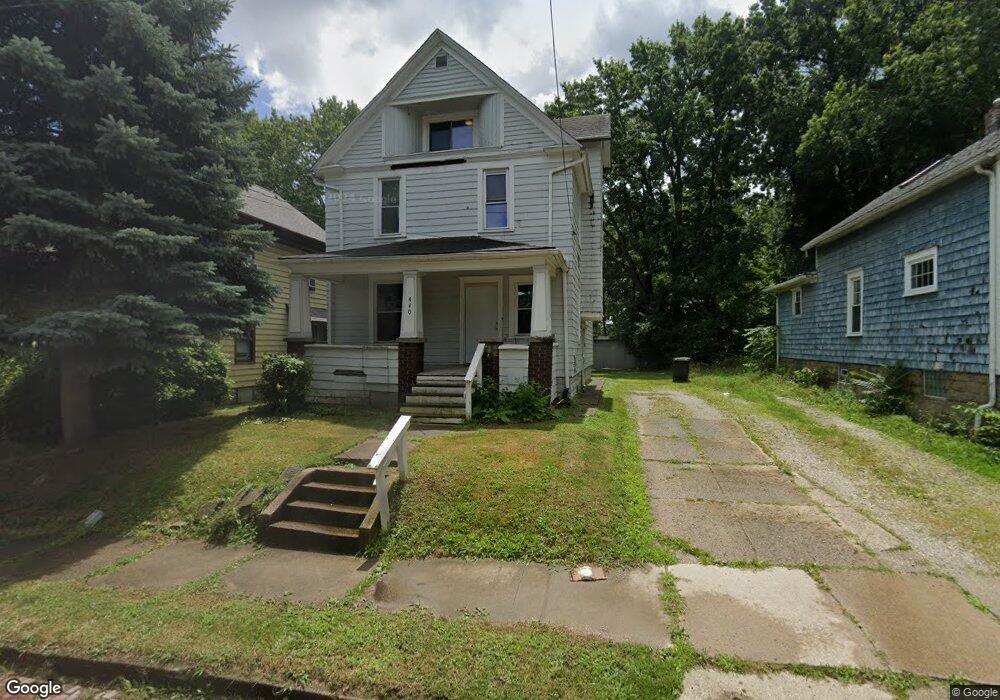
440 E Voris St Akron, OH 44311
Downtown Akron NeighborhoodEstimated Value: $88,000 - $115,000
3
Beds
1
Bath
1,508
Sq Ft
$70/Sq Ft
Est. Value
About This Home
This home is located at 440 E Voris St, Akron, OH 44311 and is currently estimated at $105,368, approximately $69 per square foot. 440 E Voris St is a home located in Summit County with nearby schools including North High School, Main Preparatory Academy, and Case Preparatory Academy.
Ownership History
Date
Name
Owned For
Owner Type
Purchase Details
Closed on
Dec 8, 2023
Sold by
Carter Roger W
Bought by
Roger Carter Properties Llc
Current Estimated Value
Purchase Details
Closed on
Dec 7, 2023
Sold by
Carter Roger W
Bought by
Roger Carter Properties Llc
Purchase Details
Closed on
May 19, 2005
Sold by
Zilka Marilyn and Maguire Robert D
Bought by
Carter Roger W
Create a Home Valuation Report for This Property
The Home Valuation Report is an in-depth analysis detailing your home's value as well as a comparison with similar homes in the area
Home Values in the Area
Average Home Value in this Area
Purchase History
| Date | Buyer | Sale Price | Title Company |
|---|---|---|---|
| Roger Carter Properties Llc | -- | None Listed On Document | |
| Roger Carter Properties Llc | -- | None Listed On Document | |
| Carter Roger W | $48,500 | Land America-Lawyers Title |
Source: Public Records
Tax History
| Year | Tax Paid | Tax Assessment Tax Assessment Total Assessment is a certain percentage of the fair market value that is determined by local assessors to be the total taxable value of land and additions on the property. | Land | Improvement |
|---|---|---|---|---|
| 2025 | $1,816 | $32,936 | $7,585 | $25,351 |
| 2024 | $1,816 | $32,936 | $7,585 | $25,351 |
| 2023 | $1,816 | $32,936 | $7,585 | $25,351 |
| 2022 | $1,559 | $22,047 | $5,023 | $17,024 |
| 2021 | $1,560 | $22,047 | $5,023 | $17,024 |
| 2020 | $1,538 | $22,040 | $5,020 | $17,020 |
| 2019 | $900 | $11,240 | $3,880 | $7,360 |
| 2018 | $889 | $11,240 | $3,880 | $7,360 |
| 2017 | $902 | $11,240 | $3,880 | $7,360 |
| 2016 | $903 | $11,240 | $3,880 | $7,360 |
| 2015 | $902 | $11,240 | $3,880 | $7,360 |
| 2014 | $895 | $11,240 | $3,880 | $7,360 |
| 2013 | $1,019 | $13,230 | $3,880 | $9,350 |
Source: Public Records
Map
Nearby Homes
- 446 E Voris St
- 434 E Voris St
- 453 Lamparter St
- 449 Lamparter St
- 448 E Voris St
- 457 Lamparter St
- 445 Lamparter St
- 430 E Voris St
- 678 Brown St
- 684 Brown St
- 674 Brown St
- 688 Brown St
- 452 E Voris St
- 426 E Voris St
- 697 Kling St
- 693 Kling St Unit 695
- 465 Lamparter St
- 701 Kling St
- 443 Lamparter St
- 454 E Voris St
Your Personal Tour Guide
Ask me questions while you tour the home.