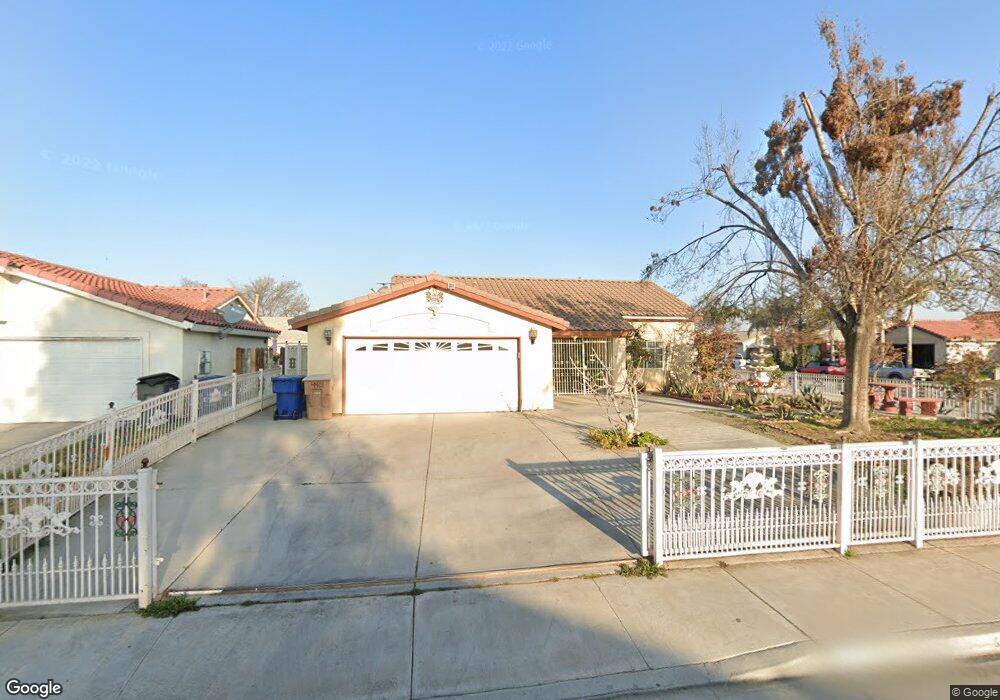
4401 Letzring Ln Bakersfield, CA 93304
South Wible Orchard NeighborhoodEstimated Value: $314,495 - $358,000
4
Beds
2
Baths
1,283
Sq Ft
$260/Sq Ft
Est. Value
About This Home
This home is located at 4401 Letzring Ln, Bakersfield, CA 93304 and is currently estimated at $333,374, approximately $259 per square foot. 4401 Letzring Ln is a home located in Kern County with nearby schools including Planz Elementary School, Greenfield Middle School, and South High School.
Ownership History
Date
Name
Owned For
Owner Type
Purchase Details
Closed on
Nov 8, 1999
Sold by
Syroli
Bought by
Martin Ramon and Martin Patricia
Current Estimated Value
Home Financials for this Owner
Home Financials are based on the most recent Mortgage that was taken out on this home.
Original Mortgage
$95,424
Interest Rate
7.84%
Mortgage Type
FHA
Create a Home Valuation Report for This Property
The Home Valuation Report is an in-depth analysis detailing your home's value as well as a comparison with similar homes in the area
Home Values in the Area
Average Home Value in this Area
Purchase History
| Date | Buyer | Sale Price | Title Company |
|---|---|---|---|
| Martin Ramon | $96,500 | First American Title Co |
Source: Public Records
Mortgage History
| Date | Status | Borrower | Loan Amount |
|---|---|---|---|
| Previous Owner | Martin Ramon | $95,424 | |
| Closed | Martin Ramon | $2,714 |
Source: Public Records
Tax History Compared to Growth
Tax History
| Year | Tax Paid | Tax Assessment Tax Assessment Total Assessment is a certain percentage of the fair market value that is determined by local assessors to be the total taxable value of land and additions on the property. | Land | Improvement |
|---|---|---|---|---|
| 2025 | $2,387 | $147,526 | $30,727 | $116,799 |
| 2024 | $2,332 | $144,634 | $30,125 | $114,509 |
| 2023 | $2,332 | $141,799 | $29,535 | $112,264 |
| 2022 | $2,298 | $139,019 | $28,956 | $110,063 |
| 2021 | $2,177 | $136,294 | $28,389 | $107,905 |
| 2020 | $2,119 | $134,897 | $28,098 | $106,799 |
| 2019 | $2,085 | $134,897 | $28,098 | $106,799 |
| 2018 | $1,997 | $129,660 | $27,008 | $102,652 |
| 2017 | $1,977 | $127,119 | $26,479 | $100,640 |
| 2016 | $1,862 | $124,627 | $25,960 | $98,667 |
| 2015 | $1,833 | $122,756 | $25,571 | $97,185 |
| 2014 | $1,763 | $117,000 | $29,000 | $88,000 |
Source: Public Records
Map
Nearby Homes
- 4515 Letzring Ln
- 2114 Foxglove Ct
- 2010 Fern Tree Ct
- 2212 Saint Helens Ave
- 2005 Kelso Peak Ave
- 1501 Calcutta Dr Unit 34
- 1501 Calcutta Dr Unit 48
- 2401 Kelso Peak Ave Unit 1
- 3713 Teal St
- 2509 Blue Mountain Way
- 4401 Hughes Ln Unit 32
- 4401 Hughes Ln Unit 118
- 4401 Hughes Ln Unit 135
- 4401 Hughes Ln Unit 200
- 4401 Hughes Ln Unit 57
- 4401 Hughes Ln Unit 116
- 4401 Hughes Ln Unit 136
- 4401 Hughes Ln Unit 173
- 4401 Hughes Ln Unit 162
- 4401 Hughes Ln Unit 7
- 4405 Letzring Ln
- 4300 Snapdragon Ln
- 4304 Snapdragon Ln
- 4503 Letzring Ln
- 1926 Verbena Dr
- 2004 Foxglove Ct
- 4308 Snapdragon Ln
- 2000 Foxglove Ct
- 2008 Foxglove Ct
- 4507 Letzring Ln
- 1921 Calla Lily Dr
- 1922 Verbena Dr
- 4402 Snapdragon Ln
- 2102 Foxglove Ct
- 1927 Verbena Dr
- 2103 Foxglove Ct
- 4511 Letzring Ln
- 1917 Calla Lily Dr
- 1914 Verbena Dr
- 4406 Snapdragon Ln