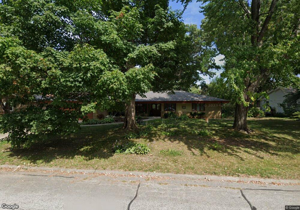
4402 Dunbar Place Rockford, IL 61114
Estimated Value: $288,802 - $325,000
4
Beds
3
Baths
2,430
Sq Ft
$127/Sq Ft
Est. Value
About This Home
This home is located at 4402 Dunbar Place, Rockford, IL 61114 and is currently estimated at $307,951, approximately $126 per square foot. 4402 Dunbar Place is a home located in Winnebago County with nearby schools including Clifford P. Carlson Elementary School, Eisenhower Middle School, and Guilford High School.
Ownership History
Date
Name
Owned For
Owner Type
Purchase Details
Closed on
May 5, 2021
Sold by
Ross Trust
Bought by
Hackl Martin H and Siegel Kathryn M
Current Estimated Value
Home Financials for this Owner
Home Financials are based on the most recent Mortgage that was taken out on this home.
Original Mortgage
$120,000
Outstanding Balance
$17,093
Interest Rate
3.1%
Mortgage Type
New Conventional
Estimated Equity
$290,858
Create a Home Valuation Report for This Property
The Home Valuation Report is an in-depth analysis detailing your home's value as well as a comparison with similar homes in the area
Home Values in the Area
Average Home Value in this Area
Purchase History
| Date | Buyer | Sale Price | Title Company |
|---|---|---|---|
| Hackl Martin H | $170,000 | Lakeshore Title |
Source: Public Records
Mortgage History
| Date | Status | Borrower | Loan Amount |
|---|---|---|---|
| Open | Hackl Martin H | $120,000 |
Source: Public Records
Tax History Compared to Growth
Tax History
| Year | Tax Paid | Tax Assessment Tax Assessment Total Assessment is a certain percentage of the fair market value that is determined by local assessors to be the total taxable value of land and additions on the property. | Land | Improvement |
|---|---|---|---|---|
| 2024 | $6,944 | $84,279 | $12,380 | $71,899 |
| 2023 | $6,574 | $74,313 | $10,916 | $63,397 |
| 2022 | $7,589 | $66,422 | $9,757 | $56,665 |
| 2021 | $7,465 | $60,904 | $8,946 | $51,958 |
| 2020 | $6,565 | $57,057 | $8,457 | $48,600 |
| 2019 | $6,481 | $54,381 | $8,060 | $46,321 |
| 2018 | $6,909 | $51,249 | $7,595 | $43,654 |
| 2017 | $6,387 | $49,047 | $7,269 | $41,778 |
| 2016 | $7,270 | $48,128 | $7,133 | $40,995 |
| 2015 | $7,362 | $48,128 | $7,133 | $40,995 |
| 2014 | $6,201 | $52,038 | $8,928 | $43,110 |
Source: Public Records
Map
Nearby Homes
- 4012 Pleasant Valley Blvd
- 4015 Coventry Dr
- 2929 Sunnyside Dr
- 2929 Sunnyside Dr Unit 331B
- 2180 Stornway Dr
- 4685 High Point Dr Unit 17
- 3815 Cass Ct
- 2699 Hickory Ave
- 3527 Inglenook Ln Unit 3527
- 5807 Forest Hills Rd
- 3505 Brookview Rd
- 3407 La Salle Ave
- 3364 Ramblewood Ln
- 5075 Welsh Rd
- 2020 Valley Rd
- 2020 Glenview Rd
- 1940 Hawthorne Dr
- 2014 Glenview Rd
- 5087 Wilderness Trail
- 1954 Wisteria Rd
- 4314 Dunbar Place
- 4406 Dunbar Place
- 4411 Eaton Dr
- 4407 Eaton Dr
- 4415 Eaton Dr
- 4310 Dunbar Place
- 4403 Dunbar Place
- 4410 Dunbar Place
- 4313 Dunbar Place
- 4403 Eaton Dr
- 4419 Eaton Dr
- 4306 Dunbar Place
- 4309 Dunbar Place
- 4411 Dunbar Place
- 4416 Dunbar Place
- 4423 Eaton Dr
- 4402 Dorset Dr
- 4412 Eaton Dr
- 4335 Eaton Dr
- 4408 Eaton Dr