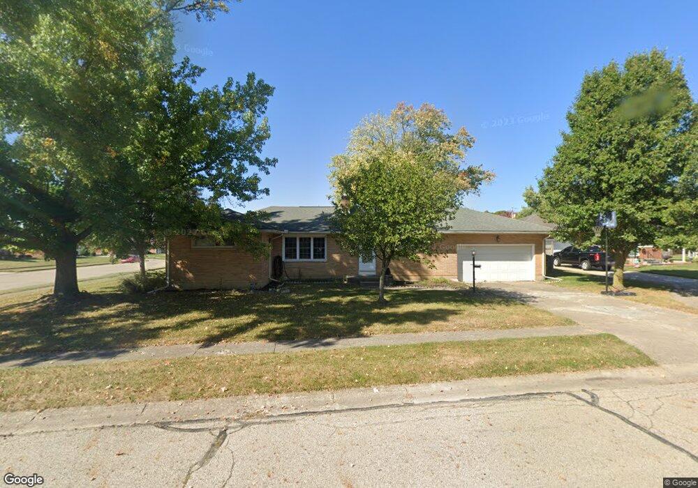
4402 Tulane Ct Springfield, OH 45503
Estimated Value: $218,640 - $245,000
3
Beds
2
Baths
1,325
Sq Ft
$178/Sq Ft
Est. Value
About This Home
This home is located at 4402 Tulane Ct, Springfield, OH 45503 and is currently estimated at $236,410, approximately $178 per square foot. 4402 Tulane Ct is a home located in Clark County with nearby schools including Northridge Elementary School, Kenton Ridge Middle & High School, and Emmanuel Christian Academy.
Ownership History
Date
Name
Owned For
Owner Type
Purchase Details
Closed on
Jan 30, 2024
Sold by
Sheppard Julie
Bought by
Tower Collina Llc
Current Estimated Value
Purchase Details
Closed on
Oct 17, 2019
Sold by
Sheppard John A
Bought by
Sheppard Julie
Purchase Details
Closed on
Jan 21, 2000
Sold by
Raymond Wermuth Steven
Bought by
Sheppard John A and Sheppard Julie
Home Financials for this Owner
Home Financials are based on the most recent Mortgage that was taken out on this home.
Original Mortgage
$103,050
Interest Rate
7.81%
Mortgage Type
FHA
Purchase Details
Closed on
Nov 22, 1996
Sold by
Bakle Vincent L
Bought by
Wermuth Steven R
Home Financials for this Owner
Home Financials are based on the most recent Mortgage that was taken out on this home.
Original Mortgage
$73,200
Interest Rate
7.94%
Mortgage Type
New Conventional
Create a Home Valuation Report for This Property
The Home Valuation Report is an in-depth analysis detailing your home's value as well as a comparison with similar homes in the area
Home Values in the Area
Average Home Value in this Area
Purchase History
| Date | Buyer | Sale Price | Title Company |
|---|---|---|---|
| Tower Collina Llc | $105,300 | None Listed On Document | |
| Sheppard Julie | -- | None Available | |
| Sheppard John A | $103,900 | -- | |
| Wermuth Steven R | $91,500 | -- |
Source: Public Records
Mortgage History
| Date | Status | Borrower | Loan Amount |
|---|---|---|---|
| Previous Owner | Sheppard John A | $103,050 | |
| Previous Owner | Wermuth Steven R | $73,200 |
Source: Public Records
Tax History
| Year | Tax Paid | Tax Assessment Tax Assessment Total Assessment is a certain percentage of the fair market value that is determined by local assessors to be the total taxable value of land and additions on the property. | Land | Improvement |
|---|---|---|---|---|
| 2025 | $2,246 | $69,570 | $16,000 | $53,570 |
| 2024 | $2,172 | $51,360 | $10,700 | $40,660 |
| 2023 | $2,172 | $51,360 | $10,700 | $40,660 |
| 2022 | $2,180 | $51,360 | $10,700 | $40,660 |
| 2021 | $2,154 | $43,010 | $8,490 | $34,520 |
| 2020 | $2,156 | $43,010 | $8,490 | $34,520 |
| 2019 | $2,197 | $43,010 | $8,490 | $34,520 |
| 2018 | $2,120 | $39,820 | $7,620 | $32,200 |
| 2017 | $1,817 | $39,095 | $7,616 | $31,479 |
| 2016 | $1,779 | $38,605 | $7,616 | $30,989 |
| 2015 | $1,662 | $36,541 | $7,326 | $29,215 |
| 2014 | $1,661 | $36,541 | $7,326 | $29,215 |
| 2013 | $1,623 | $36,541 | $7,326 | $29,215 |
Source: Public Records
Map
Nearby Homes
- 4577 Reno Ln Unit 2
- 4652 Reno Ln Unit 15
- 4446 Ridgewood Rd E Unit 3
- 4256 Midfield St Unit 9
- 1341 Student Ave
- 3969 Covington Dr Unit 3969
- 1709 Thomas Dr
- 4028 Ryland Dr Unit 4028
- 4500 Bosart Rd
- 1831 Pinehurst Dr Unit 37
- 4802 Willowbrook Dr
- 5033 Ridgewood Rd E
- 4343 Burchill St
- 1711 Pinehurst Dr
- 4741 Cullen Ave
- 1503 Kingsgate Rd
- 1505 Kingsgate Rd
- 1500 Kingsgate Rd
- 1502 Kingsgate Rd
- 1500 Kingsgate Rd Unit 19430
- 4414 Tulane Rd
- 4378 Tulane Ct
- 4346 Tulane Rd
- 4420 Tulane Rd
- 4369 Tulane Rd
- 4370 Tulane Ct
- 4401 Tulane Rd
- 4345 Tulane Rd
- 4340 Tulane Rd
- 4358 Tulane Ct
- 4352 Tulane Ct
- 4426 Tulane Rd
- 4415 Tulane Rd
- 4364 Tulane Ct
- 4339 Tulane Rd
- 4481 Phoenix Dr
- 4477 Phoenix Dr
- 4485 Phoenix Dr
- 4330 Reno Rd
- 4473 Phoenix Dr
Your Personal Tour Guide
Ask me questions while you tour the home.