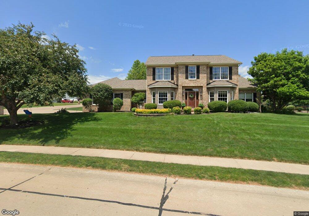
4405 Forest Rd Davenport, IA 52807
North Side NeighborhoodEstimated Value: $487,000 - $551,000
4
Beds
4
Baths
2,959
Sq Ft
$174/Sq Ft
Est. Value
About This Home
This home is located at 4405 Forest Rd, Davenport, IA 52807 and is currently estimated at $514,550, approximately $173 per square foot. 4405 Forest Rd is a home located in Scott County with nearby schools including Jones Park Elementary School, Eisenhower Elementary School, and Casey County Middle School.
Ownership History
Date
Name
Owned For
Owner Type
Purchase Details
Closed on
Sep 4, 2025
Sold by
Wahl Brian M and Wahl Margaret A
Bought by
Wahl
Current Estimated Value
Purchase Details
Closed on
Oct 18, 2010
Sold by
Petersen Gary L and Petersen Hildasue A
Bought by
Wahl Brian M and Wahl Margaret A
Home Financials for this Owner
Home Financials are based on the most recent Mortgage that was taken out on this home.
Original Mortgage
$268,000
Interest Rate
4.26%
Mortgage Type
New Conventional
Create a Home Valuation Report for This Property
The Home Valuation Report is an in-depth analysis detailing your home's value as well as a comparison with similar homes in the area
Home Values in the Area
Average Home Value in this Area
Purchase History
| Date | Buyer | Sale Price | Title Company |
|---|---|---|---|
| Wahl | -- | None Listed On Document | |
| Wahl Brian M | $335,000 | None Available |
Source: Public Records
Mortgage History
| Date | Status | Borrower | Loan Amount |
|---|---|---|---|
| Previous Owner | Wahl Brian M | $268,000 |
Source: Public Records
Tax History Compared to Growth
Tax History
| Year | Tax Paid | Tax Assessment Tax Assessment Total Assessment is a certain percentage of the fair market value that is determined by local assessors to be the total taxable value of land and additions on the property. | Land | Improvement |
|---|---|---|---|---|
| 2025 | $8,068 | $513,350 | $60,920 | $452,430 |
| 2024 | $7,868 | $461,640 | $60,920 | $400,720 |
| 2023 | $8,428 | $461,640 | $60,920 | $400,720 |
| 2022 | $8,466 | $403,470 | $54,510 | $348,960 |
| 2021 | $8,466 | $403,470 | $54,510 | $348,960 |
| 2020 | $8,402 | $375,490 | $54,510 | $320,980 |
| 2019 | $8,632 | $393,240 | $54,510 | $338,730 |
| 2018 | $8,444 | $393,240 | $54,510 | $338,730 |
| 2017 | $2,187 | $393,240 | $54,510 | $338,730 |
| 2016 | $7,986 | $373,320 | $0 | $0 |
| 2015 | $7,986 | $346,900 | $0 | $0 |
| 2014 | $7,510 | $326,410 | $0 | $0 |
| 2013 | $6,930 | $0 | $0 | $0 |
| 2012 | -- | $336,510 | $51,950 | $284,560 |
Source: Public Records
Map
Nearby Homes
- 2919 E 44th Ct
- 2916 E 45th Ct
- 2924 E 45th Ct
- 4005 Forest Rd
- 4919 Lorton Ave
- 4230 Jersey Ridge Rd
- 2318 E 46th St
- 2321 E 47th St
- 2203 E 46th St
- 2403 E 51st St Unit 102E
- 2422 E 51st St Unit E
- 4406 Belle Ave
- 2506 E 35th Street Ct
- 3315 Fairhaven Rd
- 2501 E 34th Street Ct
- 3000 E 32nd St Unit 14
- 4324 Spring St
- 1960 E 50th Ct
- 1120 Terrace Park Dr
- 2723 E 58th St
- 4409 Forest Rd
- 2810 E 44th St
- 4349 Forest Rd
- 4411 Forest Rd
- 4402 Forest Rd
- 2809 E 44th St
- 4420 Fairhaven Ct
- 4410 Forest Rd
- 4338 Forest Rd
- 4420 Forest Rd
- 2800 E 43rd St
- 4504 Fairhaven Ct
- 2815 E 44th St
- 2810 E 43rd St
- 4401 Fairhaven Ct
- 4405 Fairhaven Ct
- 4504 Forest Rd
- 4409 Fairhaven Ct
- 2828 E 43rd St
- 4525 Forest Rd