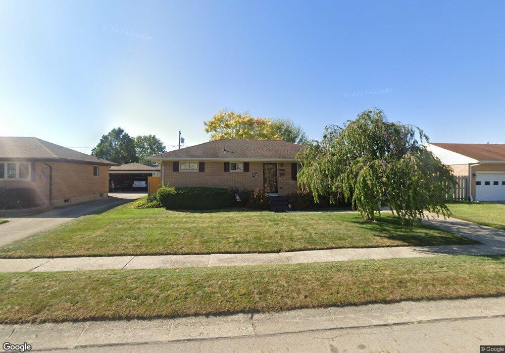
4405 Randall Dr Springfield, OH 45503
Estimated Value: $175,413 - $216,000
3
Beds
1
Bath
1,025
Sq Ft
$190/Sq Ft
Est. Value
About This Home
This home is located at 4405 Randall Dr, Springfield, OH 45503 and is currently estimated at $195,103, approximately $190 per square foot. 4405 Randall Dr is a home located in Clark County with nearby schools including Northridge Elementary School, Kenton Ridge Middle & High School, and Emmanuel Christian Academy.
Ownership History
Date
Name
Owned For
Owner Type
Purchase Details
Closed on
Nov 19, 1996
Sold by
Pond R Ellen
Bought by
Bartley Bill E
Current Estimated Value
Home Financials for this Owner
Home Financials are based on the most recent Mortgage that was taken out on this home.
Original Mortgage
$68,400
Outstanding Balance
$5,393
Interest Rate
8.18%
Mortgage Type
New Conventional
Estimated Equity
$189,711
Purchase Details
Closed on
Oct 19, 1993
Create a Home Valuation Report for This Property
The Home Valuation Report is an in-depth analysis detailing your home's value as well as a comparison with similar homes in the area
Home Values in the Area
Average Home Value in this Area
Purchase History
| Date | Buyer | Sale Price | Title Company |
|---|---|---|---|
| Bartley Bill E | $85,500 | -- | |
| -- | -- | -- |
Source: Public Records
Mortgage History
| Date | Status | Borrower | Loan Amount |
|---|---|---|---|
| Open | Bartley Bill E | $68,400 |
Source: Public Records
Tax History
| Year | Tax Paid | Tax Assessment Tax Assessment Total Assessment is a certain percentage of the fair market value that is determined by local assessors to be the total taxable value of land and additions on the property. | Land | Improvement |
|---|---|---|---|---|
| 2025 | $1,268 | $56,270 | $16,510 | $39,760 |
| 2024 | $1,253 | $38,800 | $9,610 | $29,190 |
| 2023 | $1,253 | $38,800 | $9,610 | $29,190 |
| 2022 | $1,275 | $38,800 | $9,610 | $29,190 |
| 2021 | $1,338 | $35,390 | $7,120 | $28,270 |
| 2020 | $1,339 | $35,390 | $7,120 | $28,270 |
| 2019 | $1,365 | $35,390 | $7,120 | $28,270 |
| 2018 | $1,147 | $30,280 | $9,070 | $21,210 |
| 2017 | $984 | $28,942 | $9,072 | $19,870 |
| 2016 | $977 | $28,942 | $9,072 | $19,870 |
| 2015 | $886 | $28,592 | $8,722 | $19,870 |
| 2014 | $886 | $28,592 | $8,722 | $19,870 |
| 2013 | $1,067 | $28,592 | $8,722 | $19,870 |
Source: Public Records
Map
Nearby Homes
- 4343 Burchill St
- 1341 Student Ave
- 4256 Midfield St Unit 9
- 4741 Cullen Ave
- 4802 Willowbrook Dr
- 4446 Ridgewood Rd E Unit 3
- 862 Brendle Trace Unit 20
- 593 Hiser Ave
- 4652 Reno Ln Unit 15
- 1162 Kingsgate Rd
- 1201 Kingsgate Rd
- 1709 Thomas Dr
- 5033 Ridgewood Rd E
- 1521 Erika Dr
- 1500 Kingsgate Rd
- 1502 Kingsgate Rd
- 1500 Kingsgate Rd Unit 19430
- 1502 Kingsgate Rd Unit 19432
- 1509 Kingsgate Rd
- 3631 Kingsgate Ln
- 4355 Randall Dr
- 4413 Randall Dr
- 4427 Randall Dr
- 4349 Randall Dr
- 4406 Burchill St
- 4354 Burchill St
- 4431 Randall Dr
- 4348 Burchill St
- 4408 Randall Dr
- 4402 Randall Dr
- 4414 Randall Dr
- 4352 Randall Dr
- 1126 Student Ave
- 4344 Randall Dr
- 4426 Randall Dr
- 4428 Randall Dr
- 4420 Randall Dr
- 4424 Randall Dr
- 1116 Student Ave
- 4430 Burchill St
Your Personal Tour Guide
Ask me questions while you tour the home.